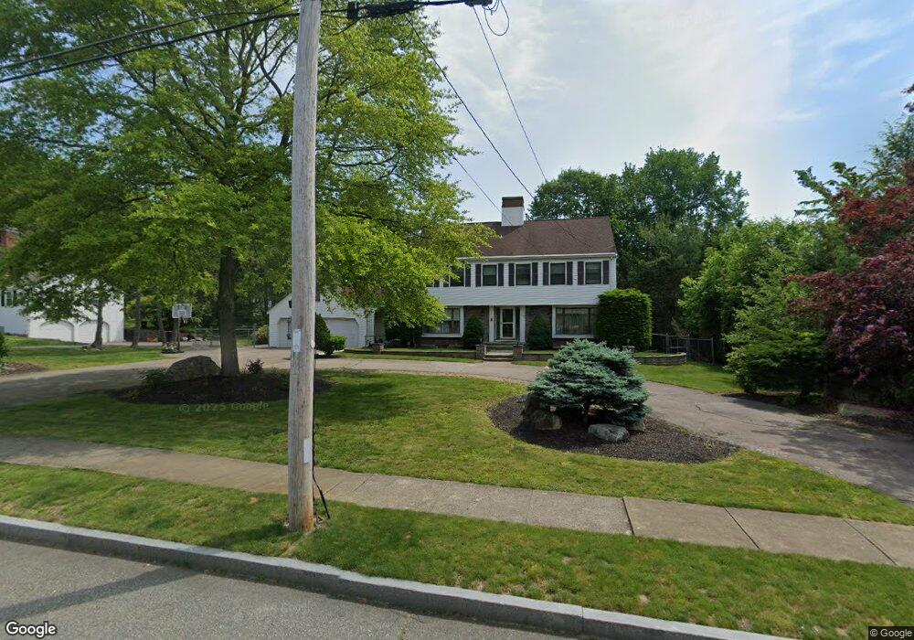
159 Braemoor Rd Brockton, MA 02301
Winters Corner NeighborhoodEstimated Value: $704,985 - $837,000
3
Beds
3
Baths
2,628
Sq Ft
$287/Sq Ft
Est. Value
About This Home
This home is located at 159 Braemoor Rd, Brockton, MA 02301 and is currently estimated at $754,746, approximately $287 per square foot. 159 Braemoor Rd is a home located in Plymouth County with nearby schools including Hancock Elementary School, Manthala George Jr. School, and Louis F Angelo Elementary School.
Ownership History
Date
Name
Owned For
Owner Type
Purchase Details
Closed on
Sep 29, 2003
Sold by
Anderson Keith G and Anderson Mary E
Bought by
Mohammed Azid and Mohammed Cheryl V
Current Estimated Value
Home Financials for this Owner
Home Financials are based on the most recent Mortgage that was taken out on this home.
Original Mortgage
$399,000
Interest Rate
6.29%
Mortgage Type
Purchase Money Mortgage
Create a Home Valuation Report for This Property
The Home Valuation Report is an in-depth analysis detailing your home's value as well as a comparison with similar homes in the area
Home Values in the Area
Average Home Value in this Area
Purchase History
| Date | Buyer | Sale Price | Title Company |
|---|---|---|---|
| Mohammed Azid | $420,000 | -- |
Source: Public Records
Mortgage History
| Date | Status | Borrower | Loan Amount |
|---|---|---|---|
| Open | Mohammed Azid | $405,000 | |
| Closed | Mohammed Azid | $399,000 | |
| Previous Owner | Mohammed Azid | $107,000 | |
| Previous Owner | Mohammed Azid | $115,000 |
Source: Public Records
Tax History
| Year | Tax Paid | Tax Assessment Tax Assessment Total Assessment is a certain percentage of the fair market value that is determined by local assessors to be the total taxable value of land and additions on the property. | Land | Improvement |
|---|---|---|---|---|
| 2025 | $7,618 | $629,100 | $179,900 | $449,200 |
| 2024 | $7,531 | $626,500 | $179,900 | $446,600 |
| 2023 | $7,505 | $578,200 | $130,800 | $447,400 |
| 2022 | $6,989 | $500,300 | $118,900 | $381,400 |
| 2021 | $7,054 | $486,500 | $104,200 | $382,300 |
| 2020 | $7,217 | $476,400 | $102,300 | $374,100 |
| 2019 | $6,946 | $447,000 | $97,700 | $349,300 |
| 2018 | $6,963 | $398,200 | $97,700 | $300,500 |
| 2017 | $6,356 | $394,800 | $97,700 | $297,100 |
| 2016 | $6,857 | $395,000 | $94,000 | $301,000 |
| 2015 | $6,545 | $360,600 | $94,000 | $266,600 |
| 2014 | $6,171 | $340,400 | $94,000 | $246,400 |
Source: Public Records
Map
Nearby Homes
- 61 Huntington Ave
- 54 West St
- 18 Edinboro Ave
- 20 Auna Dr Unit 7
- 32 Hampden Ave
- 69 W Elm Terrace Unit 1
- 16 Palmer St
- 29 Auna Dr Unit 3
- 425 W Elm St Unit 7
- 11 Auna Dr Unit 6
- 11 Othello St
- 24 N Byron Ave
- 32 Byron Ave
- 282 Belmont St
- 82 Belmont Ave
- 16 Sudbury St
- 27 Hamilton St
- 77 Colonel Bell Dr Unit 4
- 75 Colonel Bell Dr Unit 77-11
- 81 Colonel Bell Dr Unit 9
- 149 Braemoor Rd
- 10 Briarcliff Rd
- 169 Braemoor Rd
- 24 Briarcliff Rd
- 40 Briarcliff Rd
- 6 Briarcliff Rd
- 150 Braemoor Rd
- 7 Briarcliff Rd
- 140 Braemoor Rd
- 73 Westwood Ave
- 4 Briarcliff Rd
- 2 Briarcliff Rd
- 4 Briarcliff Rd
- 48 Briarcliff Rd
- 1 Briarcliff Rd
- 177 Braemoor Rd
- 164 Braemoor Rd
- 3 Briarcliff Rd
- 135 Fairview Ave
- 15 Briarcliff Rd
Your Personal Tour Guide
Ask me questions while you tour the home.