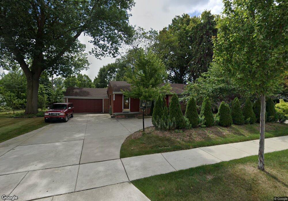
1590 E Maple Rd Birmingham, MI 48009
Estimated Value: $377,521 - $536,000
3
Beds
2
Baths
1,125
Sq Ft
$399/Sq Ft
Est. Value
About This Home
This home is located at 1590 E Maple Rd, Birmingham, MI 48009 and is currently estimated at $449,130, approximately $399 per square foot. 1590 E Maple Rd is a home located in Oakland County with nearby schools including Harlan Elementary School, Derby Middle School, and Ernest W. Seaholm High School.
Ownership History
Date
Name
Owned For
Owner Type
Purchase Details
Closed on
Sep 10, 2009
Sold by
Mortgage Electronic Registration Systems
Bought by
Federal National Mortgage Association
Current Estimated Value
Purchase Details
Closed on
Aug 25, 2009
Sold by
Peters Ellyn and Ellyn L Peters Revocable Trust
Bought by
Mortgage Electronic Registration Systems
Purchase Details
Closed on
May 1, 1998
Sold by
Lopez Maria Linda
Bought by
Peters Ellyn L
Home Financials for this Owner
Home Financials are based on the most recent Mortgage that was taken out on this home.
Original Mortgage
$90,000
Interest Rate
6.99%
Purchase Details
Closed on
Dec 28, 1995
Sold by
Mills Kathrine H
Bought by
Lopez Maria B
Home Financials for this Owner
Home Financials are based on the most recent Mortgage that was taken out on this home.
Original Mortgage
$103,600
Interest Rate
7.36%
Create a Home Valuation Report for This Property
The Home Valuation Report is an in-depth analysis detailing your home's value as well as a comparison with similar homes in the area
Home Values in the Area
Average Home Value in this Area
Purchase History
| Date | Buyer | Sale Price | Title Company |
|---|---|---|---|
| Federal National Mortgage Association | -- | None Available | |
| Mortgage Electronic Registration Systems | $101,158 | None Available | |
| Peters Ellyn L | $150,000 | -- | |
| Lopez Maria B | $129,500 | -- |
Source: Public Records
Mortgage History
| Date | Status | Borrower | Loan Amount |
|---|---|---|---|
| Previous Owner | Peters Ellyn L | $90,000 | |
| Previous Owner | Lopez Maria B | $103,600 |
Source: Public Records
Tax History
| Year | Tax Paid | Tax Assessment Tax Assessment Total Assessment is a certain percentage of the fair market value that is determined by local assessors to be the total taxable value of land and additions on the property. | Land | Improvement |
|---|---|---|---|---|
| 2025 | $3,910 | $169,140 | $0 | $0 |
| 2024 | $3,452 | $157,810 | $0 | $0 |
| 2023 | $3,308 | $147,080 | $0 | $0 |
| 2022 | $3,547 | $138,390 | $0 | $0 |
| 2021 | $3,578 | $132,000 | $0 | $0 |
| 2020 | $3,188 | $124,950 | $0 | $0 |
| 2019 | $3,608 | $116,510 | $0 | $0 |
| 2018 | $3,581 | $108,410 | $0 | $0 |
| 2017 | $3,575 | $106,180 | $0 | $0 |
| 2016 | $3,582 | $104,520 | $0 | $0 |
| 2015 | -- | $97,530 | $0 | $0 |
| 2014 | -- | $81,580 | $0 | $0 |
| 2011 | -- | $73,300 | $0 | $0 |
Source: Public Records
Map
Nearby Homes
- 1235 Yorkshire Rd
- 1850 Dorchester Rd
- 1447 Buckingham Ave
- 1397 Hazel St
- 1777 Hazel St
- 323 N Eton St Unit 35C
- 475 S Adams Rd
- 1881 Hazel St
- 1336 Haynes St
- 1675 Graefield Rd
- 683 Graefield Ct
- 716 Graefield Ct Unit 158
- 1724 Graefield Rd
- 1180 Manchester Rd
- 1974 Graefield Rd
- 729 N Eton St
- 1985 Graefield Rd Unit 28
- 2051 Villa Rd Unit 401
- 1489 Holland St
- 864 Chestnut St
- 1602 E Maple Rd
- 1556 E Maple Rd
- 1595 Yosemite Blvd
- 1551 Yosemite Blvd
- 1609 Yosemite Blvd
- 1616 E Maple Rd
- 1535 E Maple Rd
- 1567 E Maple Rd
- 1528 E Maple Rd
- 1591 E Maple Rd
- 1628 E Maple Rd
- 1511 E Maple Rd
- 1635 Yosemite Blvd
- 1489 E Maple Rd
- 1662 E Maple Rd
- 1492 E Maple Rd
- 1659 Yosemite Blvd
- 1653 E Maple Rd
- 1493 Yosemite Blvd
- 1550 Yorkshire Rd
Your Personal Tour Guide
Ask me questions while you tour the home.