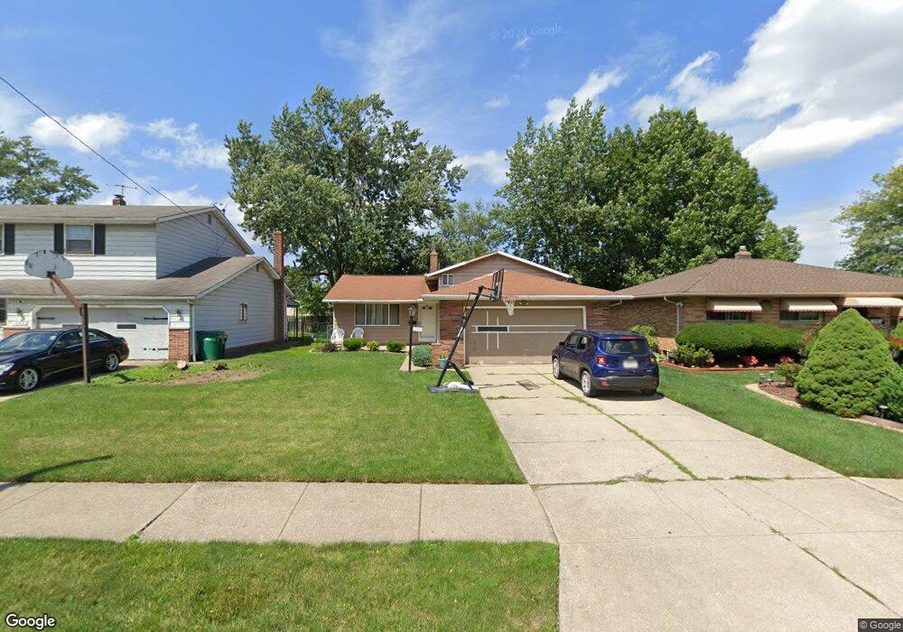
15909 Dunbury Dr Maple Heights, OH 44137
Estimated Value: $170,183 - $210,000
About This Home
This home is located at 15909 Dunbury Dr, Maple Heights, OH 44137 and is currently estimated at $186,046, approximately $114 per square foot. 15909 Dunbury Dr is a home located in Cuyahoga County with nearby schools including Abraham Lincoln Elementary School, Rockside/ J.F. Kennedy School, and Barack Obama School.
Ownership History
We collect this data history from publicly available records. To have your information removed, we recommend requesting removal directly through your county’s website.
Purchase Details
Home Financials for this Owner
Home Financials are based on the most recent Mortgage that was taken out on this home.Purchase Details
Home Financials for this Owner
Home Financials are based on the most recent Mortgage that was taken out on this home.Purchase Details
Purchase Details
Home Values in the Area
Average Home Value in this Area
Purchase History
We collect this data history from publicly available records. To have your information removed, we recommend requesting removal directly through your county’s website.
| Date | Buyer | Sale Price | Title Company |
|---|---|---|---|
| $126,000 | Hometown Usa Title Agency Lt | ||
| $108,000 | -- | ||
| $59,500 | -- | ||
| -- | -- |
Mortgage History
We collect this data history from publicly available records. To have your information removed, we recommend requesting removal directly through your county’s website.
| Date | Status | Borrower | Loan Amount |
|---|---|---|---|
| Open | $119,700 | ||
| Previous Owner | $107,193 |
Tax History
We collect this data history from publicly available records. To have your information removed, we recommend requesting removal directly through your county’s website.
| Year | Tax Paid | Tax Assessment Tax Assessment Total Assessment is a certain percentage of the fair market value that is determined by local assessors to be the total taxable value of land and additions on the property. | Land | Improvement |
|---|---|---|---|---|
| 2025 | $3,909 | $49,525 | $9,450 | $40,075 |
| 2024 | $4,355 | $49,525 | $9,450 | $40,075 |
| 2023 | $3,450 | $33,780 | $6,440 | $27,340 |
| 2022 | $3,437 | $33,780 | $6,440 | $27,340 |
| 2021 | $3,674 | $33,780 | $6,440 | $27,340 |
| 2020 | $3,338 | $27,690 | $5,290 | $22,400 |
| 2019 | $3,323 | $79,100 | $15,100 | $64,000 |
| 2018 | $3,194 | $27,690 | $5,290 | $22,400 |
| 2017 | $3,304 | $27,030 | $4,660 | $22,370 |
| 2016 | $3,195 | $27,030 | $4,660 | $22,370 |
| 2015 | $3,053 | $27,030 | $4,660 | $22,370 |
| 2014 | $3,053 | $27,870 | $4,800 | $23,070 |
Map
- 15701 Walvern Blvd
- 15811 Maplewood Ave
- 15513 Walvern Blvd
- 15626 Edgewood Ave
- 15305 Steinway Blvd
- 15401 Walvern Blvd
- 15804 Northwood Ave
- 6045 Dunham Rd
- 6089 Dunham Rd
- 14936 Janice Dr
- 15522 Turney Rd
- 16112 Rowena Ave
- 14902 James Ave
- 15300 Northwood Ave
- 115 Bayberry Ln Unit H33
- 14808 James Ave
- 14900 Summit Ave
- 15816 Mendota Ave
- 14956 Carol Dr
- 15521 Corkhill Rd
- 15905 Dunbury Dr
- 15913 Dunbury Dr
- 15901 Dunbury Dr
- 15917 Dunbury Dr
- 15908 Ramage Ave
- 15912 Ramage Ave
- 15817 Dunbury Dr
- 16001 Dunbury Dr
- 15904 Ramage Ave
- 15916 Ramage Ave
- 15900 Ramage Ave
- 15908 Dunbury Dr
- 15904 Dunbury Dr
- 15813 Dunbury Dr
- 16005 Dunbury Dr
- 15912 Dunbury Dr
- 16000 Ramage Ave
- 15816 Ramage Ave
- 15900 Dunbury Dr
- 15916 Dunbury Dr
Ask me questions while you tour the home.