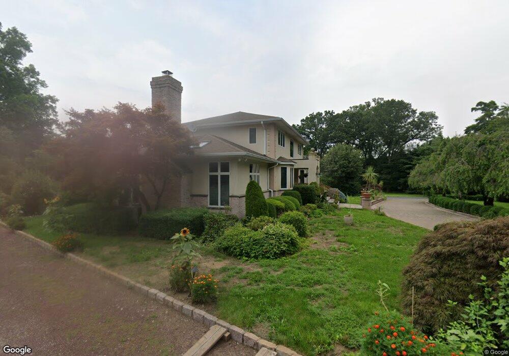
16 Bedford Rd Greenwich, CT 06831
Back Country Greenwich NeighborhoodEstimated Value: $2,670,000 - $3,087,000
4
Beds
4
Baths
4,022
Sq Ft
$704/Sq Ft
Est. Value
About This Home
This home is located at 16 Bedford Rd, Greenwich, CT 06831 and is currently estimated at $2,831,380, approximately $703 per square foot. 16 Bedford Rd is a home located in Fairfield County with nearby schools including Parkway School, Western Middle School, and Greenwich High School.
Ownership History
Date
Name
Owned For
Owner Type
Purchase Details
Closed on
Oct 7, 1994
Sold by
Sakson Nursery Inc
Bought by
Landi Joseph and Landi Luigina
Current Estimated Value
Purchase Details
Closed on
Oct 7, 1987
Sold by
Krueger Hildegard
Bought by
Sakson Nursery Inc
Create a Home Valuation Report for This Property
The Home Valuation Report is an in-depth analysis detailing your home's value as well as a comparison with similar homes in the area
Home Values in the Area
Average Home Value in this Area
Purchase History
We collect this data history from publicly available records. To have your information removed, we recommend requesting removal directly through your county’s website.
| Date | Buyer | Sale Price | Title Company |
|---|---|---|---|
| Landi Joseph | $290,000 | -- | |
| Sakson Nursery Inc | $600,000 | -- |
Source: Public Records
Mortgage History
We collect this data history from publicly available records. To have your information removed, we recommend requesting removal directly through your county’s website.
| Date | Status | Borrower | Loan Amount |
|---|---|---|---|
| Open | Sakson Nursery Inc | $91,500 | |
| Open | Sakson Nursery Inc | $249,999 | |
| Closed | Sakson Nursery Inc | $400,000 | |
| Closed | Sakson Nursery Inc | $200,000 |
Source: Public Records
Tax History
| Year | Tax Paid | Tax Assessment Tax Assessment Total Assessment is a certain percentage of the fair market value that is determined by local assessors to be the total taxable value of land and additions on the property. | Land | Improvement |
|---|---|---|---|---|
| 2025 | $18,105 | $1,503,740 | $560,000 | $943,740 |
| 2024 | $17,609 | $1,503,740 | $560,000 | $943,740 |
| 2023 | $17,128 | $1,503,740 | $560,000 | $943,740 |
| 2022 | $16,962 | $1,503,740 | $560,000 | $943,740 |
| 2021 | $15,205 | $1,311,940 | $392,000 | $919,940 |
| 2020 | $15,205 | $1,311,940 | $392,000 | $919,940 |
| 2019 | $15,323 | $1,311,940 | $392,000 | $919,940 |
| 2018 | $14,917 | $1,311,940 | $392,000 | $919,940 |
| 2017 | $14,917 | $1,311,940 | $392,000 | $919,940 |
| 2016 | $14,694 | $1,311,940 | $392,000 | $919,940 |
| 2015 | $16,455 | $1,460,060 | $817,460 | $642,600 |
| 2014 | $16,017 | $1,460,060 | $817,460 | $642,600 |
Source: Public Records
Map
Nearby Homes
- 38 Bedford Rd
- 6 Carpenters Brook Rd
- 33 Cliffdale Rd
- 1 Fieldstone Knoll Unit 47
- 3 Fieldstone Knoll Unit 46
- 9 Fieldstone Knoll Unit 43
- 43 Fieldstone Knoll Unit 26
- 11 Fieldstone Knoll Unit 42
- 13 Fieldstone Knoll Unit 41
- 8 Fieldstone Knoll
- 8 Fieldstone Knoll Unit 51
- 38 Fieldstone Knoll Unit 66
- 53 Fieldstone Knoll Unit 21
- 16 Fieldstone Knoll Unit 55
- 18 Fieldstone Knoll Unit 56
- 25 Fieldstone
- 25 Fieldstone Unit 35
- 27 Fieldstone Knoll
- 29 Fieldstone Knoll Unit 33
- 31 Fieldstone Knoll Unit 32
Your Personal Tour Guide
Ask me questions while you tour the home.