16 Capt Peter Simpson Rd Millbury, MA 01527
Armory Village NeighborhoodEstimated Value: $421,239 - $500,000
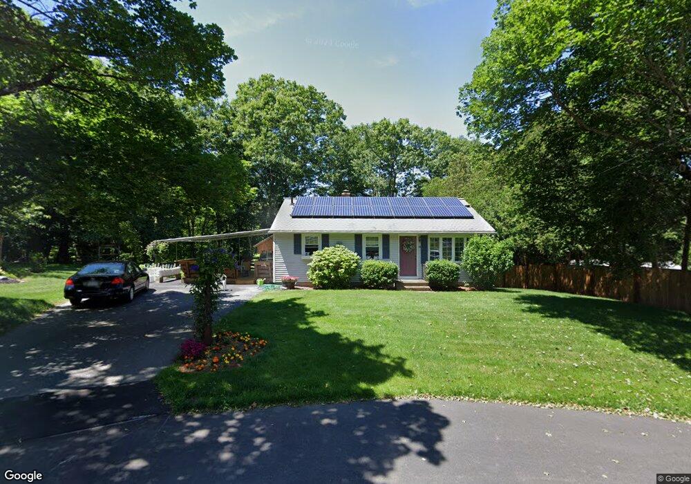
About This Home
This home is located at 16 Capt Peter Simpson Rd, Millbury, MA 01527 and is currently estimated at $455,810, approximately $500 per square foot. 16 Capt Peter Simpson Rd is a home located in Worcester County with nearby schools including Elmwood Street Elementary School, Raymond E. Shaw Elementary School, and Millbury Junior/Senior High School.
Ownership History
Purchase Details
Home Financials for this Owner
Home Financials are based on the most recent Mortgage that was taken out on this home.Purchase Details
Home Financials for this Owner
Home Financials are based on the most recent Mortgage that was taken out on this home.Home Values in the Area
Average Home Value in this Area
Purchase History
We collect this data history from publicly available records. To have your information removed, we recommend requesting removal directly through your county’s website.
| Date | Buyer | Sale Price | Title Company |
|---|---|---|---|
| Bednar Paul J | $109,000 | -- | |
| Bednar Paul J | $109,000 | -- | |
| Husband Todd | $100,000 | -- |
Mortgage History
We collect this data history from publicly available records. To have your information removed, we recommend requesting removal directly through your county’s website.
| Date | Status | Borrower | Loan Amount |
|---|---|---|---|
| Open | Husband Todd | $89,000 | |
| Closed | Husband Todd | $97,000 | |
| Previous Owner | Husband Todd | $98,610 |
Tax History
| Year | Tax Paid | Tax Assessment Tax Assessment Total Assessment is a certain percentage of the fair market value that is determined by local assessors to be the total taxable value of land and additions on the property. | Land | Improvement |
|---|---|---|---|---|
| 2025 | $5,071 | $378,700 | $116,100 | $262,600 |
| 2024 | $4,654 | $351,800 | $107,500 | $244,300 |
| 2023 | $4,260 | $294,800 | $75,300 | $219,500 |
| 2022 | $4,086 | $272,400 | $75,300 | $197,100 |
| 2021 | $4,007 | $259,700 | $75,300 | $184,400 |
| 2020 | $3,909 | $255,000 | $75,300 | $179,700 |
| 2019 | $3,733 | $235,500 | $68,500 | $167,000 |
| 2018 | $3,511 | $214,900 | $68,500 | $146,400 |
| 2017 | $3,373 | $205,300 | $68,500 | $136,800 |
| 2016 | $3,154 | $191,600 | $68,500 | $123,100 |
| 2015 | $3,175 | $192,900 | $72,800 | $120,100 |
| 2014 | $3,001 | $175,500 | $72,800 | $102,700 |
Map
- 3 Moore Dr
- 16 Herricks Ln
- 128 Worcester Providence Turnpike
- 108 Worcester Providence Turnpike
- 124 Worcester Providence Turnpike
- 131 Elm St
- 122 Elm St
- 11 Elmwood Terrace Unit A
- 63 Miles St
- 66 Buttonwood Ave
- 20 Old Providence Rd
- 0 W Main St
- 0 Worcester Providence Turnpike
- 121 Millbury Ave
- 32 Sibley Rd
- 9 Cyndy Ln
- 2 Wingfoot Ln
- 4 Herbert Dr Unit B
- 14 Millers Way Unit D
- 2 Wilson Rd Unit B
- 14 Capt Peter Simpson Rd
- 18 Capt Peter Simpson Rd
- 19 Capt Peter Simpson Rd
- 12 Capt Peter Simpson Rd
- 17 Capt Peter Simpson Rd
- 15 Capt Peter Simpson Rd
- 14 Thomas Hill Rd
- 13 Capt Peter Simpson Rd
- 12 Thomas Hill Rd
- 1 Ilyas Ln Unit 1A
- 1 Ilyas Ln Unit 2
- 91 S Main St
- 11 Capt Peter Simpson Rd
- 99 S Main St
- 97 S Main St
- 8 Thomas Hill Rd
- 13 Thomas Hill Rd
- 89 S Main St
- 87 S Main St
- 11 Thomas Hill Rd
Ask me questions while you tour the home.