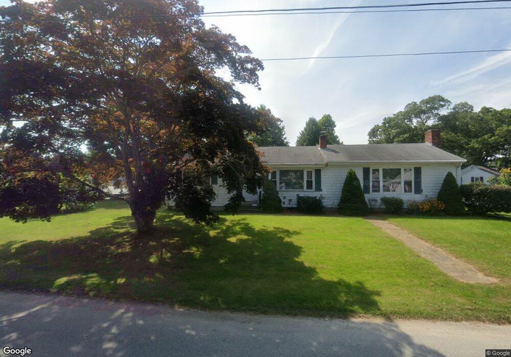
16 Cohasset Rd Buzzards Bay, MA 02532
Estimated Value: $468,959 - $508,000
2
Beds
1
Bath
1,232
Sq Ft
$399/Sq Ft
Est. Value
About This Home
This home is located at 16 Cohasset Rd, Buzzards Bay, MA 02532 and is currently estimated at $491,990, approximately $399 per square foot. 16 Cohasset Rd is a home with nearby schools including St Margaret Regional School.
Ownership History
Date
Name
Owned For
Owner Type
Purchase Details
Closed on
Aug 30, 2023
Sold by
Lindsey Cheryl L
Bought by
Mhb Properties Llc
Current Estimated Value
Home Financials for this Owner
Home Financials are based on the most recent Mortgage that was taken out on this home.
Original Mortgage
$570,000
Outstanding Balance
$556,377
Interest Rate
6.78%
Mortgage Type
Commercial
Estimated Equity
-$64,387
Purchase Details
Closed on
May 30, 2007
Sold by
Piekarski Carol A
Bought by
Lindsey Cheryl L
Home Financials for this Owner
Home Financials are based on the most recent Mortgage that was taken out on this home.
Original Mortgage
$198,750
Interest Rate
6.24%
Mortgage Type
Purchase Money Mortgage
Purchase Details
Closed on
Nov 29, 2004
Sold by
Halloran John J
Bought by
Piekarski Carol A
Home Financials for this Owner
Home Financials are based on the most recent Mortgage that was taken out on this home.
Original Mortgage
$50,000
Interest Rate
5.75%
Mortgage Type
Purchase Money Mortgage
Create a Home Valuation Report for This Property
The Home Valuation Report is an in-depth analysis detailing your home's value as well as a comparison with similar homes in the area
Purchase History
| Date | Buyer | Sale Price | Title Company |
|---|---|---|---|
| Mhb Properties Llc | $475,000 | None Available | |
| Mhb Properties Llc | $475,000 | None Available | |
| Mhb Properties Llc | $475,000 | None Available | |
| Lindsey Cheryl L | $265,000 | -- | |
| Lindsey Cheryl L | $265,000 | -- | |
| Piekarski Carol A | $258,000 | -- |
Source: Public Records
Mortgage History
| Date | Status | Borrower | Loan Amount |
|---|---|---|---|
| Open | Mhb Properties Llc | $570,000 | |
| Closed | Mhb Properties Llc | $570,000 | |
| Previous Owner | Piekarski Carol A | $198,750 | |
| Previous Owner | Piekarski Carol A | $39,700 | |
| Previous Owner | Piekarski Carol A | $50,000 |
Source: Public Records
Tax History
| Year | Tax Paid | Tax Assessment Tax Assessment Total Assessment is a certain percentage of the fair market value that is determined by local assessors to be the total taxable value of land and additions on the property. | Land | Improvement |
|---|---|---|---|---|
| 2025 | $4,070 | $370,700 | $115,300 | $255,400 |
| 2024 | $4,082 | $349,500 | $90,300 | $259,200 |
| 2023 | $3,845 | $312,600 | $82,000 | $230,600 |
| 2022 | $3,635 | $266,900 | $82,000 | $184,900 |
| 2021 | $3,618 | $258,400 | $82,000 | $176,400 |
| 2020 | $3,347 | $244,100 | $82,000 | $162,100 |
| 2019 | $3,094 | $228,200 | $79,600 | $148,600 |
| 2018 | $2,889 | $205,800 | $79,600 | $126,200 |
| 2017 | $2,695 | $192,800 | $79,600 | $113,200 |
| 2016 | $2,469 | $175,200 | $77,600 | $97,600 |
| 2015 | $2,400 | $175,200 | $77,600 | $97,600 |
| 2014 | $2,473 | $186,100 | $81,700 | $104,400 |
Source: Public Records
Map
Nearby Homes
- 3132 Cranberry Hwy Unit 59
- 92 Choctaw Dr
- 7 Fearing St
- 60 Martin St
- 3 Fairway Dr Unit F
- 67 Algonquin St
- 20 Salt Works Rd
- 8 Pine Tree Dr
- 13 Monack Rd
- 22 Long Neck Rd
- 56 Rip Van Winkle Way
- 22 Wallace Point
- 3 Wolf Rd
- 23 Starboard Dr Unit Lot 50
- 4 Van Bummel Rd
- 36B Starboard Dr Unit 36E
- 36B Starboard Dr Unit 36G
- 36B Starboard Dr Unit 36C
- 36B Starboard Dr Unit 36A
- 36B Starboard Dr Unit 36D
Your Personal Tour Guide
Ask me questions while you tour the home.