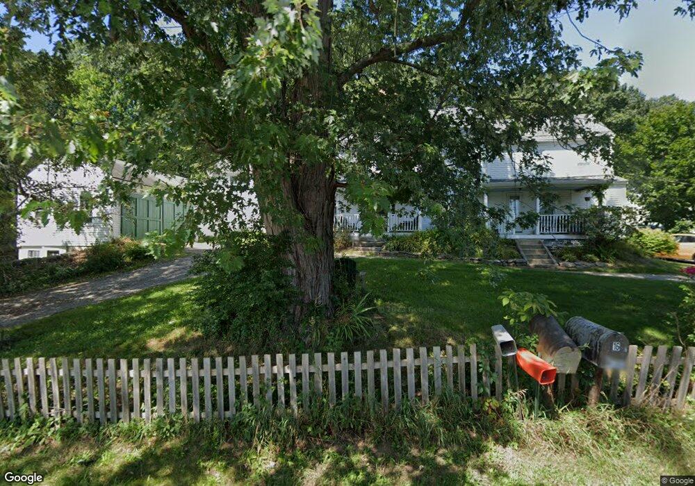
16 Roper Rd Westminster, MA 01473
Estimated Value: $449,000 - $769,000
5
Beds
3
Baths
3,088
Sq Ft
$196/Sq Ft
Est. Value
About This Home
This home is located at 16 Roper Rd, Westminster, MA 01473 and is currently estimated at $606,198, approximately $196 per square foot. 16 Roper Rd is a home located in Worcester County with nearby schools including Oakmont Regional High School.
Ownership History
Date
Name
Owned For
Owner Type
Purchase Details
Closed on
Oct 3, 2018
Sold by
Mcgee Francis and Mcgee Carol E
Bought by
Mcgee Lt and Mcgee
Current Estimated Value
Purchase Details
Closed on
Apr 11, 2003
Sold by
Roper Phyllis C Est and Roper
Bought by
Roper Road Land Trust and Mizhir
Home Financials for this Owner
Home Financials are based on the most recent Mortgage that was taken out on this home.
Original Mortgage
$205,000
Interest Rate
5.91%
Purchase Details
Closed on
Jul 31, 2002
Sold by
Roper Phyllis C Est and Roper
Bought by
Mcgee Francis and Nitchie Carol E
Home Financials for this Owner
Home Financials are based on the most recent Mortgage that was taken out on this home.
Original Mortgage
$172,000
Interest Rate
6.64%
Mortgage Type
Purchase Money Mortgage
Create a Home Valuation Report for This Property
The Home Valuation Report is an in-depth analysis detailing your home's value as well as a comparison with similar homes in the area
Home Values in the Area
Average Home Value in this Area
Purchase History
| Date | Buyer | Sale Price | Title Company |
|---|---|---|---|
| Mcgee Lt | -- | -- | |
| Roper Road Land Trust | $99,900 | -- | |
| Mcgee Francis | $215,000 | -- |
Source: Public Records
Mortgage History
| Date | Status | Borrower | Loan Amount |
|---|---|---|---|
| Previous Owner | Mcgee Francis | $190,000 | |
| Previous Owner | Mcgee Francis | $205,000 | |
| Previous Owner | Mcgee Francis | $172,000 | |
| Previous Owner | Mcgee Francis | $21,000 |
Source: Public Records
Tax History
| Year | Tax Paid | Tax Assessment Tax Assessment Total Assessment is a certain percentage of the fair market value that is determined by local assessors to be the total taxable value of land and additions on the property. | Land | Improvement |
|---|---|---|---|---|
| 2025 | $5,788 | $470,600 | $137,400 | $333,200 |
| 2024 | $5,577 | $454,900 | $137,400 | $317,500 |
| 2023 | $5,191 | $397,500 | $128,500 | $269,000 |
| 2022 | $5,094 | $322,400 | $112,200 | $210,200 |
| 2021 | $5,060 | $301,900 | $98,400 | $203,500 |
| 2020 | $5,028 | $286,500 | $89,800 | $196,700 |
| 2019 | $4,962 | $271,900 | $75,200 | $196,700 |
| 2018 | $4,777 | $257,500 | $75,200 | $182,300 |
| 2017 | $4,622 | $254,100 | $75,200 | $178,900 |
| 2016 | $4,447 | $236,800 | $63,100 | $173,700 |
| 2015 | $4,167 | $219,900 | $63,100 | $156,800 |
| 2014 | $4,174 | $219,900 | $63,100 | $156,800 |
Source: Public Records
Map
Nearby Homes
- 147 Constitution Dr Unit 147
- 64 Loiselle Ave
- 51 Sawmill Pond Rd Unit 51
- 2 Roberts Way
- 76 Saw Mill Pond Rd
- 33 Green Briar Rd
- 16 Acorn Ave
- 34 Mountain Laurel Ln
- 122 Sanborn St
- 180 Ashburnham St
- 17 Fairview St
- Lot 25 Ashburnham St
- 0-1 Bean Porridge Hill Rd
- Lot 0 Narrows Rd
- 0 Syd Smith Rd (Rear)
- 815-819 River St
- 0 Grand St
- 0 Highview St
- 500 Oak Hill Rd
- 12 Lakewood Park Rd
- 22 Roper Rd
- 15 W Hill Dr Unit D
- 15 W Hill Dr Unit C
- 15 W Hill Dr Unit B
- 15 W Hill Dr Unit A
- 15 A W Hill Dr Unit A
- 15 W Hill Dr Unit 15,A
- 10 Roper Rd
- 17B W Hill Dr Unit 17B
- 17 W Hill Dr Unit D
- 17 W Hill Dr Unit C
- 17 W Hill Dr Unit B
- 17 W Hill Dr Unit A
- 17 W Hill Dr Unit 17D
- 24 Roper Rd
- 16 B W Hill Dr Unit 16B
- 19 W Hill Dr Unit D
- 19 W Hill Dr Unit C
- 19 W Hill Dr Unit B
- 19 W Hill Dr Unit A
Your Personal Tour Guide
Ask me questions while you tour the home.