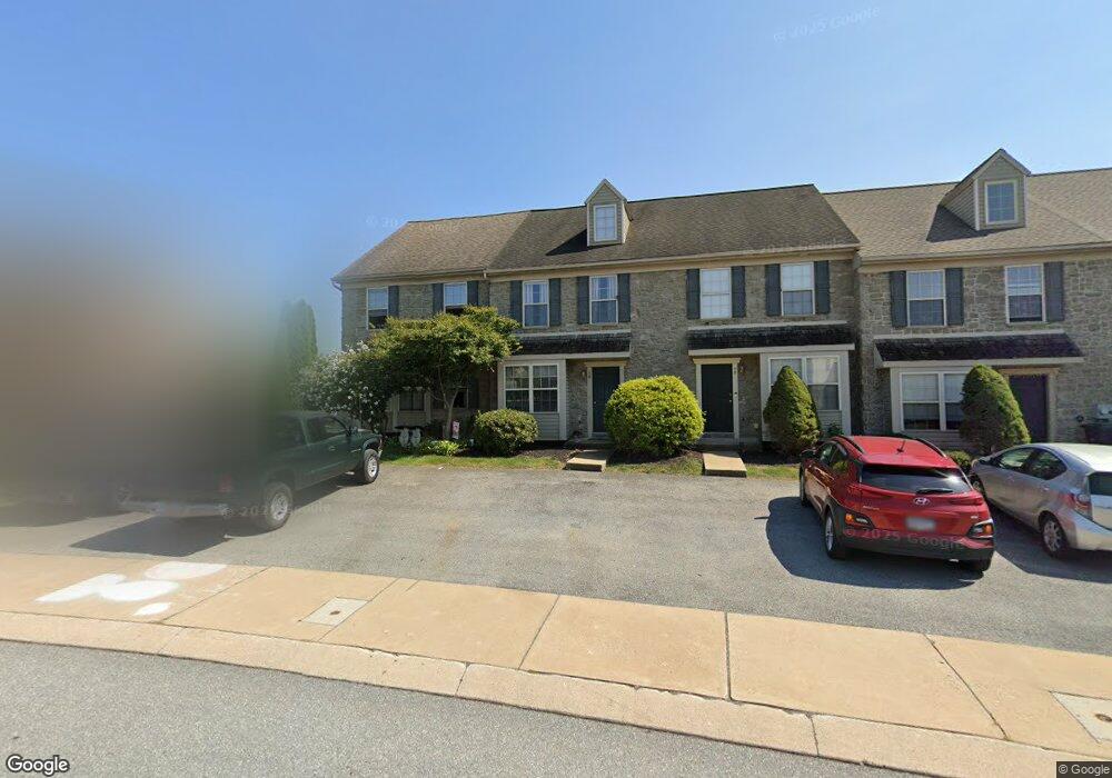
16 Tia Cir Mount Joy, PA 17552
Estimated Value: $268,683 - $281,000
3
Beds
2
Baths
1,391
Sq Ft
$199/Sq Ft
Est. Value
About This Home
This home is located at 16 Tia Cir, Mount Joy, PA 17552 and is currently estimated at $276,921, approximately $199 per square foot. 16 Tia Cir is a home located in Lancaster County with nearby schools including Donegal Intermediate School, Donegal High School, and Mount Calvary Christian School.
Ownership History
Date
Name
Owned For
Owner Type
Purchase Details
Closed on
Jul 28, 2011
Sold by
Donegal Crossing Associates Llc
Bought by
Jantzi Lowell and Jantzi Ruth
Current Estimated Value
Home Financials for this Owner
Home Financials are based on the most recent Mortgage that was taken out on this home.
Original Mortgage
$90,000
Outstanding Balance
$62,140
Interest Rate
4.51%
Mortgage Type
New Conventional
Estimated Equity
$214,781
Purchase Details
Closed on
Sep 10, 2002
Sold by
Horst Gerald R
Bought by
Donegal Crossing Associates Llc
Create a Home Valuation Report for This Property
The Home Valuation Report is an in-depth analysis detailing your home's value as well as a comparison with similar homes in the area
Home Values in the Area
Average Home Value in this Area
Purchase History
| Date | Buyer | Sale Price | Title Company |
|---|---|---|---|
| Jantzi Lowell | $120,000 | None Available | |
| Donegal Crossing Associates Llc | $4,057,200 | First American Title Ins Co |
Source: Public Records
Mortgage History
| Date | Status | Borrower | Loan Amount |
|---|---|---|---|
| Open | Jantzi Lowell | $90,000 |
Source: Public Records
Tax History
| Year | Tax Paid | Tax Assessment Tax Assessment Total Assessment is a certain percentage of the fair market value that is determined by local assessors to be the total taxable value of land and additions on the property. | Land | Improvement |
|---|---|---|---|---|
| 2025 | $3,683 | $144,300 | $38,400 | $105,900 |
| 2024 | $3,683 | $144,300 | $38,400 | $105,900 |
| 2023 | $3,669 | $144,300 | $38,400 | $105,900 |
| 2022 | $3,570 | $144,300 | $38,400 | $105,900 |
| 2021 | $3,430 | $144,300 | $38,400 | $105,900 |
| 2020 | $3,430 | $144,300 | $38,400 | $105,900 |
| 2019 | $3,428 | $144,300 | $38,400 | $105,900 |
| 2018 | $2,622 | $144,300 | $38,400 | $105,900 |
| 2017 | $2,704 | $93,400 | $27,800 | $65,600 |
| 2016 | $2,657 | $93,400 | $27,800 | $65,600 |
| 2015 | $559 | $93,400 | $27,800 | $65,600 |
| 2014 | $2,057 | $93,400 | $27,800 | $65,600 |
Source: Public Records
Map
Nearby Homes
- 1889 Shady Oak Dr
- 239 Mill Rd
- 1588 Harrisburg Ave
- 1584 Harrisburg Ave
- 2256 High St
- 2085 Andrew Ave
- 103 Brookfield Dr
- 107 Sparrow Ln
- 186 N Melhorn Dr
- 104 Merchant Ave Unit ANDOVER
- 104 Merchant Ave Unit MARLOW
- 104 Merchant Ave Unit ELGIN
- 104 Merchant Ave Unit DUNDEE
- 104 Merchant Ave Unit ANDERS
- 104 Merchant Ave Unit LATIMER
- 104 Merchant Ave Unit ARUNDEL
- 104 Merchant Ave Unit CARTER
- 104 Merchant Ave Unit HELSTON
- 104 Merchant Ave Unit TONBRIDGE
- 104 Merchant Ave Unit BROMLEY
Your Personal Tour Guide
Ask me questions while you tour the home.