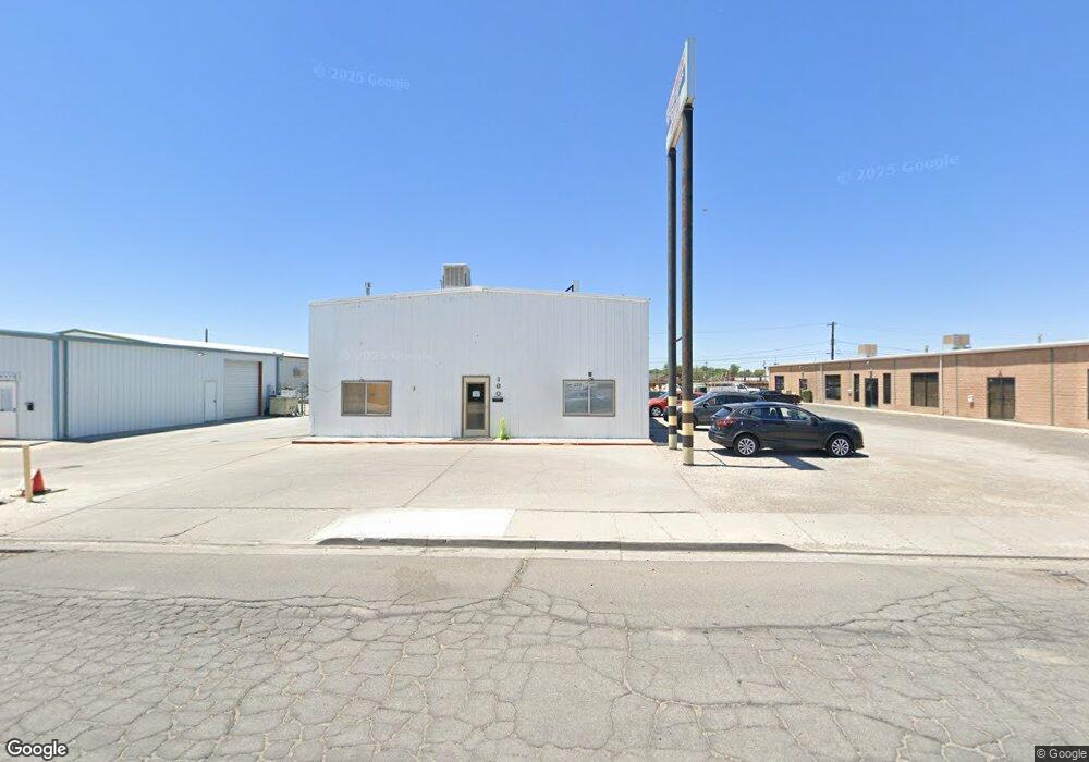
160 Industrial Way Fallon, NV 89406
Estimated Value: $267,284
Studio
--
Bath
4,000
Sq Ft
$67/Sq Ft
Est. Value
About This Home
This home is located at 160 Industrial Way, Fallon, NV 89406 and is currently estimated at $267,284, approximately $66 per square foot. 160 Industrial Way is a home located in Churchill County with nearby schools including Lahontan Elementary School, E.C. Best Elementary School, and Numa Elementary School.
Ownership History
Date
Name
Owned For
Owner Type
Purchase Details
Closed on
Apr 28, 2014
Sold by
Kent Bruce K
Bought by
Louie S Commercial Properties Llc
Current Estimated Value
Purchase Details
Closed on
Sep 6, 2012
Sold by
Taylor Bruce and Taylor Debbie
Bought by
Friedrich Pauline Joan Hall and Friedrich John Tilton
Purchase Details
Closed on
Aug 11, 2009
Sold by
Taylor Bruce J and Taylor Debbie Jo
Bought by
Taylor Bruce J and Taylor Debbie Jo
Purchase Details
Closed on
Feb 1, 2007
Sold by
Cody Mark and Cody Karen
Bought by
Taylor Bruce and Taylor Debbie
Home Financials for this Owner
Home Financials are based on the most recent Mortgage that was taken out on this home.
Original Mortgage
$110,000
Interest Rate
6.21%
Mortgage Type
Stand Alone Second
Create a Home Valuation Report for This Property
The Home Valuation Report is an in-depth analysis detailing your home's value as well as a comparison with similar homes in the area
Home Values in the Area
Average Home Value in this Area
Purchase History
| Date | Buyer | Sale Price | Title Company |
|---|---|---|---|
| Louie S Commercial Properties Llc | $115,000 | Western Nevada Title Company | |
| Friedrich Pauline Joan Hall | $311,598 | Western Nevada Title Company | |
| Taylor Bruce J | -- | None Available | |
| Taylor Bruce | $400,000 | Stewart Title Company |
Source: Public Records
Mortgage History
| Date | Status | Borrower | Loan Amount |
|---|---|---|---|
| Previous Owner | Taylor Bruce | $110,000 | |
| Previous Owner | Taylor Bruce | $250,000 |
Source: Public Records
Tax History
| Year | Tax Paid | Tax Assessment Tax Assessment Total Assessment is a certain percentage of the fair market value that is determined by local assessors to be the total taxable value of land and additions on the property. | Land | Improvement |
|---|---|---|---|---|
| 2025 | $3,657 | $99,850 | $12,310 | $87,540 |
| 2024 | $3,657 | $104,394 | $12,310 | $92,084 |
| 2023 | $3,657 | $97,272 | $12,310 | $84,962 |
| 2022 | $3,135 | $85,424 | $10,588 | $74,836 |
| 2021 | $1,201 | $32,587 | $10,588 | $21,999 |
| 2020 | $1,224 | $33,272 | $10,588 | $22,684 |
| 2019 | $1,195 | $32,481 | $10,588 | $21,893 |
| 2018 | $1,190 | $32,359 | $10,588 | $21,771 |
| 2017 | $1,197 | $32,552 | $10,588 | $21,964 |
| 2016 | $1,180 | $31,494 | $10,588 | $20,906 |
| 2015 | $1,158 | $31,756 | $10,588 | $21,168 |
| 2014 | $1,167 | $34,483 | $10,588 | $23,895 |
Source: Public Records
Map
Nearby Homes
- 1044 Allen Rd
- 521 Whitaker Ln
- 861 W Center St
- 841 W Center St
- 2320 Smart Ln
- 800 W 5th St
- 2210 Christie Cir
- 745 W Center St
- APN 007-091-73 Casey Rd
- APN 007-091-70 Casey Rd
- APN 007-091-75 Casey Rd
- APN 007-091-74 Casey Rd
- APN 007-091-72 Casey Rd
- APN 007-091-71 Casey Rd
- 5011 Reno Hwy
- 650 Cora Way
- 250 S Taylor St
- 1755 Coleman Rd
- 1135 Tamarack Dr
- 1009 Deena Way
- 170 Industrial Way
- 150 Industrial Way
- 180 Industrial Way
- 190 Industrial Way
- 130 $ 140 Industrial Way
- 171 Industrial Way
- 161 Industrial Way
- 161 Industrial Way
- 141 Industrial Way
- 141 Industrial Way Unit 7
- 1857 Grimes St
- 1869 Grimes St
- 1881 Grimes St
- 301 Burntwood St
- 1803 Grimes St Unit 3
- 1854 Albert St
- 1659 Kaiser St
- 1878 Albert St Unit 3
- 1661 Kaiser St Unit 1
- 1661 Kaiser St
Your Personal Tour Guide
Ask me questions while you tour the home.