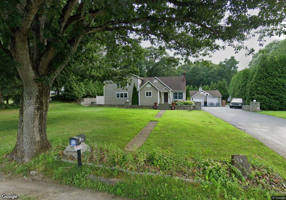
160 Riverside Dr Baltic, CT 06330
Estimated Value: $411,000 - $650,000
2
Beds
2
Baths
3,382
Sq Ft
$157/Sq Ft
Est. Value
About This Home
This home is located at 160 Riverside Dr, Baltic, CT 06330 and is currently estimated at $529,533, approximately $156 per square foot. 160 Riverside Dr is a home located in New London County with nearby schools including Sayles School, St. Joseph Elementary School, and Academy of the Holy Family.
Ownership History
Date
Name
Owned For
Owner Type
Purchase Details
Closed on
Jul 7, 2003
Sold by
Menard Richard and Menard Melody
Bought by
Kempesta Mark
Current Estimated Value
Home Financials for this Owner
Home Financials are based on the most recent Mortgage that was taken out on this home.
Original Mortgage
$88,000
Outstanding Balance
$37,977
Interest Rate
5.46%
Estimated Equity
$491,556
Purchase Details
Closed on
May 3, 1994
Sold by
Shortoff Peter and Shortoff Edward
Bought by
Menard Richard F and Menard Melody
Home Financials for this Owner
Home Financials are based on the most recent Mortgage that was taken out on this home.
Original Mortgage
$100,200
Interest Rate
7.7%
Mortgage Type
Unknown
Create a Home Valuation Report for This Property
The Home Valuation Report is an in-depth analysis detailing your home's value as well as a comparison with similar homes in the area
Home Values in the Area
Average Home Value in this Area
Purchase History
| Date | Buyer | Sale Price | Title Company |
|---|---|---|---|
| Kempesta Mark | $110,000 | -- | |
| Menard Richard F | $101,000 | -- |
Source: Public Records
Mortgage History
| Date | Status | Borrower | Loan Amount |
|---|---|---|---|
| Open | Menard Richard F | $50,000 | |
| Open | Menard Richard F | $88,000 | |
| Previous Owner | Menard Richard F | $11,000 | |
| Previous Owner | Menard Richard F | $100,200 |
Source: Public Records
Tax History
| Year | Tax Paid | Tax Assessment Tax Assessment Total Assessment is a certain percentage of the fair market value that is determined by local assessors to be the total taxable value of land and additions on the property. | Land | Improvement |
|---|---|---|---|---|
| 2025 | $10,216 | $336,050 | $46,360 | $289,690 |
| 2024 | $9,913 | $336,050 | $46,360 | $289,690 |
| 2023 | $9,577 | $336,050 | $46,360 | $289,690 |
| 2022 | $8,026 | $221,400 | $31,220 | $190,180 |
| 2021 | $7,970 | $221,400 | $31,220 | $190,180 |
| 2020 | $7,915 | $221,400 | $31,220 | $190,180 |
| 2019 | $4,316 | $221,400 | $31,220 | $190,180 |
| 2018 | $7,362 | $221,400 | $31,220 | $190,180 |
| 2017 | $3,880 | $214,690 | $34,580 | $180,110 |
| 2016 | $6,763 | $214,690 | $34,580 | $180,110 |
| 2015 | $6,655 | $214,690 | $34,580 | $180,110 |
| 2014 | $6,655 | $214,690 | $34,580 | $180,110 |
Source: Public Records
Map
Nearby Homes
- 23 Versailles Rd
- 18 Baltic Rd
- 28 Nashua St
- 32 Nashua St
- 306 Old Canterbury Turnpike
- 282-318R Old Canterbury Turnpike
- 91 Taftville Occum Rd
- 220 Preston Allen Rd
- 5 Town House Rd
- 119 Taftville Occum Rd
- 24 Newent Rd
- 252 Old Canterbury Turnpike Unit LOT 94
- 252 Old Canterbury Turnpike Unit LOT 32
- 252 Old Canterbury Turnpike Unit LOT 89
- 120 Hanover Versailles Rd
- 148 Main St
- 10 Meadow Brook Cir
- 71 River St
- 12 W Main St
- 19 Gavin Way
- 90 Riverside Dr
- 150 Riverside Dr
- 168 Riverside Dr
- 147 Riverside Dr
- 149 Riverside Dr
- 82 Riverside Dr
- 178 Riverside Dr
- 140 Riverside Dr
- 166 Riverside Dr
- 186 Riverside Dr
- 142 Riverside Dr
- 191 Riverside Dr
- 114 Riverside Dr
- 206 Riverside Dr
- 55 Wendy Dr
- 53 Wendy Dr
- 35 Wendy Dr
- 51 Wendy Dr
- 99 Riverside Dr
- 96 Riverside Dr
Your Personal Tour Guide
Ask me questions while you tour the home.