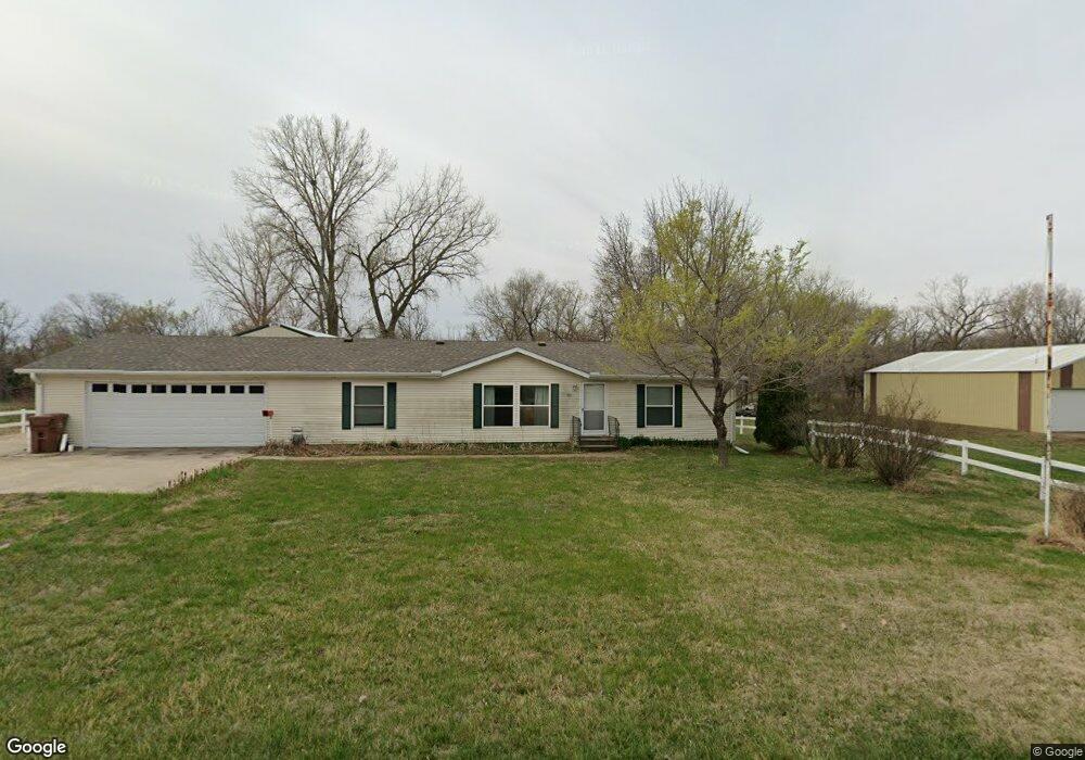
1601 W Sprague Rd Sprague, NE 68438
Estimated Value: $247,000 - $261,000
3
Beds
4
Baths
1,404
Sq Ft
$180/Sq Ft
Est. Value
About This Home
This home is located at 1601 W Sprague Rd, Sprague, NE 68438 and is currently estimated at $253,072, approximately $180 per square foot. 1601 W Sprague Rd is a home located in Lancaster County with nearby schools including Crete Elementary School, Crete Middle School, and Crete High School.
Ownership History
Date
Name
Owned For
Owner Type
Purchase Details
Closed on
May 23, 2005
Sold by
Green Tree Servicing Llc
Bought by
Bittinger Richard L and Bittinger Doris H
Current Estimated Value
Purchase Details
Closed on
Nov 17, 1999
Sold by
Mahler Bruce L and Mahler Peggy D
Bought by
Mertens James J and Mertens Carly A
Home Financials for this Owner
Home Financials are based on the most recent Mortgage that was taken out on this home.
Original Mortgage
$91,933
Interest Rate
7.83%
Mortgage Type
Construction
Create a Home Valuation Report for This Property
The Home Valuation Report is an in-depth analysis detailing your home's value as well as a comparison with similar homes in the area
Purchase History
| Date | Buyer | Sale Price | Title Company |
|---|---|---|---|
| Bittinger Richard L | $87,000 | -- | |
| Mertens James J | $11,000 | -- |
Source: Public Records
Mortgage History
| Date | Status | Borrower | Loan Amount |
|---|---|---|---|
| Previous Owner | Mertens James J | $91,933 |
Source: Public Records
Tax History
| Year | Tax Paid | Tax Assessment Tax Assessment Total Assessment is a certain percentage of the fair market value that is determined by local assessors to be the total taxable value of land and additions on the property. | Land | Improvement |
|---|---|---|---|---|
| 2025 | $1,967 | $224,200 | $45,500 | $178,700 |
| 2024 | $1,967 | $177,700 | $41,600 | $136,100 |
| 2023 | $2,680 | $177,700 | $41,600 | $136,100 |
| 2022 | $2,537 | $140,400 | $35,100 | $105,300 |
| 2021 | $2,386 | $140,400 | $35,100 | $105,300 |
| 2020 | $2,076 | $120,500 | $32,500 | $88,000 |
| 2019 | $2,121 | $120,500 | $32,500 | $88,000 |
| 2018 | $2,044 | $114,400 | $26,000 | $88,400 |
| 2017 | $2,044 | $114,400 | $22,000 | $92,400 |
| 2016 | $1,709 | $94,800 | $22,000 | $72,800 |
| 2015 | $1,729 | $94,800 | $22,000 | $72,800 |
| 2014 | $1,884 | $102,200 | $22,000 | $80,200 |
| 2013 | -- | $102,200 | $22,000 | $80,200 |
Source: Public Records
Map
Nearby Homes
- 1700 W 3rd St
- Lot 2 Block 8 W Lady May Ln
- TBD SW 14th St
- 17801 SW 2nd St
- Lot 6 Block 5 W Lady May Ln
- Lot 3 Block 5 W Lady May Ln
- TBD 2 W Lady May Ln
- TBD 1 W Lady May Ln
- SW 36th Street W Lady May Ln
- Lot 1 Block 6 W Lady May Ln
- Lot 1 Block 4 W Lady May Ln
- Lot 2 Block 3 W Lady May Ln
- Lot 2 Block 4 W Lady May Ln
- 0 SW 2nd St
- TBD Ringo Rd
- 1530 Deer Trail
- 5231 W Roca Rd
- TBD 1 SW 54th St
- TBD 2 SW 54th St
- TBD 4 SW 54th St
- 1645 W Sprague Rd
- 1540 W Sprague Rd
- 1640 W Sprague Rd
- 18945 Market St
- 18945 Market St
- 18905 Broom St
- 1535 W 2nd St
- 18935 Market St
- 1625 W 2nd St
- 18920 Buell St
- 18915 Market St
- 18940 Market St
- 5895 W Sprague Rd
- 0 W Sprague Rd
- 18835 Broom St
- 18820 Broom St
- 18925 Buell St
- 1530 W 2nd St
- 19300 SW 58th St
- 18835 Market St
Your Personal Tour Guide
Ask me questions while you tour the home.