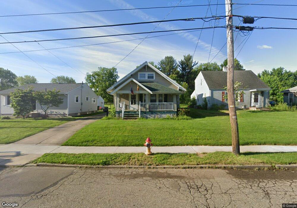
1601 Walnut Rd SW Massillon, OH 44647
Lawndale NeighborhoodEstimated Value: $136,634 - $149,000
3
Beds
1
Bath
1,614
Sq Ft
$88/Sq Ft
Est. Value
About This Home
This home is located at 1601 Walnut Rd SW, Massillon, OH 44647 and is currently estimated at $142,159, approximately $88 per square foot. 1601 Walnut Rd SW is a home located in Stark County with nearby schools including Massillon Intermediate School, Massillon Junior High School, and Washington High School.
Ownership History
Date
Name
Owned For
Owner Type
Purchase Details
Closed on
Nov 3, 2014
Sold by
Keller Evelyn F
Bought by
Keller Thomas A
Current Estimated Value
Home Financials for this Owner
Home Financials are based on the most recent Mortgage that was taken out on this home.
Original Mortgage
$58,990
Outstanding Balance
$45,569
Interest Rate
4.23%
Mortgage Type
New Conventional
Estimated Equity
$96,590
Create a Home Valuation Report for This Property
The Home Valuation Report is an in-depth analysis detailing your home's value as well as a comparison with similar homes in the area
Home Values in the Area
Average Home Value in this Area
Purchase History
| Date | Buyer | Sale Price | Title Company |
|---|---|---|---|
| Keller Thomas A | $61,000 | Erieview Title Agency Llc |
Source: Public Records
Mortgage History
| Date | Status | Borrower | Loan Amount |
|---|---|---|---|
| Open | Keller Thomas A | $58,990 |
Source: Public Records
Tax History
| Year | Tax Paid | Tax Assessment Tax Assessment Total Assessment is a certain percentage of the fair market value that is determined by local assessors to be the total taxable value of land and additions on the property. | Land | Improvement |
|---|---|---|---|---|
| 2025 | -- | $34,830 | $9,800 | $25,030 |
| 2024 | -- | $34,830 | $9,800 | $25,030 |
| 2023 | $1,719 | $33,600 | $7,840 | $25,760 |
| 2022 | $1,722 | $33,600 | $7,840 | $25,760 |
| 2021 | $1,750 | $33,600 | $7,840 | $25,760 |
| 2020 | $1,552 | $28,040 | $6,440 | $21,600 |
| 2019 | $1,530 | $28,040 | $6,440 | $21,600 |
Source: Public Records
Map
Nearby Homes
- 1521 Tremont Ave SW
- 804 15th St SW
- 918 15th St SW
- 1307 Main Ave W
- 43 14th St NW
- 1833 Carlene Ave SW
- 1105 Tremont Ave SW
- 104 12th St NW
- 1301 Lincoln Way NW
- 37 23rd St NW
- 322 21st St NW
- 827 9th St SW
- 831 9th St SW
- 2488 Carlene Ave SW
- 864 Liberty Ct SW
- 1244 Patriot Place SW
- 817 7th St SW
- 1252 Patriot Place SW
- 1290 Patriot Place SW
- 2119 Alden Ave NW
- 1541 Walnut Rd SW
- 1607 Walnut Rd SW
- 1537 Walnut Rd SW
- 1613 Walnut Rd SW
- 1533 Walnut Rd SW
- 1617 Walnut Rd SW
- 1600 Walnut Rd SW
- 1529 Walnut Rd SW
- 1610 Walnut Rd SW
- 1600 Byron Ave SW
- 1606 Byron Ave SW
- 1540 Byron Ave SW
- 1623 Walnut Rd SW
- 1610 Byron Ave SW
- 718 17th St SW
- 1523 Walnut Rd SW
- 724 17th St SW
- 1540 Walnut Rd SW
- 1530 Byron Ave SW
- 706 17th St SW
Your Personal Tour Guide
Ask me questions while you tour the home.