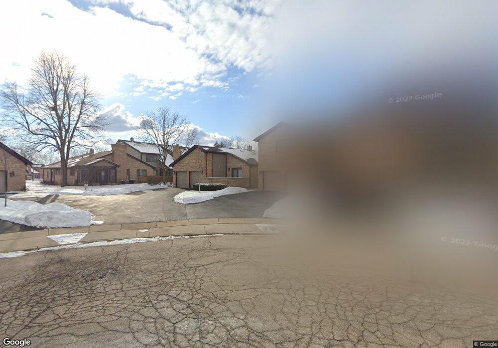
1602 Cypress Ct Hoffman Estates, IL 60169
South Hoffman Estates NeighborhoodEstimated Value: $353,583 - $420,000
4
Beds
3
Baths
1,385
Sq Ft
$276/Sq Ft
Est. Value
About This Home
This home is located at 1602 Cypress Ct, Hoffman Estates, IL 60169 and is currently estimated at $382,646, approximately $276 per square foot. 1602 Cypress Ct is a home located in Cook County with nearby schools including Neil Armstrong Elementary School, Dwight D Eisenhower Junior High School, and Hoffman Estates High School.
Ownership History
Date
Name
Owned For
Owner Type
Purchase Details
Closed on
Feb 18, 2002
Sold by
Rinder Nancy A
Bought by
Rinder Nancy A and The Nancy A Rinder Trust
Current Estimated Value
Purchase Details
Closed on
Oct 27, 2000
Sold by
Lewis Carolyn K
Bought by
Rinder Nancy A
Home Financials for this Owner
Home Financials are based on the most recent Mortgage that was taken out on this home.
Original Mortgage
$107,500
Outstanding Balance
$37,485
Interest Rate
7.87%
Estimated Equity
$345,161
Purchase Details
Closed on
Apr 1, 1995
Sold by
Wenger Robert W and Wenger Roberta
Bought by
Lewis Carolyn K
Home Financials for this Owner
Home Financials are based on the most recent Mortgage that was taken out on this home.
Original Mortgage
$136,800
Interest Rate
8.79%
Create a Home Valuation Report for This Property
The Home Valuation Report is an in-depth analysis detailing your home's value as well as a comparison with similar homes in the area
Home Values in the Area
Average Home Value in this Area
Purchase History
| Date | Buyer | Sale Price | Title Company |
|---|---|---|---|
| Rinder Nancy A | -- | -- | |
| Rinder Nancy A | $207,500 | -- | |
| Lewis Carolyn K | $171,000 | -- |
Source: Public Records
Mortgage History
| Date | Status | Borrower | Loan Amount |
|---|---|---|---|
| Open | Rinder Nancy A | $107,500 | |
| Previous Owner | Lewis Carolyn K | $136,800 |
Source: Public Records
Tax History
| Year | Tax Paid | Tax Assessment Tax Assessment Total Assessment is a certain percentage of the fair market value that is determined by local assessors to be the total taxable value of land and additions on the property. | Land | Improvement |
|---|---|---|---|---|
| 2025 | $7,268 | $32,000 | $4,146 | $27,854 |
| 2024 | $7,268 | $27,000 | $4,500 | $22,500 |
| 2023 | $7,003 | $27,000 | $4,500 | $22,500 |
| 2022 | $7,003 | $27,000 | $4,500 | $22,500 |
| 2021 | $5,218 | $18,905 | $3,264 | $15,641 |
| 2020 | $5,171 | $18,905 | $3,264 | $15,641 |
| 2019 | $5,146 | $21,006 | $3,264 | $17,742 |
| 2018 | $4,816 | $18,206 | $2,850 | $15,356 |
| 2017 | $4,750 | $18,206 | $2,850 | $15,356 |
| 2016 | $4,680 | $18,206 | $2,850 | $15,356 |
| 2015 | $4,778 | $17,500 | $2,487 | $15,013 |
| 2014 | $4,711 | $17,500 | $2,487 | $15,013 |
| 2013 | $4,572 | $17,500 | $2,487 | $15,013 |
Source: Public Records
Map
Nearby Homes
- 1800 Monterey Ct
- 1375 Rebecca Dr Unit 408
- 1475 Rebecca Dr Unit 213
- 1500 Robin Cir Unit 314
- 1880 Bonnie Ln Unit 116
- 1880 Bonnie Ln Unit 112
- 1729 Pebble Beach Ct
- 1987 Leiter Way Unit 11003
- 1988 Leiter Way Unit 13001
- 1994 Leiter Way Unit 14003
- 1986 Leiter Way Unit 13002
- 1989 Leiter Way Unit 11004
- 1450 Meyer Rd
- 1776 Bristol Walk Unit 1776
- 1809 Lancashire Ct
- 1975 Windsong Dr Unit 333E1
- 1803 Dumont Ln Unit 3
- 1722 Fayette Walk Unit E
- 1797 Queensbury Cir Unit 5764
- 1800 Huntington Blvd Unit 412
- 1600 Cypress Ct
- 1598 Cypress Ct
- 1596 Cypress Ct Unit 4
- 1783 Monterey Ct
- 1785 Monterey Ct Unit 4
- 1787 Monterey Ct Unit 4
- 1789 Monterey Ct
- 1604 Cypress Ct
- 1606 Cypress Ct
- 1791 Monterey Ct
- 1791 Monterey Ct Unit 1791
- 1608 Cypress Ct
- 1610 Cypress Ct
- 1782 Monterey Ct
- 1612 Cypress Ct Unit 4
- 1784 Monterey Ct
- 1786 Monterey Ct
- 1616 Cypress Ct
- 1618 Cypress Ct
- 1614 Cypress Ct Unit 4
Your Personal Tour Guide
Ask me questions while you tour the home.