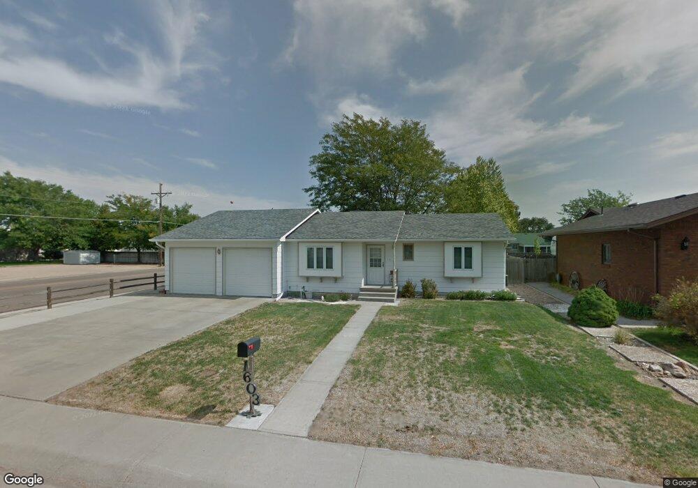
1603 Robin Rd Sterling, CO 80751
Estimated Value: $292,380 - $403,000
3
Beds
2
Baths
1,356
Sq Ft
$250/Sq Ft
Est. Value
About This Home
This home is located at 1603 Robin Rd, Sterling, CO 80751 and is currently estimated at $339,595, approximately $250 per square foot. 1603 Robin Rd is a home located in Logan County with nearby schools including Ayres Elementary School, Campbell Elementary School, and Sterling Middle School.
Ownership History
Date
Name
Owned For
Owner Type
Purchase Details
Closed on
Sep 11, 2013
Sold by
Lambrecht Janelle Clarissa and Nicolaus Janelle Clarissa
Bought by
Lambrecht Annette M
Current Estimated Value
Home Financials for this Owner
Home Financials are based on the most recent Mortgage that was taken out on this home.
Original Mortgage
$123,200
Outstanding Balance
$85,192
Interest Rate
2.95%
Mortgage Type
Adjustable Rate Mortgage/ARM
Estimated Equity
$254,403
Purchase Details
Closed on
Jul 7, 2011
Sold by
Boxler Daniel Anthony
Bought by
Lambrecht Janelle Clarissa
Home Financials for this Owner
Home Financials are based on the most recent Mortgage that was taken out on this home.
Original Mortgage
$117,000
Interest Rate
4.65%
Mortgage Type
New Conventional
Purchase Details
Closed on
Feb 6, 2007
Sold by
The Carolyn Harley Brooks Trust
Bought by
Boxler Daniel Anthony
Create a Home Valuation Report for This Property
The Home Valuation Report is an in-depth analysis detailing your home's value as well as a comparison with similar homes in the area
Purchase History
| Date | Buyer | Sale Price | Title Company |
|---|---|---|---|
| Lambrecht Annette M | $154,000 | Stewart Title | |
| Lambrecht Janelle Clarissa | $152,000 | Stewart Title | |
| Boxler Daniel Anthony | $8,000 | None Available |
Source: Public Records
Mortgage History
| Date | Status | Borrower | Loan Amount |
|---|---|---|---|
| Open | Lambrecht Annette M | $123,200 | |
| Closed | Lambrecht Janelle Clarissa | $117,000 |
Source: Public Records
Tax History
| Year | Tax Paid | Tax Assessment Tax Assessment Total Assessment is a certain percentage of the fair market value that is determined by local assessors to be the total taxable value of land and additions on the property. | Land | Improvement |
|---|---|---|---|---|
| 2025 | $1,686 | $20,108 | $0 | $0 |
| 2024 | $1,282 | $20,510 | $0 | $0 |
| 2023 | $1,282 | $20,510 | $0 | $0 |
| 2022 | $1,353 | $16,060 | $2,350 | $13,710 |
| 2021 | $1,323 | $16,530 | $2,420 | $14,110 |
| 2020 | $1,250 | $29,700 | $2,270 | $27,430 |
| 2019 | $1,255 | $29,700 | $2,270 | $27,430 |
| 2018 | $1,114 | $13,160 | $1,710 | $11,450 |
| 2017 | $1,096 | $63,980 | $8,300 | $55,680 |
| 2015 | $1,021 | $57,460 | $7,700 | $49,760 |
| 2014 | $1,021 | $51,780 | $7,700 | $44,080 |
| 2013 | $1,021 | $51,780 | $7,700 | $44,080 |
Source: Public Records
Map
Nearby Homes
- 1617 Zachary Dr
- 504 Lily Ln
- 404-406 Kochia Way
- 508 Fairhurst St
- 817 Nicole Rd
- 909 Fairhurst St
- 714 Delmar St
- 309 Delmar St
- 603 Park St Unit 106
- 419 Taylor St
- 530 Taylor St
- 302 Beattie St
- 401 Park St Unit 403
- 905 S 2nd Ave
- 310 Taylor St
- 228-230 Taylor St
- 704 S 3rd Ave
- 115 Taylor St
- 709 S 2nd Ave
- 131 Park St Unit A, B, C
- 1609 Robin Rd
- 1615 Robin Rd
- 1610 Pheasant Ridge
- 715 Holly Dr
- 709 Holly Dr
- 1616 Pheasant Ridge
- 703 Holly Dr
- 803 Holly Dr
- 1621 Robin Rd
- 1618 Robin Rd
- 1622 Pheasant Ridge
- 1624 Robin Rd
- 814 Iris Dr
- 814 Iris Dr
- 814 Iris Dr
- 814 Iris Dr
- 814 Iris Dr Unit D
- 814 Iris Dr Unit A
- 814 Iris Dr Unit B
- 1627 Robin Rd
Your Personal Tour Guide
Ask me questions while you tour the home.