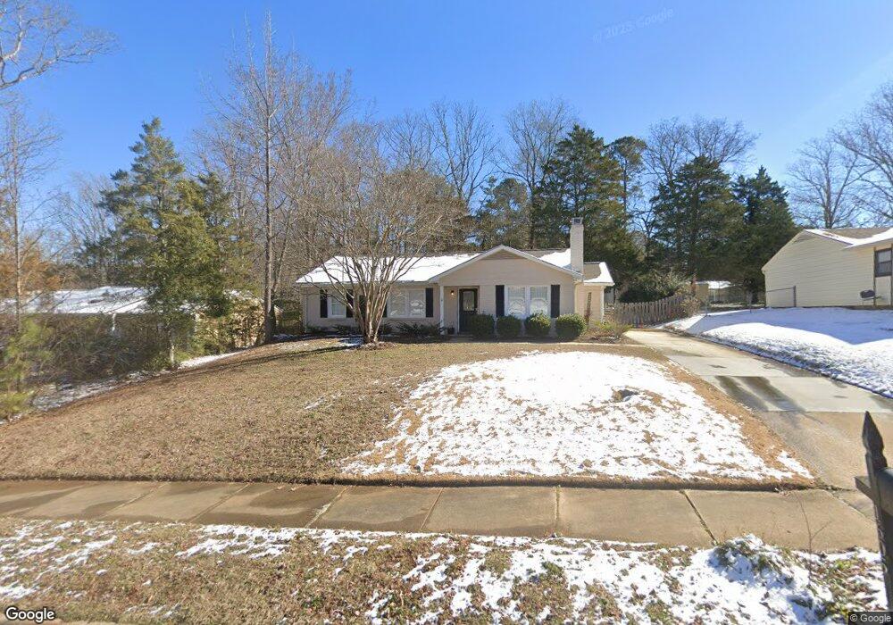
1605 Burnley Dr Cary, NC 27511
South Cary NeighborhoodEstimated Value: $402,000 - $406,936
About This Home
This home is located at 1605 Burnley Dr, Cary, NC 27511 and is currently estimated at $404,484, approximately $296 per square foot. 1605 Burnley Dr is a home located in Wake County with nearby schools including Laurel Park Elementary, Salem Middle, and Apex High School.
Ownership History
We collect this data history from publicly available records. To have your information removed, we recommend requesting removal directly through your county’s website.
Purchase Details
Home Financials for this Owner
Home Financials are based on the most recent Mortgage that was taken out on this home.Purchase Details
Home Financials for this Owner
Home Financials are based on the most recent Mortgage that was taken out on this home.Purchase Details
Purchase Details
Purchase Details
Home Financials for this Owner
Home Financials are based on the most recent Mortgage that was taken out on this home.Home Values in the Area
Average Home Value in this Area
Purchase History
We collect this data history from publicly available records. To have your information removed, we recommend requesting removal directly through your county’s website.
| Date | Buyer | Sale Price | Title Company |
|---|---|---|---|
| -- | None Available | ||
| -- | None Available | ||
| $111,500 | None Available | ||
| -- | None Available | ||
| $132,000 | -- |
Mortgage History
We collect this data history from publicly available records. To have your information removed, we recommend requesting removal directly through your county’s website.
| Date | Status | Borrower | Loan Amount |
|---|---|---|---|
| Open | $108,000 | ||
| Open | $250,000 | ||
| Closed | $116,685 | ||
| Previous Owner | $118,800 |
Tax History
We collect this data history from publicly available records. To have your information removed, we recommend requesting removal directly through your county’s website.
| Year | Tax Paid | Tax Assessment Tax Assessment Total Assessment is a certain percentage of the fair market value that is determined by local assessors to be the total taxable value of land and additions on the property. | Land | Improvement |
|---|---|---|---|---|
| 2025 | $3,201 | $371,164 | $175,000 | $196,164 |
| 2024 | $3,132 | $371,164 | $175,000 | $196,164 |
| 2023 | $2,444 | $241,898 | $113,000 | $128,898 |
| 2022 | $2,353 | $241,898 | $113,000 | $128,898 |
| 2021 | $2,306 | $241,898 | $113,000 | $128,898 |
| 2020 | $2,318 | $241,898 | $113,000 | $128,898 |
| 2019 | $2,025 | $187,298 | $88,000 | $99,298 |
| 2018 | $1,901 | $187,298 | $88,000 | $99,298 |
| 2017 | $1,827 | $187,298 | $88,000 | $99,298 |
| 2016 | $1,800 | $187,298 | $88,000 | $99,298 |
| 2015 | $1,526 | $152,936 | $58,000 | $94,936 |
| 2014 | $1,439 | $152,936 | $58,000 | $94,936 |
Map
- 1748 Laurel Park Place
- 202 Stoneleigh Dr
- 1757 Laurel Park Place
- 104 Applecross Dr
- 1061 Monmouth Loop
- 116 Carostone Ct
- 104 Charter Ct
- 215 Pointe Crest Ct
- 107 Mccloud Ct
- 100 Lost Tree Ln
- 416 Center Pointe Dr
- 211 Kilbreck Dr
- 324 Vinca Cir
- 306 Vinca Cir
- 113 Arvo Ln
- 304 Vinca Cir
- 619 Laurel Berry Ct
- 306 Wax Myrtle Ct
- 218 Arvo Ln
- 1206 Wishaw Ct
- 1607 Burnley Dr
- 1609 Burnley Dr
- 1108 Broadford Dr
- 1603 Burnley Dr
- 1611 Burnley Dr
- 1106 Broadford Dr
- 1110 Broadford Dr
- 1606 Burnley Dr
- 1104 Broadford Dr
- 1610 Burnley Dr
- 1613 Burnley Dr
- 1601 Burnley Dr
- 1200 Broadford Dr
- 1612 Burnley Dr
- 1602 Burnley Dr
- 1202 Broadford Dr
- 1102 Broadford Dr
- 114 Mcdole Cir
- 1615 Burnley Dr
- 1614 Burnley Dr
Ask me questions while you tour the home.