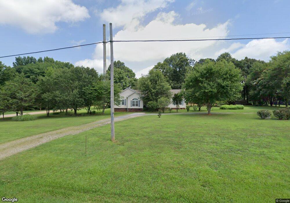
1614 Webb Rd Salisbury, NC 28146
Estimated Value: $238,000 - $381,000
Studio
2
Baths
2,296
Sq Ft
$140/Sq Ft
Est. Value
About This Home
This home is located at 1614 Webb Rd, Salisbury, NC 28146 and is currently estimated at $320,333, approximately $139 per square foot. 1614 Webb Rd is a home located in Rowan County with nearby schools including China Grove Elementary School, Southeast Middle School, and Jesse C Carson High School.
Ownership History
Date
Name
Owned For
Owner Type
Purchase Details
Closed on
Oct 13, 2004
Sold by
Toler James A and Toler Patricia A
Bought by
Toler James A and Toler Patricia A
Current Estimated Value
Home Financials for this Owner
Home Financials are based on the most recent Mortgage that was taken out on this home.
Original Mortgage
$180,000
Interest Rate
5.71%
Mortgage Type
Construction
Create a Home Valuation Report for This Property
The Home Valuation Report is an in-depth analysis detailing your home's value as well as a comparison with similar homes in the area
Purchase History
We collect this data history from publicly available records. To have your information removed, we recommend requesting removal directly through your county’s website.
| Date | Buyer | Sale Price | Title Company |
|---|---|---|---|
| Toler James A | -- | -- |
Source: Public Records
Mortgage History
We collect this data history from publicly available records. To have your information removed, we recommend requesting removal directly through your county’s website.
| Date | Status | Borrower | Loan Amount |
|---|---|---|---|
| Closed | Toler James A | $180,000 |
Source: Public Records
Tax History
| Year | Tax Paid | Tax Assessment Tax Assessment Total Assessment is a certain percentage of the fair market value that is determined by local assessors to be the total taxable value of land and additions on the property. | Land | Improvement |
|---|---|---|---|---|
| 2025 | $1,861 | $277,734 | $27,000 | $250,734 |
| 2024 | $1,861 | $277,734 | $27,000 | $250,734 |
| 2023 | $1,861 | $277,734 | $27,000 | $250,734 |
| 2022 | $1,268 | $169,684 | $22,500 | $147,184 |
| 2021 | $1,256 | $169,684 | $22,500 | $147,184 |
| 2020 | $1,268 | $169,684 | $22,500 | $147,184 |
| 2019 | $1,256 | $169,684 | $22,500 | $147,184 |
| 2018 | $1,085 | $148,895 | $22,500 | $126,395 |
| 2017 | $1,085 | $148,895 | $22,500 | $126,395 |
| 2016 | $1,085 | $148,895 | $22,500 | $126,395 |
| 2015 | $1,102 | $148,895 | $22,500 | $126,395 |
| 2014 | $1,079 | $148,331 | $22,500 | $125,831 |
Source: Public Records
Map
Nearby Homes
- 1084 Castlebrook Dr
- 0 Brookfield Cir Unit CAR4292885
- 112 John Michael Ln
- 1140 Peeler Rd
- 1352 Eva Ln
- 0 Blackwelder Rd Unit 1
- 0 Blackwelder Rd Unit 2
- 0 Blackwelder Rd Unit 3
- 1100 Peach Orchard Rd
- 5510 S Main St
- 425 Acorn Oaks Dr
- 225 Dulin Ave
- 137 Stafford Estates Dr
- 380 Pop Stirewalt Rd
- 1012 Saint Paul Church Rd
- 0 Peach Tree Ave
- 0 Maple St
- 124 Settlers Grove Ln
- 475 Pamela St
- 6255 Meadow Ln
- 1604 Webb Rd
- 1514 Webb Rd
- 1512 Webb Rd
- 1010 Sir Lance Cir
- 1026 Arrowhead Cir
- 155 Lamb Dr
- 1038 Arrowhead Cir
- 1062 Arrowhead Cir
- 1005 Arrowhead Cir
- 1074 Arrowhead Cir
- 111 Safrit Rd
- 1052 Arrowhead Cir
- 1060 Sir Lance Cir
- 1065 Arrowhead Cir
- 230 Lamb Dr
- 1140 Dukemont St Unit 29 & 40
- 1140 Dukemont St
- 1803 Webb Rd
- 1220 Dukemont St
- 245 Lamb Dr
Your Personal Tour Guide
Ask me questions while you tour the home.