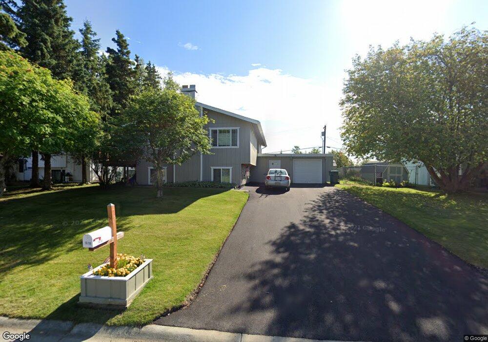
1618 Cara Loop Anchorage, AK 99515
Old Seward-Oceanview NeighborhoodEstimated Value: $350,000 - $466,000
4
Beds
2
Baths
2,084
Sq Ft
$197/Sq Ft
Est. Value
About This Home
This home is located at 1618 Cara Loop, Anchorage, AK 99515 and is currently estimated at $411,294, approximately $197 per square foot. 1618 Cara Loop is a home located in Anchorage Municipality with nearby schools including Ocean View Elementary School, Goldenview Middle School, and South Anchorage High School.
Ownership History
Date
Name
Owned For
Owner Type
Purchase Details
Closed on
Oct 15, 2007
Sold by
Fredrickson Sandra A
Bought by
Fredrickson Trigvee P
Current Estimated Value
Home Financials for this Owner
Home Financials are based on the most recent Mortgage that was taken out on this home.
Original Mortgage
$192,500
Outstanding Balance
$120,548
Interest Rate
6.27%
Mortgage Type
Purchase Money Mortgage
Estimated Equity
$290,746
Purchase Details
Closed on
Nov 25, 1993
Sold by
Barnett Kenneth L and Barnett Kathleen C
Bought by
Fredrickson Sandra A and Fredrickson Trigvee P
Home Financials for this Owner
Home Financials are based on the most recent Mortgage that was taken out on this home.
Original Mortgage
$133,000
Interest Rate
6.85%
Mortgage Type
VA
Create a Home Valuation Report for This Property
The Home Valuation Report is an in-depth analysis detailing your home's value as well as a comparison with similar homes in the area
Home Values in the Area
Average Home Value in this Area
Purchase History
| Date | Buyer | Sale Price | Title Company |
|---|---|---|---|
| Fredrickson Trigvee P | -- | Pacific Northwest Title Of A | |
| Fredrickson Sandra A | -- | -- |
Source: Public Records
Mortgage History
| Date | Status | Borrower | Loan Amount |
|---|---|---|---|
| Open | Fredrickson Trigvee P | $192,500 | |
| Previous Owner | Fredrickson Sandra A | $133,000 |
Source: Public Records
Tax History
| Year | Tax Paid | Tax Assessment Tax Assessment Total Assessment is a certain percentage of the fair market value that is determined by local assessors to be the total taxable value of land and additions on the property. | Land | Improvement |
|---|---|---|---|---|
| 2025 | $4,831 | $405,500 | $100,400 | $305,100 |
| 2024 | $4,831 | $374,200 | $100,400 | $273,800 |
| 2023 | $5,715 | $335,600 | $100,400 | $235,200 |
| 2022 | $4,692 | $328,600 | $100,400 | $228,200 |
| 2021 | $5,628 | $312,300 | $100,400 | $211,900 |
| 2020 | $4,313 | $304,000 | $100,400 | $203,600 |
| 2019 | $4,277 | $311,400 | $100,400 | $211,000 |
| 2018 | $4,225 | $307,600 | $100,400 | $207,200 |
| 2017 | $4,469 | $305,400 | $95,700 | $209,700 |
| 2016 | $3,746 | $299,500 | $95,700 | $203,800 |
| 2015 | $3,746 | $285,800 | $95,700 | $190,100 |
| 2014 | $3,746 | $273,200 | $81,300 | $191,900 |
Source: Public Records
Map
Nearby Homes
- 1548 Cara Loop Unit 5B
- 12631 Tanada Loop
- 12636 Silver Fox Ln
- 1270 Snow Fox Ln Unit 1
- 12521 Tanada Loop
- 2103 Tributary Cir
- 13051 Sues Way
- 12438 Silver Fox Ln Unit 3
- 2241 Sues Way
- 13730 Sunset View St
- 2430 Legacy Dr
- 2311 Sues Way
- 13410 Windrush Cir
- 13540 Baywind Dr
- 360 Oceanview Dr
- 12314 Timberwood Cir
- 12900 Monterey Cir
- 12901 Monterey Cir
- 500 Dailey Ave
- 2860 Seafarer Loop
- 1624 Cara Loop
- 1612 Cara Loop
- 13209 Brant Way
- 1630 Cara Loop
- 1606 Cara Loop
- 1611 Cara Loop
- 13201 Brant Way
- 13208 Brant Way
- 13219 Brant Way
- 1605 Cara Loop
- 13131 Scottie Ct
- 1636 Cara Loop
- 13214 Brant Way
- 13120 Scottie Ct
- 1600 Cara Loop
- 13121 Scottie Ct
- 1741 Hamilton Dr
- 1709 Hamilton Dr
- 1547 Harriet Ct
- 13211 Old Seward Hwy
Your Personal Tour Guide
Ask me questions while you tour the home.