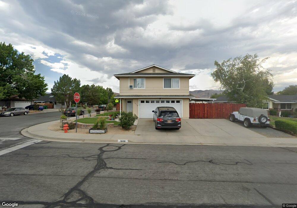
1618 Karin Dr Carson City, NV 89706
Northridge NeighborhoodEstimated Value: $456,000 - $512,000
4
Beds
3
Baths
2,044
Sq Ft
$234/Sq Ft
Est. Value
About This Home
This home is located at 1618 Karin Dr, Carson City, NV 89706 and is currently estimated at $478,113, approximately $233 per square foot. 1618 Karin Dr is a home located in Carson City with nearby schools including Mark Twain Elementary School, Carson Middle School, and Carson High School.
Ownership History
Date
Name
Owned For
Owner Type
Purchase Details
Closed on
Apr 3, 2006
Sold by
Merritt Matthew P and Sachs Wendy E
Bought by
Merritt Matthew P
Current Estimated Value
Purchase Details
Closed on
Dec 14, 2005
Sold by
Ledford Cynthia M and Ledford Cynthia May
Bought by
Merritt Matthew P and Sachs Wendy E
Home Financials for this Owner
Home Financials are based on the most recent Mortgage that was taken out on this home.
Original Mortgage
$245,600
Outstanding Balance
$136,872
Interest Rate
6.62%
Mortgage Type
Balloon
Estimated Equity
$341,241
Create a Home Valuation Report for This Property
The Home Valuation Report is an in-depth analysis detailing your home's value as well as a comparison with similar homes in the area
Home Values in the Area
Average Home Value in this Area
Purchase History
| Date | Buyer | Sale Price | Title Company |
|---|---|---|---|
| Merritt Matthew P | -- | Accommodation | |
| Merritt Matthew P | $327,500 | First American Title Co |
Source: Public Records
Mortgage History
| Date | Status | Borrower | Loan Amount |
|---|---|---|---|
| Open | Merritt Matthew P | $245,600 |
Source: Public Records
Tax History
| Year | Tax Paid | Tax Assessment Tax Assessment Total Assessment is a certain percentage of the fair market value that is determined by local assessors to be the total taxable value of land and additions on the property. | Land | Improvement |
|---|---|---|---|---|
| 2025 | $1,658 | $63,527 | $34,300 | $29,227 |
| 2024 | $1,564 | $63,576 | $34,300 | $29,276 |
| 2023 | $1,519 | $58,032 | $29,750 | $28,282 |
| 2022 | $1,475 | $50,103 | $23,800 | $26,303 |
| 2021 | $1,432 | $47,212 | $20,650 | $26,562 |
| 2019 | $1,348 | $44,027 | $16,800 | $27,227 |
| 2018 | $1,309 | $40,809 | $14,000 | $26,809 |
| 2017 | $1,271 | $39,810 | $12,600 | $27,210 |
| 2016 | $1,240 | $38,817 | $10,500 | $28,317 |
| 2015 | $1,237 | $38,418 | $9,625 | $28,793 |
| 2014 | $1,201 | $34,218 | $7,700 | $26,518 |
Source: Public Records
Map
Nearby Homes
- 1942 Hamilton Ave
- 2419 Hunterwood Ct Unit 4
- 1605 Marian Ave
- 1790 Bobarly Ct
- 1453 Molly Dr
- 1408 Molly Dr
- 1310 Shadowridge Dr
- 2632 New Ridge Dr
- 428 E Long St
- 415 Lee St
- 2048 Poole Way
- 1965 H St
- 1404 E Robinson St
- 7 Esther Cir
- 1852 Hogan Peak St
- 2316 Bunch Way
- 368 Porter Peak Dr
- 351 Porter Peak Dr
- 1331 Ashby Ct
- 1321 Ashby Ct
- 1624 Karin Dr
- 1978 Hamilton Ave
- 1974 Hamilton Ave
- 1619 Karin Dr
- 1630 Karin Dr
- 1978 Carriage Crest Dr
- 1972 Carriage Crest Dr Unit 12B
- 1625 Karin Dr
- 2010 Hamilton Ave
- 1966 Carriage Crest Dr
- 1959 Carriage Crest Dr
- 1636 Karin Dr
- 1981 Hamilton Ave
- 1960 Carriage Crest Dr
- 1977 Hamilton Ave
- 1954 Sunland Dr
- 2011 Hamilton Ave
- 2016 Hamilton Ave
- 1966 Hamilton Ave
- 1953 Carriage Crest Dr
Your Personal Tour Guide
Ask me questions while you tour the home.