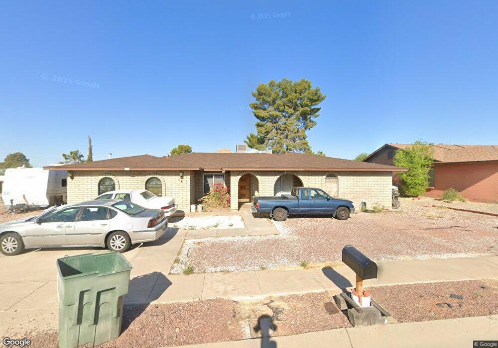
1618 S Burning Tree Ave Tucson, AZ 85710
Rolling Hills NeighborhoodEstimated Value: $332,273 - $422,000
Studio
2
Baths
2,657
Sq Ft
$145/Sq Ft
Est. Value
About This Home
This home is located at 1618 S Burning Tree Ave, Tucson, AZ 85710 and is currently estimated at $384,068, approximately $144 per square foot. 1618 S Burning Tree Ave is a home located in Pima County with nearby schools including Marshall Elementary School, Secrist Middle School, and Santa Rita High School.
Ownership History
Date
Name
Owned For
Owner Type
Purchase Details
Closed on
Feb 14, 2000
Sold by
Lovett John H and Lovett Barbara A
Bought by
Drinkwater Gene W and Drinkwater Debra A
Current Estimated Value
Home Financials for this Owner
Home Financials are based on the most recent Mortgage that was taken out on this home.
Original Mortgage
$124,000
Outstanding Balance
$38,327
Interest Rate
8.14%
Mortgage Type
New Conventional
Estimated Equity
$345,741
Create a Home Valuation Report for This Property
The Home Valuation Report is an in-depth analysis detailing your home's value as well as a comparison with similar homes in the area
Home Values in the Area
Average Home Value in this Area
Purchase History
| Date | Buyer | Sale Price | Title Company |
|---|---|---|---|
| Drinkwater Gene W | $155,000 | -- |
Source: Public Records
Mortgage History
| Date | Status | Borrower | Loan Amount |
|---|---|---|---|
| Open | Drinkwater Gene W | $124,000 |
Source: Public Records
Tax History
| Year | Tax Paid | Tax Assessment Tax Assessment Total Assessment is a certain percentage of the fair market value that is determined by local assessors to be the total taxable value of land and additions on the property. | Land | Improvement |
|---|---|---|---|---|
| 2026 | $2,768 | $24,913 | -- | -- |
| 2025 | $2,768 | $23,727 | -- | -- |
| 2024 | $2,651 | $22,597 | -- | -- |
| 2023 | $2,485 | $21,521 | $0 | $0 |
| 2022 | $2,503 | $20,496 | $0 | $0 |
| 2021 | $2,512 | $18,591 | $0 | $0 |
| 2020 | $2,411 | $18,591 | $0 | $0 |
| 2019 | $2,342 | $20,373 | $0 | $0 |
| 2018 | $2,234 | $16,059 | $0 | $0 |
| 2017 | $2,132 | $16,059 | $0 | $0 |
| 2016 | $2,079 | $15,295 | $0 | $0 |
| 2015 | $1,988 | $14,566 | $0 | $0 |
Source: Public Records
Map
Nearby Homes
- 1717 S Burning Tree Ave
- 1246 S Camino Seco
- 1240 S Camino Seco
- 1238 S Camino Seco
- 8909 E Palm Tree Dr
- 8437 E Rolling Ridge St
- 8509 E Sarnoff Ridge Loop
- 8878 E Abrams Loop
- 8434 E Brookside Ln Unit 53
- 8885 E Abrams Loop
- 8427 E Foursome Ln Unit 55
- 8350 E 25th St
- 8924 E Abrams Loop
- 1752 S Avenue Sosegado
- 1701 S Palm Springs Cir
- 8342 E Cypress Point Ln
- 2240 S Quail Hollow Dr
- 9056 E Calle Norlo
- 8341 E Via Arboleda
- 8338 E Placita Prado
- 1610 S Burning Tree Ave
- 8677 E 24th St
- 1702 S Burning Tree Ave
- 8670 E 24th St
- 1602 S Burning Tree Ave
- 1619 S Burning Tree Ave
- 1627 S Burning Tree Ave
- 1611 S Burning Tree Ave
- 8661 E 24th Cir
- 8660 E 24th St
- 8671 E 24th St
- 1701 S Burning Tree Ave
- 1710 S Burning Tree Ave
- 1525 S Burning Tree Ave
- 1526 S Burning Tree Ave
- 8652 E 24th St
- 8655 E 24th Cir
- 1709 S Burning Tree Ave
- 1618 S Pebble Beach Ave
- 1626 S Pebble Beach Ave
Your Personal Tour Guide
Ask me questions while you tour the home.