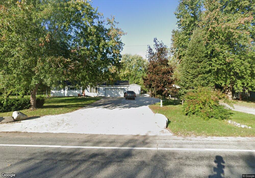
162 S Aurelius Rd Mason, MI 48854
Mason AreaEstimated Value: $296,000 - $353,000
About This Home
This home is located at 162 S Aurelius Rd, Mason, MI 48854 and is currently estimated at $315,549, approximately $268 per square foot. 162 S Aurelius Rd is a home located in Ingham County with nearby schools including Mason High School.
Ownership History
We collect this data history from publicly available records. To have your information removed, we recommend requesting removal directly through your county’s website.
Purchase Details
Purchase Details
Home Financials for this Owner
Home Financials are based on the most recent Mortgage that was taken out on this home.Purchase Details
Home Financials for this Owner
Home Financials are based on the most recent Mortgage that was taken out on this home.Purchase Details
Purchase Details
Home Values in the Area
Average Home Value in this Area
Purchase History
We collect this data history from publicly available records. To have your information removed, we recommend requesting removal directly through your county’s website.
| Date | Buyer | Sale Price | Title Company |
|---|---|---|---|
| -- | None Listed On Document | ||
| $250,000 | Liberty Title | ||
| $147,500 | First American Title Ins Co | ||
| $112,000 | -- | ||
| $74,400 | -- |
Mortgage History
We collect this data history from publicly available records. To have your information removed, we recommend requesting removal directly through your county’s website.
| Date | Status | Borrower | Loan Amount |
|---|---|---|---|
| Previous Owner | $213,675 | ||
| Previous Owner | $130,000 | ||
| Previous Owner | $100,000 | ||
| Previous Owner | $45,000 | ||
| Previous Owner | $40,000 | ||
| Previous Owner | $100,000 | ||
| Previous Owner | $178,000 | ||
| Previous Owner | $174,800 | ||
| Previous Owner | $112,000 | ||
| Previous Owner | $98,900 | ||
| Previous Owner | $12,000 |
Tax History
We collect this data history from publicly available records. To have your information removed, we recommend requesting removal directly through your county’s website.
| Year | Tax Paid | Tax Assessment Tax Assessment Total Assessment is a certain percentage of the fair market value that is determined by local assessors to be the total taxable value of land and additions on the property. | Land | Improvement |
|---|---|---|---|---|
| 2026 | $5,017 | $150,700 | $31,500 | $119,200 |
| 2025 | $2,876 | $144,500 | $32,100 | $112,400 |
| 2024 | $28 | $139,000 | $31,600 | $107,400 |
| 2023 | $4,492 | $123,900 | $20,400 | $103,500 |
| 2022 | $4,248 | $110,000 | $26,300 | $83,700 |
| 2021 | $3,363 | $105,300 | $0 | $105,300 |
| 2020 | $3,891 | $96,100 | $21,500 | $74,600 |
| 2019 | $3,785 | $93,800 | $19,100 | $74,700 |
| 2018 | $3,119 | $87,300 | $19,100 | $68,200 |
| 2017 | $2,733 | $87,300 | $19,100 | $68,200 |
| 2016 | -- | $83,100 | $19,100 | $64,000 |
| 2015 | -- | $80,800 | $38,140 | $42,660 |
| 2014 | -- | $77,100 | $38,140 | $38,960 |
Map
- 4249 Black Cherry Ln
- 380 Spicetree Ln Unit 48
- 4660 Curtice Rd
- 60 Lake Ridge Dr
- 47 Lake Ridge Dr
- 4789 Nichols Rd
- 4666 Bunker Rd
- 888 S Eifert Rd
- 0 S Aurelius Rd Unit 292647
- 0 Eifert Rd
- 3494 W Kipp Rd
- 4125 Harper Rd
- 5770 W Columbia Rd
- 3384 W Howell Rd
- 655 N Onondaga Rd
- 142 Ware St
- 301 Ware St Unit 44
- 855 Onondaga Rd
- 3687 Josephine Ln
- 1266 Sumac Ln
- 160 S Aurelius Rd
- 150 S Aurelius Rd
- 198 S Aurelius Rd
- 140 S Aurelius Rd
- 195 S Aurelius Rd
- 123 S Aurelius Rd
- 200 S Aurelius Rd
- 4552 Elliott Rd
- 111 S Aurelius Rd
- 99 S Aurelius Rd
- 259 S Aurelius Rd
- 256 S Aurelius Rd
- 4588 Elliott Rd
- 69 S Aurelius Rd
- 58 S Aurelius Rd
- 52 S Aurelius Rd
- 48 S Aurelius Rd
- 42 S Aurelius Rd
- 47 S Aurelius Rd
- 4613 Elliott Rd
Ask me questions while you tour the home.