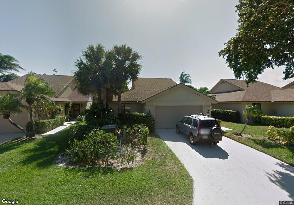
162 Seashore Dr Jupiter, FL 33477
The Bluffs NeighborhoodEstimated Value: $860,000 - $1,308,000
3
Beds
2
Baths
2,113
Sq Ft
$494/Sq Ft
Est. Value
About This Home
This home is located at 162 Seashore Dr, Jupiter, FL 33477 and is currently estimated at $1,044,201, approximately $494 per square foot. 162 Seashore Dr is a home located in Palm Beach County with nearby schools including William T. Dwyer High School, Lighthouse Elementary School, and Beacon Cove Intermediate School.
Ownership History
Date
Name
Owned For
Owner Type
Purchase Details
Closed on
Jun 28, 2019
Sold by
Hamerling Aaron Wolf
Bought by
Hamerling Aaron Wolf and The Aaron Wolf Hamerling Livin
Current Estimated Value
Purchase Details
Closed on
Oct 25, 2000
Sold by
Mcdevitt Alexander J and Mcdevitt Theresa H
Bought by
Hamerling Aaron
Home Financials for this Owner
Home Financials are based on the most recent Mortgage that was taken out on this home.
Original Mortgage
$155,000
Outstanding Balance
$54,971
Interest Rate
7.91%
Mortgage Type
New Conventional
Estimated Equity
$989,230
Create a Home Valuation Report for This Property
The Home Valuation Report is an in-depth analysis detailing your home's value as well as a comparison with similar homes in the area
Home Values in the Area
Average Home Value in this Area
Purchase History
| Date | Buyer | Sale Price | Title Company |
|---|---|---|---|
| Hamerling Aaron Wolf | -- | Attorney | |
| Hamerling Aaron | $194,000 | -- |
Source: Public Records
Mortgage History
| Date | Status | Borrower | Loan Amount |
|---|---|---|---|
| Open | Hamerling Aaron | $155,000 |
Source: Public Records
Tax History
| Year | Tax Paid | Tax Assessment Tax Assessment Total Assessment is a certain percentage of the fair market value that is determined by local assessors to be the total taxable value of land and additions on the property. | Land | Improvement |
|---|---|---|---|---|
| 2025 | $4,173 | $282,550 | -- | -- |
| 2024 | $4,173 | $274,587 | -- | -- |
| 2023 | $4,106 | $266,589 | $0 | $0 |
| 2022 | $4,095 | $258,824 | $0 | $0 |
| 2021 | $4,058 | $251,285 | $0 | $0 |
| 2020 | $4,052 | $247,816 | $0 | $0 |
| 2019 | $4,000 | $242,244 | $0 | $0 |
| 2018 | $3,799 | $237,727 | $0 | $0 |
| 2017 | $3,785 | $232,837 | $0 | $0 |
| 2016 | $3,790 | $228,048 | $0 | $0 |
| 2015 | $3,883 | $226,463 | $0 | $0 |
| 2014 | $3,935 | $224,666 | $0 | $0 |
Source: Public Records
Map
Nearby Homes
- 327 Ridge Rd
- 181 Cape Pointe Cir
- 2429 24th Ct
- 2715 27th Ct
- 329 Leeward Dr
- 246 Ridge Rd
- 232 E River Park Dr
- 334 Leeward Dr
- 126 Cape Pointe Cir
- 316 River Edge Rd
- 125 Cape Pointe Cir
- 306 Leeward Dr
- 115 Olympus Way
- 121 Olympus Way
- 401 Ocean Bluffs Blvd Unit 4020
- 301 Ocean Bluffs Blvd Unit 5040
- 123 Olympus Way
- 108 Pegasus Dr
- 352 River Edge Rd
- 2000 S Highway A1a Unit N507
- 164 Seashore Dr
- 160 Seashore Dr
- 166 Seashore Dr
- 158 Seashore Dr
- 168 Seashore Dr
- 156 Seashore Dr
- 159 Seashore Dr
- 161 Seashore Dr
- 157 Seashore Dr
- 163 Seashore Dr
- 170 Seashore Dr
- 154 Seashore Dr
- 155 Seashore Dr
- 165 Seashore Dr
- 172 Seashore Dr
- 153 Seashore Dr
- 152 Seashore Dr
- 167 Seashore Dr
- 151 Seashore Dr
- 169 Seashore Dr
Your Personal Tour Guide
Ask me questions while you tour the home.