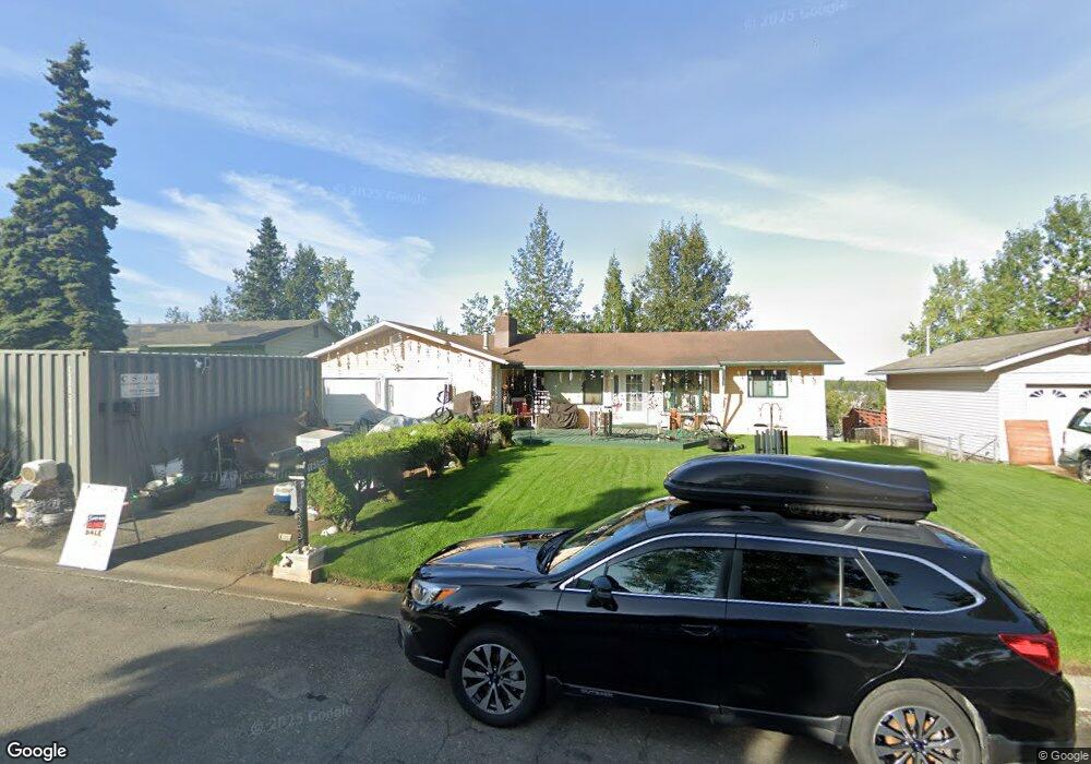
1635 Brink Dr Anchorage, AK 99504
Northeast Anchorage NeighborhoodEstimated Value: $272,000 - $481,000
About This Home
This home is located at 1635 Brink Dr, Anchorage, AK 99504 and is currently estimated at $390,086, approximately $183 per square foot. 1635 Brink Dr is a home located in Anchorage Municipality with nearby schools including Susitna Elementary School, Nicholas J. Begich Middle School, and Bartlett High School.
Ownership History
We collect this data history from publicly available records. To have your information removed, we recommend requesting removal directly through your county’s website.
Purchase Details
Home Financials for this Owner
Home Financials are based on the most recent Mortgage that was taken out on this home.Purchase Details
Home Financials for this Owner
Home Financials are based on the most recent Mortgage that was taken out on this home.Purchase Details
Home Financials for this Owner
Home Financials are based on the most recent Mortgage that was taken out on this home.Home Values in the Area
Average Home Value in this Area
Purchase History
We collect this data history from publicly available records. To have your information removed, we recommend requesting removal directly through your county’s website.
| Date | Buyer | Sale Price | Title Company |
|---|---|---|---|
| -- | United Title | ||
| -- | -- | ||
| -- | -- |
Mortgage History
We collect this data history from publicly available records. To have your information removed, we recommend requesting removal directly through your county’s website.
| Date | Status | Borrower | Loan Amount |
|---|---|---|---|
| Open | $208,800 | ||
| Previous Owner | $206,369 | ||
| Previous Owner | $206,369 |
Tax History
We collect this data history from publicly available records. To have your information removed, we recommend requesting removal directly through your county’s website.
| Year | Tax Paid | Tax Assessment Tax Assessment Total Assessment is a certain percentage of the fair market value that is determined by local assessors to be the total taxable value of land and additions on the property. | Land | Improvement |
|---|---|---|---|---|
| 2025 | $5,852 | $425,300 | $92,000 | $333,300 |
| 2024 | $5,100 | $390,900 | $92,000 | $298,900 |
| 2023 | $5,184 | $362,600 | $92,000 | $270,600 |
| 2022 | $5,237 | $361,000 | $92,000 | $269,000 |
| 2021 | $5,929 | $329,000 | $92,000 | $237,000 |
| 2020 | $4,471 | $313,300 | $92,000 | $221,300 |
| 2019 | $4,244 | $309,400 | $92,000 | $217,400 |
| 2018 | $4,023 | $295,300 | $92,000 | $203,300 |
| 2017 | $4,895 | $312,600 | $92,000 | $220,600 |
| 2016 | $4,070 | $311,100 | $89,100 | $222,000 |
| 2015 | $4,070 | $306,400 | $89,100 | $217,300 |
| 2014 | $4,070 | $293,000 | $83,500 | $209,500 |
Map
- 1900 Muldoon Rd
- 1640 Parkway Dr
- 7944 Parkway Dr
- 8070 Giddeon Cir Unit 5
- 8100 E 20th Ave
- 1542 Northview Dr Unit E7
- 1541 State St Unit B-3
- 1473 Shallow Pool Dr Unit J1
- 1950 Rebel Ridge Dr
- 8280 E 20th Ave
- 1461 Northview Dr Unit I-03
- 8401 E 20th Ave
- 2242 Brookshire Loop Unit 2242
- 2221 Muldoon Rd Unit 68
- 2221 Muldoon Rd Unit 524
- 2221 Muldoon Rd Unit 70
- 2221 Muldoon Rd Unit space 129
- 1751 Diomede St
- 000 Muldoon & Debarr Rd
- 7532 Eastbrook Cir
- 1713 Brink Dr
- 1701 Brink Dr
- 1725 Brink Dr
- L17A Brink Dr Unit 1
- L17A Brink Dr
- 1647 Brink Dr
- 1739 Brink Dr
- 1710 Brink Dr
- 1700 Brink Dr
- 1745 Brink Dr
- 1722 Brink Dr
- 000 Muldoon Rd
- 0000 Muldoon Rd
- L2 B1 Muldoon Rd
- L1 B1 Muldoon Rd
- 1001 Muldoon Rd
- 1301 Muldoon Rd
- L1a Muldoon Rd
- 1650 Brink Dr
- 1750 Muldoon Rd
Ask me questions while you tour the home.