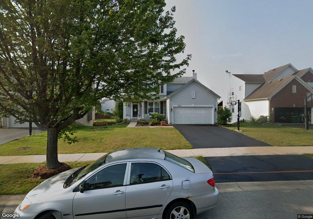
16413 Lanfear Dr Unit 2 Lockport, IL 60441
Estimated Value: $446,014 - $491,000
4
Beds
4
Baths
2,736
Sq Ft
$172/Sq Ft
Est. Value
About This Home
This home is located at 16413 Lanfear Dr Unit 2, Lockport, IL 60441 and is currently estimated at $471,254, approximately $172 per square foot. 16413 Lanfear Dr Unit 2 is a home located in Will County with nearby schools including William J. Butler, Hadley Middle School, and Homer Jr High School.
Ownership History
Date
Name
Owned For
Owner Type
Purchase Details
Closed on
Aug 21, 2020
Sold by
Foxworth Thomas J
Bought by
Foxworth Thomas J and Foxworth Victoria R
Current Estimated Value
Home Financials for this Owner
Home Financials are based on the most recent Mortgage that was taken out on this home.
Original Mortgage
$200,000
Outstanding Balance
$105,566
Interest Rate
2.9%
Mortgage Type
New Conventional
Estimated Equity
$365,688
Purchase Details
Closed on
Jan 17, 2003
Sold by
The Ryland Group Inc
Bought by
Foxworth Thomas J
Home Financials for this Owner
Home Financials are based on the most recent Mortgage that was taken out on this home.
Original Mortgage
$165,000
Interest Rate
6.01%
Mortgage Type
Purchase Money Mortgage
Create a Home Valuation Report for This Property
The Home Valuation Report is an in-depth analysis detailing your home's value as well as a comparison with similar homes in the area
Home Values in the Area
Average Home Value in this Area
Purchase History
We collect this data history from publicly available records. To have your information removed, we recommend requesting removal directly through your county’s website.
| Date | Buyer | Sale Price | Title Company |
|---|---|---|---|
| Foxworth Thomas J | -- | Old Republic Title | |
| Foxworth Thomas J | $218,500 | -- |
Source: Public Records
Mortgage History
We collect this data history from publicly available records. To have your information removed, we recommend requesting removal directly through your county’s website.
| Date | Status | Borrower | Loan Amount |
|---|---|---|---|
| Open | Foxworth Thomas J | $200,000 | |
| Closed | Foxworth Thomas J | $165,000 |
Source: Public Records
Tax History
| Year | Tax Paid | Tax Assessment Tax Assessment Total Assessment is a certain percentage of the fair market value that is determined by local assessors to be the total taxable value of land and additions on the property. | Land | Improvement |
|---|---|---|---|---|
| 2024 | $9,468 | $111,821 | $28,592 | $83,229 |
| 2023 | $9,092 | $101,360 | $25,917 | $75,443 |
| 2022 | $8,340 | $94,641 | $24,199 | $70,442 |
| 2021 | $7,959 | $89,665 | $22,927 | $66,738 |
| 2020 | $7,925 | $86,365 | $22,083 | $64,282 |
| 2019 | $7,622 | $83,083 | $21,244 | $61,839 |
| 2018 | $7,119 | $76,847 | $15,717 | $61,130 |
| 2017 | $7,005 | $74,696 | $15,277 | $59,419 |
| 2016 | $6,848 | $72,205 | $14,768 | $57,437 |
| 2015 | $6,562 | $69,495 | $14,214 | $55,281 |
| 2014 | $6,562 | $66,699 | $13,920 | $52,779 |
| 2013 | $6,562 | $66,699 | $13,920 | $52,779 |
Source: Public Records
Map
Nearby Homes
- 17660 S Alta Dr
- 17543 S Gilbert Dr
- 18138 S Mitchell Ln
- 15880 W Bruce Rd
- 16623 Willow Walk Dr
- 16440 W Cottonwood Dr
- 16446 W Cottonwood Dr
- 16629 Willow Walk Dr
- 16438 Teton Dr
- 16224 Golfview Dr Unit 3
- 16668 W Adobe Dr
- 17426 Tanglewood Unit 1
- 16007 W Bruce Rd
- 14805 S Hillside Dr
- 14845 S Hillside Dr
- 14801 S Hillside Dr
- 15909 Prairie View Ct
- 17053 Mendota Dr
- 2905 Carol Dr
- 17009 Mendota Dr
- 16419 W Lanfear Dr
- 16407 Lanfear Dr
- 16425 Lanfear Dr
- 17866 Alta Dr Unit 2
- 16431 Lanfear Dr
- 16416 Lanfear Dr
- 16410 Lanfear Dr
- 17864 S Alta Dr
- 17864 Alta Dr Unit 2
- 16422 Lanfear Dr
- 16404 Lanfear Dr
- 16428 Lanfear Dr
- 16358 Caraway Ct
- 16437 Lanfear Dr Unit 2
- 16362 Caraway Ct Unit 2
- 16354 Caraway Ct Unit 2
- 16434 Lanfear Dr
- 16423 Cagwin Dr
- 16429 Cagwin Dr
- 16443 Lanfear Dr Unit 2
Your Personal Tour Guide
Ask me questions while you tour the home.