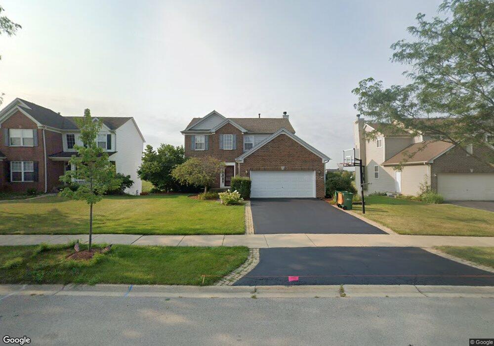
16425 Lanfear Dr Lockport, IL 60441
Estimated Value: $443,000 - $491,000
About This Home
This home is located at 16425 Lanfear Dr, Lockport, IL 60441 and is currently estimated at $464,903, approximately $212 per square foot. 16425 Lanfear Dr is a home located in Will County with nearby schools including William J. Butler, Hadley Middle School, and Homer Jr High School.
Ownership History
We collect this data history from publicly available records. To have your information removed, we recommend requesting removal directly through your county’s website.
Purchase Details
Home Financials for this Owner
Home Financials are based on the most recent Mortgage that was taken out on this home.Purchase Details
Home Financials for this Owner
Home Financials are based on the most recent Mortgage that was taken out on this home.Purchase Details
Home Financials for this Owner
Home Financials are based on the most recent Mortgage that was taken out on this home.Home Values in the Area
Average Home Value in this Area
Purchase History
We collect this data history from publicly available records. To have your information removed, we recommend requesting removal directly through your county’s website.
| Date | Buyer | Sale Price | Title Company |
|---|---|---|---|
| -- | Amrock | ||
| $305,000 | Attorney | ||
| $244,000 | -- |
Mortgage History
We collect this data history from publicly available records. To have your information removed, we recommend requesting removal directly through your county’s website.
| Date | Status | Borrower | Loan Amount |
|---|---|---|---|
| Open | $301,394 | ||
| Closed | $315,065 | ||
| Previous Owner | $194,890 |
Tax History
We collect this data history from publicly available records. To have your information removed, we recommend requesting removal directly through your county’s website.
| Year | Tax Paid | Tax Assessment Tax Assessment Total Assessment is a certain percentage of the fair market value that is determined by local assessors to be the total taxable value of land and additions on the property. | Land | Improvement |
|---|---|---|---|---|
| 2024 | $9,048 | $126,609 | $28,592 | $98,017 |
| 2023 | $9,048 | $114,765 | $25,917 | $88,848 |
| 2022 | $9,048 | $107,157 | $24,199 | $82,958 |
| 2021 | $8,612 | $101,523 | $22,927 | $78,596 |
| 2020 | $8,558 | $97,787 | $22,083 | $75,704 |
| 2019 | $8,708 | $94,071 | $21,244 | $72,827 |
| 2018 | $8,210 | $87,709 | $15,717 | $71,992 |
| 2017 | $8,081 | $85,254 | $15,277 | $69,977 |
| 2016 | $7,903 | $82,411 | $14,768 | $67,643 |
| 2015 | $7,530 | $79,318 | $14,214 | $65,104 |
| 2014 | $7,530 | $76,077 | $13,920 | $62,157 |
| 2013 | $7,530 | $76,077 | $13,920 | $62,157 |
Map
- 17543 S Gilbert Dr
- 18138 S Mitchell Ln
- 16623 Willow Walk Dr
- 15880 W Bruce Rd
- 16446 W Cottonwood Dr
- 16629 Willow Walk Dr
- 16438 Teton Dr
- 16224 Golfview Dr Unit 3
- 16516 Teton Dr Unit 64
- 16668 W Adobe Dr
- 17328 Long Bow Dr
- 16007 W Bruce Rd
- 14805 S Hillside Dr
- 14801 S Hillside Dr
- 16129 W Red Cloud Dr
- 15909 Prairie View Ct
- 16946 Mohican Dr
- 17014 Roosevelt Ave
- 2905 Carol Dr
- 17009 Mendota Dr
- 16431 Lanfear Dr
- 16419 W Lanfear Dr
- 16437 Lanfear Dr Unit 2
- 16413 Lanfear Dr Unit 2
- 16422 Lanfear Dr
- 16428 Lanfear Dr
- 16443 Lanfear Dr Unit 2
- 16407 Lanfear Dr
- 16434 Lanfear Dr
- 16416 Lanfear Dr
- 16410 Lanfear Dr
- 16444 Lanfear Dr
- 16449 Lanfear Dr
- 17866 Alta Dr Unit 2
- 16455 Lanfear Dr
- 16435 Cagwin Dr Unit 2
- 16450 Lanfear Dr
- 16429 Cagwin Dr
- 16404 Lanfear Dr
- 16441 Cagwin Dr Unit 2
Ask me questions while you tour the home.