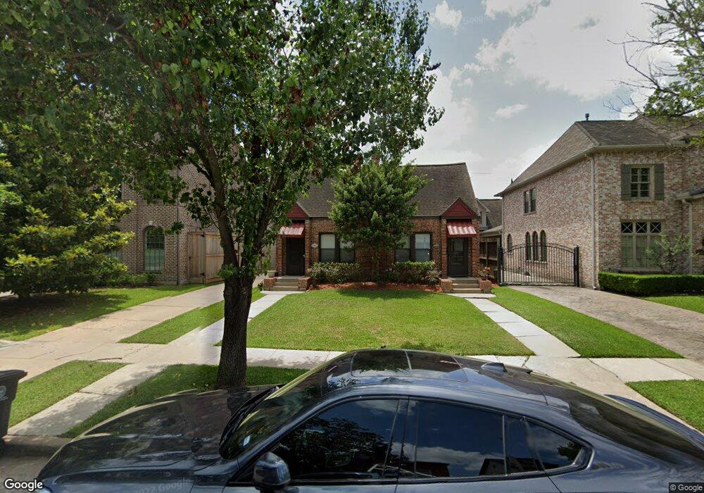
1645 Harold St Houston, TX 77006
Montrose NeighborhoodEstimated Value: $518,000 - $797,534
About This Home
This home is located at 1645 Harold St, Houston, TX 77006 and is currently estimated at $671,884, approximately $790 per square foot. 1645 Harold St is a home located in Harris County with nearby schools including Baker Montessori, Lanier Middle School, and Lamar High School.
Ownership History
We collect this data history from publicly available records. To have your information removed, we recommend requesting removal directly through your county’s website.
Purchase Details
Purchase Details
Purchase Details
Home Financials for this Owner
Home Financials are based on the most recent Mortgage that was taken out on this home.Purchase Details
Home Financials for this Owner
Home Financials are based on the most recent Mortgage that was taken out on this home.Purchase Details
Home Financials for this Owner
Home Financials are based on the most recent Mortgage that was taken out on this home.Purchase Details
Home Financials for this Owner
Home Financials are based on the most recent Mortgage that was taken out on this home.Purchase Details
Purchase Details
Home Financials for this Owner
Home Financials are based on the most recent Mortgage that was taken out on this home.Home Values in the Area
Average Home Value in this Area
Purchase History
We collect this data history from publicly available records. To have your information removed, we recommend requesting removal directly through your county’s website.
| Date | Buyer | Sale Price | Title Company |
|---|---|---|---|
| -- | None Available | ||
| -- | None Available | ||
| -- | Startex Title Co Clear Lake | ||
| -- | First American Title | ||
| -- | -- | ||
| -- | First American Title | ||
| -- | -- | ||
| -- | American Title Co |
Mortgage History
We collect this data history from publicly available records. To have your information removed, we recommend requesting removal directly through your county’s website.
| Date | Status | Borrower | Loan Amount |
|---|---|---|---|
| Previous Owner | $248,000 | ||
| Previous Owner | $273,750 | ||
| Previous Owner | $224,640 | ||
| Previous Owner | $158,800 | ||
| Closed | $56,160 |
Tax History
We collect this data history from publicly available records. To have your information removed, we recommend requesting removal directly through your county’s website.
| Year | Tax Paid | Tax Assessment Tax Assessment Total Assessment is a certain percentage of the fair market value that is determined by local assessors to be the total taxable value of land and additions on the property. | Land | Improvement |
|---|---|---|---|---|
| 2025 | $16,152 | $760,000 | $750,000 | $10,000 |
| 2024 | $14,228 | $680,000 | $679,900 | $100 |
| 2023 | $14,228 | $680,000 | $679,000 | $1,000 |
| 2022 | $12,348 | $560,800 | $500,000 | $60,800 |
| 2021 | $12,576 | $539,600 | $500,000 | $39,600 |
| 2020 | $13,108 | $541,300 | $500,000 | $41,300 |
| 2019 | $13,697 | $541,300 | $500,000 | $41,300 |
| 2018 | $13,317 | $526,273 | $468,750 | $57,523 |
| 2017 | $13,965 | $526,273 | $468,750 | $57,523 |
| 2016 | $12,525 | $472,000 | $406,250 | $65,750 |
| 2015 | $9,948 | $469,520 | $406,250 | $63,270 |
| 2014 | $9,948 | $387,000 | $343,750 | $43,250 |
Map
- 1645 Kipling St
- 1634 Marshall St
- 1660 Hawthorne St
- 1534 Harold St
- 1640 W Alabama St
- 1511 Kipling St
- 1523 Marshall St
- 2427 Ralph St
- 2503 Park St
- 1636 Sul Ross St
- 1919 Missouri St
- 2507 Mandell St
- 2409 Ralph St Unit D
- 1415 Harold St
- 1705 California St
- 1421 Marshall St
- 2412 Elmen St
- 1824 Marshall St
- 1621 California St
- 2308 Dunlavy St
- 1639 Harold St
- 1635 Harold St
- 1641 Harold St
- 1629 Harold St
- 1645 Harold St
- 1645 Harold St Unit 1/2
- 1640 Kipling St
- 1644 Kipling St
- 1636 Kipling St
- 1625 Harold St
- 1649 Harold St
- 1632 Kipling St
- 1648 Kipling St
- 1638 Harold St
- 1636 Harold St
- 1644 Harold St
- 1624 Kipling St
- 1652 Kipling St
- 1621 Harold St
- 1655 Harold St
Ask me questions while you tour the home.