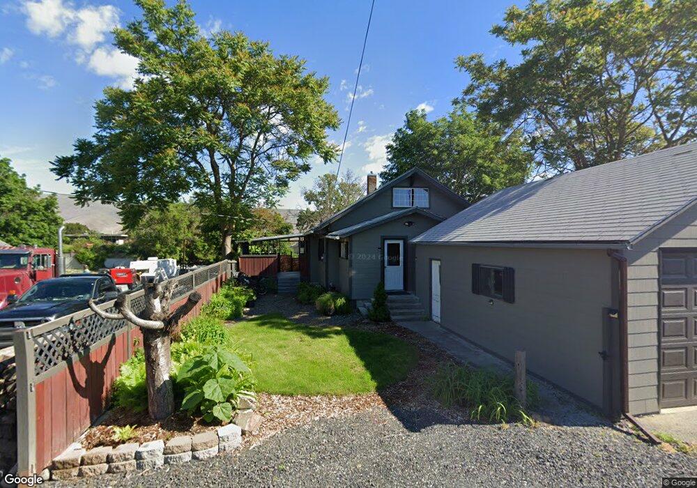
1648 9th Ave Lewiston, ID 83501
Estimated Value: $276,877 - $326,000
3
Beds
2
Baths
1,940
Sq Ft
$158/Sq Ft
Est. Value
About This Home
This home is located at 1648 9th Ave, Lewiston, ID 83501 and is currently estimated at $306,469, approximately $157 per square foot. 1648 9th Ave is a home located in Nez Perce County with nearby schools including Webster Elementary School, Lewiston High School, and Northwest Children's Home Educ.
Ownership History
Date
Name
Owned For
Owner Type
Purchase Details
Closed on
Oct 20, 2021
Sold by
Edmonson Rory L and Edmonson Tamra
Bought by
Edmonso Rory Lewis
Current Estimated Value
Purchase Details
Closed on
Apr 12, 2013
Sold by
Edmonson Rory Lewis
Bought by
Edmonson Rory Lewis and Edmonson Tamra
Home Financials for this Owner
Home Financials are based on the most recent Mortgage that was taken out on this home.
Original Mortgage
$108,750
Interest Rate
3.47%
Mortgage Type
New Conventional
Create a Home Valuation Report for This Property
The Home Valuation Report is an in-depth analysis detailing your home's value as well as a comparison with similar homes in the area
Purchase History
We collect this data history from publicly available records. To have your information removed, we recommend requesting removal directly through your county’s website.
| Date | Buyer | Sale Price | Title Company |
|---|---|---|---|
| Edmonso Rory Lewis | -- | None Listed On Document | |
| Edmonson Rory Lewis | -- | Alliance Title |
Source: Public Records
Mortgage History
We collect this data history from publicly available records. To have your information removed, we recommend requesting removal directly through your county’s website.
| Date | Status | Borrower | Loan Amount |
|---|---|---|---|
| Previous Owner | Edmonson Rory Lewis | $108,750 |
Source: Public Records
Tax History
| Year | Tax Paid | Tax Assessment Tax Assessment Total Assessment is a certain percentage of the fair market value that is determined by local assessors to be the total taxable value of land and additions on the property. | Land | Improvement |
|---|---|---|---|---|
| 2025 | $1,528 | $222,142 | $47,250 | $174,892 |
| 2024 | $15 | $204,110 | $46,000 | $158,110 |
| 2023 | $1,425 | $221,514 | $42,000 | $179,514 |
| 2022 | $1,876 | $223,148 | $36,500 | $186,648 |
| 2021 | $2,275 | $154,038 | $31,000 | $123,038 |
| 2020 | $1,902 | $128,327 | $25,850 | $102,477 |
| 2019 | $1,997 | $122,839 | $25,850 | $96,989 |
| 2018 | $2,077 | $126,704 | $25,850 | $100,854 |
| 2017 | $2,069 | $0 | $0 | $0 |
| 2016 | $1,169 | $0 | $0 | $0 |
| 2015 | $2,200 | $0 | $0 | $0 |
| 2014 | $2,139 | $108,122 | $21,250 | $86,872 |
Source: Public Records
Map
Nearby Homes
Your Personal Tour Guide
Ask me questions while you tour the home.