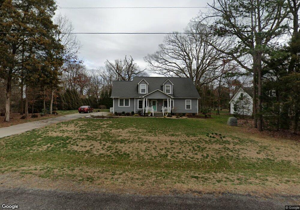
165 Daniels Rd Salisbury, NC 28144
Estimated Value: $321,623 - $400,000
4
Beds
3
Baths
2,500
Sq Ft
$141/Sq Ft
Est. Value
About This Home
This home is located at 165 Daniels Rd, Salisbury, NC 28144 and is currently estimated at $352,906, approximately $141 per square foot. 165 Daniels Rd is a home located in Rowan County with nearby schools including North Rowan Elementary School, North Rowan Middle School, and North Rowan High School.
Ownership History
Date
Name
Owned For
Owner Type
Purchase Details
Closed on
Aug 31, 2006
Sold by
Farman Koll M and Farman Jill M
Bought by
Spock Ann M and Velgus Maria
Current Estimated Value
Home Financials for this Owner
Home Financials are based on the most recent Mortgage that was taken out on this home.
Original Mortgage
$158,000
Outstanding Balance
$95,195
Interest Rate
6.73%
Mortgage Type
Purchase Money Mortgage
Estimated Equity
$257,711
Purchase Details
Closed on
Jun 16, 2005
Sold by
Central Piedmont Builders Inc
Bought by
Farman Koll M and Farman Jill M
Home Financials for this Owner
Home Financials are based on the most recent Mortgage that was taken out on this home.
Original Mortgage
$105,000
Interest Rate
6.25%
Mortgage Type
Fannie Mae Freddie Mac
Create a Home Valuation Report for This Property
The Home Valuation Report is an in-depth analysis detailing your home's value as well as a comparison with similar homes in the area
Purchase History
| Date | Buyer | Sale Price | Title Company |
|---|---|---|---|
| Spock Ann M | $166,500 | Chicago Title Insurance Co | |
| Farman Koll M | $150,000 | -- |
Source: Public Records
Mortgage History
| Date | Status | Borrower | Loan Amount |
|---|---|---|---|
| Open | Spock Ann M | $158,000 | |
| Previous Owner | Farman Koll M | $105,000 | |
| Closed | Farman Koll M | $45,000 |
Source: Public Records
Tax History
| Year | Tax Paid | Tax Assessment Tax Assessment Total Assessment is a certain percentage of the fair market value that is determined by local assessors to be the total taxable value of land and additions on the property. | Land | Improvement |
|---|---|---|---|---|
| 2025 | $1,673 | $249,651 | $28,000 | $221,651 |
| 2024 | $1,673 | $249,651 | $28,000 | $221,651 |
| 2023 | $1,673 | $249,651 | $28,000 | $221,651 |
| 2022 | $1,230 | $164,561 | $20,500 | $144,061 |
| 2021 | $1,200 | $164,561 | $20,500 | $144,061 |
| 2020 | $1,200 | $164,561 | $20,500 | $144,061 |
| 2019 | $1,200 | $164,561 | $20,500 | $144,061 |
| 2018 | $1,002 | $138,599 | $20,500 | $118,099 |
| 2017 | $1,002 | $138,599 | $20,500 | $118,099 |
| 2016 | $1,002 | $138,599 | $20,500 | $118,099 |
| 2015 | $1,017 | $138,599 | $20,500 | $118,099 |
| 2014 | $981 | $136,298 | $20,500 | $115,798 |
Source: Public Records
Map
Nearby Homes
- 1750 Sells Rd
- 1749 Sells Rd
- 280 Pinevale Dr
- 425 Lariat Cir
- 250 Douglas St
- 450 E Ridge Rd
- 120 Greenway Dr
- 4355 Franklin Community Center Rd
- 240 Eldon Ln
- 875 Bonanza Dr
- 1219 Amberlight Cir
- 4660 US Highway 601
- 270 North St
- 3230 W Innes St
- 165 Franklin Church Dr
- 307 Pantego Place
- 1410 Amberlight Cir
- 417 Rugby Rd
- 414 Rugby Rd
- 413 Rugby Rd
Your Personal Tour Guide
Ask me questions while you tour the home.