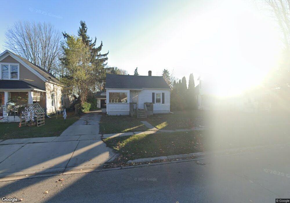
1652 Lyon St Port Huron, MI 48060
Port Huron AreaEstimated Value: $118,000 - $141,000
About This Home
This home is located at 1652 Lyon St, Port Huron, MI 48060 and is currently estimated at $131,210, approximately $187 per square foot. 1652 Lyon St is a home located in St. Clair County with nearby schools including H.D. Crull Elementary School, Holland Woods Middle School, and Port Huron Northern High School.
Ownership History
We collect this data history from publicly available records. To have your information removed, we recommend requesting removal directly through your county’s website.
Purchase Details
Home Financials for this Owner
Home Financials are based on the most recent Mortgage that was taken out on this home.Purchase Details
Purchase Details
Home Values in the Area
Average Home Value in this Area
Purchase History
We collect this data history from publicly available records. To have your information removed, we recommend requesting removal directly through your county’s website.
| Date | Buyer | Sale Price | Title Company |
|---|---|---|---|
| -- | Ata National Title Group | ||
| -- | None Listed On Document | ||
| $60,000 | -- |
Mortgage History
We collect this data history from publicly available records. To have your information removed, we recommend requesting removal directly through your county’s website.
| Date | Status | Borrower | Loan Amount |
|---|---|---|---|
| Open | $63,200 |
Tax History
We collect this data history from publicly available records. To have your information removed, we recommend requesting removal directly through your county’s website.
| Year | Tax Paid | Tax Assessment Tax Assessment Total Assessment is a certain percentage of the fair market value that is determined by local assessors to be the total taxable value of land and additions on the property. | Land | Improvement |
|---|---|---|---|---|
| 2025 | $1,764 | $64,700 | $0 | $0 |
| 2024 | $1,719 | $61,000 | $0 | $0 |
| 2023 | $2,043 | $54,200 | $0 | $0 |
| 2022 | $1,693 | $51,700 | $0 | $0 |
| 2020 | $2,274 | $45,600 | $45,600 | $0 |
| 2019 | $1,597 | $31,500 | $0 | $0 |
| 2018 | $1,561 | $31,500 | $0 | $0 |
| 2017 | $1,114 | $29,600 | $0 | $0 |
| 2016 | $946 | $29,600 | $0 | $0 |
| 2015 | $929 | $26,800 | $26,800 | $0 |
| 2014 | $929 | $25,900 | $25,900 | $0 |
| 2013 | -- | $25,900 | $0 | $0 |
Map
- 1707 Mcpherson St
- 1655 Lyon St
- 0000 Yeager St
- 1907 Riverside Dr
- 1821 11th Ave
- 1813 10th Ave
- 1732 10th Ave
- 2015 Elk St
- 1532 Poplar St
- 1607 Elk St
- 1433 Poplar St
- 2436 20th Ave
- 2007 Hancock St
- 1839 Water St
- 1568 Campau Ave
- 1628 Edison Shores Ln
- 2346 Riverwood Dr
- 2425 Woodstock Dr
- 2514 22nd Ave
- 1842 Edison Shores Place
- 1710 Lyon St
- 1714 Lyon St
- 1711 Mcpherson St
- 1704 Lyon St
- 1705 Mcpherson St
- 1718 Lyon St
- 1656 Lyon St
- 1655 Mcpherson St
- 1725 Mcpherson St
- 1724 Lyon St
- 1703 Mcpherson St
- 1703 Lyon St
- 1729 Mcpherson St Unit Bldg-Unit
- 1729 Mcpherson St
- 1713 Lyon St
- 1730 Lyon St
- 1911 13th Ave
- 1657 Lyon St
- 1734 Lyon St
- 1806 Riverside Dr
Ask me questions while you tour the home.