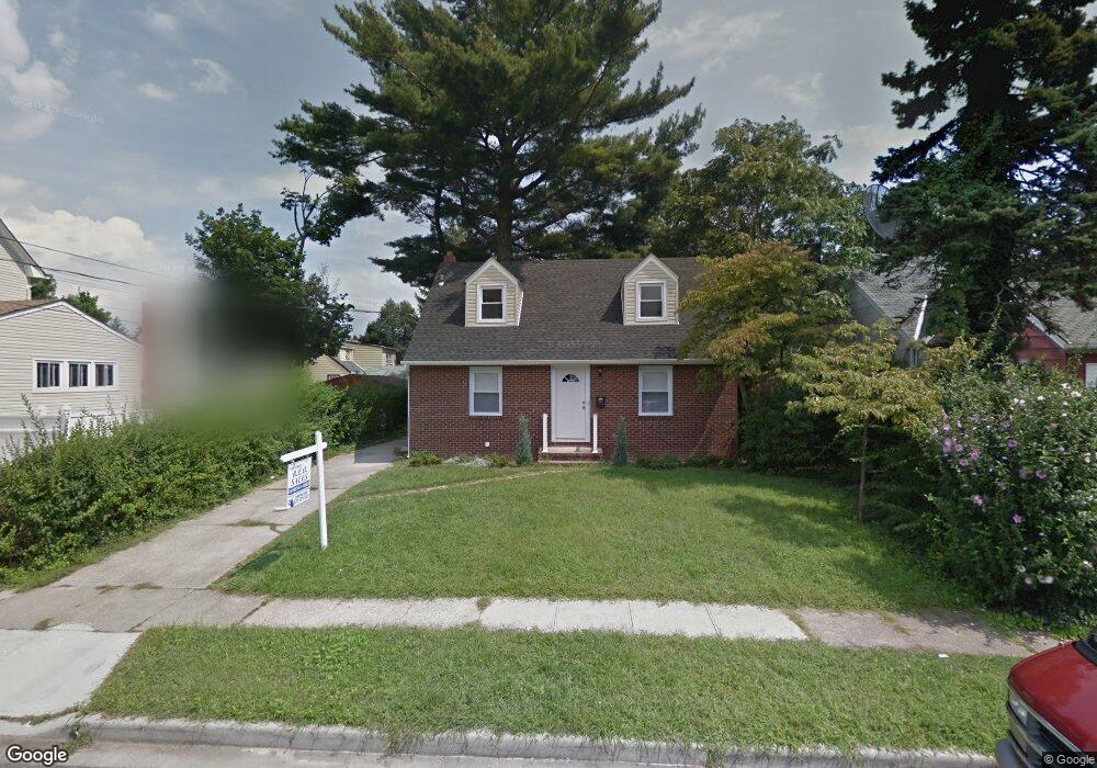
166 Beverly Rd Hempstead, NY 11550
Estimated Value: $662,000 - $672,093
5
Beds
2
Baths
1,210
Sq Ft
$551/Sq Ft
Est. Value
About This Home
This home is located at 166 Beverly Rd, Hempstead, NY 11550 and is currently estimated at $667,047, approximately $551 per square foot. 166 Beverly Rd is a home located in Nassau County with nearby schools including California Avenue Elementary School, Lawrence Road Middle School, and Uniondale High School.
Ownership History
Date
Name
Owned For
Owner Type
Purchase Details
Closed on
Dec 16, 2016
Sold by
Narain Harry and Narain Farida
Bought by
Idolor Lucky
Current Estimated Value
Home Financials for this Owner
Home Financials are based on the most recent Mortgage that was taken out on this home.
Original Mortgage
$328,932
Outstanding Balance
$268,436
Interest Rate
3.87%
Mortgage Type
FHA
Estimated Equity
$398,611
Purchase Details
Closed on
Dec 15, 2011
Sold by
Us Bank National Association
Bought by
Marti Development Llc
Purchase Details
Closed on
Jan 5, 2004
Sold by
Szul Marcella
Bought by
Goldstein Tamar
Create a Home Valuation Report for This Property
The Home Valuation Report is an in-depth analysis detailing your home's value as well as a comparison with similar homes in the area
Home Values in the Area
Average Home Value in this Area
Purchase History
| Date | Buyer | Sale Price | Title Company |
|---|---|---|---|
| Idolor Lucky | $335,000 | Allegiance Abstract | |
| Marti Development Llc | $96,900 | -- | |
| Goldstein Tamar | $289,000 | -- |
Source: Public Records
Mortgage History
| Date | Status | Borrower | Loan Amount |
|---|---|---|---|
| Open | Idolor Lucky | $328,932 |
Source: Public Records
Tax History
| Year | Tax Paid | Tax Assessment Tax Assessment Total Assessment is a certain percentage of the fair market value that is determined by local assessors to be the total taxable value of land and additions on the property. | Land | Improvement |
|---|---|---|---|---|
| 2025 | $6,526 | $375 | $134 | $241 |
| 2024 | $953 | $375 | $134 | $241 |
| 2023 | $5,451 | $375 | $134 | $241 |
| 2022 | $5,451 | $375 | $134 | $241 |
| 2021 | $7,490 | $358 | $128 | $230 |
| 2020 | $4,992 | $416 | $396 | $20 |
| 2019 | $865 | $446 | $285 | $161 |
| 2018 | $1,325 | $665 | $0 | $0 |
| 2017 | $5,284 | $665 | $425 | $240 |
| 2016 | $6,448 | $665 | $425 | $240 |
| 2015 | $1,104 | $659 | $425 | $234 |
| 2014 | $1,104 | $659 | $425 | $234 |
| 2013 | $1,022 | $659 | $425 | $234 |
Source: Public Records
Map
Nearby Homes
- 183 Perry St
- 178 Rutland Rd
- 355 Jerusalem Ave
- 353 Bedford Ave
- 63 Elmwood Ave
- 602 Leonard Ave
- 13 Fordham Place
- 678 Front St Unit E
- 2 Fordham Place
- 676 Front St Unit F
- 122 Hamilton Rd
- 17 Hope St
- 104 Phoenix St
- 25 Crowell St
- 27 Elizabeth Ct
- 59 Kernochan Ave
- 59 Broadfield Rd
- 43 Macdonald St
- 172 Argyle Ave
- 546 Clark Place
Your Personal Tour Guide
Ask me questions while you tour the home.