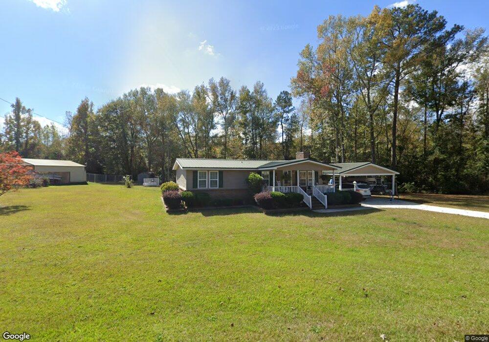
166 Hanson Dr Lagrange, GA 30240
Estimated Value: $144,246 - $201,000
2
Beds
2
Baths
1,224
Sq Ft
$138/Sq Ft
Est. Value
About This Home
This home is located at 166 Hanson Dr, Lagrange, GA 30240 and is currently estimated at $168,812, approximately $137 per square foot. 166 Hanson Dr is a home located in Troup County with nearby schools including Long Cane Elementary School, Berta Weathersbee Elementary School, and Whitesville Road Elementary School.
Ownership History
Date
Name
Owned For
Owner Type
Purchase Details
Closed on
Feb 29, 2004
Sold by
Larry P Webb
Bought by
Webb Mary Elizabeth
Current Estimated Value
Purchase Details
Closed on
Apr 2, 1968
Sold by
Webb Larry P
Bought by
Larry P Webb
Purchase Details
Closed on
Dec 31, 1966
Sold by
Shelton James and Shelton Ruth
Bought by
Webb Larry P
Purchase Details
Closed on
Sep 16, 1966
Sold by
Smith Nannie
Bought by
Shelton James and Shelton Ruth
Purchase Details
Closed on
Feb 21, 1966
Sold by
Moore Robert H and Moore Patricia
Bought by
Smith Nannie
Create a Home Valuation Report for This Property
The Home Valuation Report is an in-depth analysis detailing your home's value as well as a comparison with similar homes in the area
Purchase History
We collect this data history from publicly available records. To have your information removed, we recommend requesting removal directly through your county’s website.
| Date | Buyer | Sale Price | Title Company |
|---|---|---|---|
| Webb Mary Elizabeth | -- | -- | |
| Larry P Webb | -- | -- | |
| Webb Larry P | -- | -- | |
| Shelton James | -- | -- | |
| Smith Nannie | $600 | -- |
Source: Public Records
Tax History
| Year | Tax Paid | Tax Assessment Tax Assessment Total Assessment is a certain percentage of the fair market value that is determined by local assessors to be the total taxable value of land and additions on the property. | Land | Improvement |
|---|---|---|---|---|
| 2025 | $475 | $46,280 | $2,760 | $43,520 |
| 2024 | $379 | $40,800 | $2,760 | $38,040 |
| 2023 | $331 | $37,400 | $2,760 | $34,640 |
| 2022 | $313 | $33,600 | $2,760 | $30,840 |
| 2021 | $218 | $23,240 | $2,600 | $20,640 |
| 2020 | $641 | $23,240 | $2,600 | $20,640 |
| 2019 | $645 | $23,360 | $2,600 | $20,760 |
| 2018 | $588 | $21,480 | $2,600 | $18,880 |
| 2017 | $588 | $21,480 | $2,600 | $18,880 |
| 2016 | $567 | $20,796 | $2,600 | $18,196 |
| 2015 | $569 | $20,796 | $2,600 | $18,196 |
| 2014 | $540 | $19,838 | $2,600 | $17,238 |
| 2013 | -- | $20,429 | $2,600 | $17,829 |
Source: Public Records
Map
Nearby Homes
- 105 Redwood Dr
- 3658 W Point Rd
- 22 Freeman Rd
- 245 Teaver Rd
- 20 Hill Rd
- 36 Hill Rd
- 0 Bradfield Dr Unit 10568803
- 53 Horace Carter Rd
- 801 Glass Bridge Rd
- 6 Hastings Ct
- 104 Independence Ct
- 82 Newton Rd
- 311 Cumberland Dr
- 101 Ivy Springs Dr
- 1054 Glass Bridge Rd
- 2663-2683 W Point Rd
- 300 Cumberland Dr
- 474 Newton Rd
- 129 Angela East Dr
- 4.51 ACRES Whatley Rd N
- 135 AC Hanson Dr
- 186 Hanson Dr
- 151 Hanson Dr
- 171 Hanson Dr
- 191 Hanson Dr
- 216 Hanson Dr
- 231 Hanson Dr
- 230 Hanson Dr
- 255 Hanson Dr
- Homesite 74 Hanson Ct
- 83 Hanson Dr
- Homesite 70 Hanson Ct
- Homesite 73 Hanson Ct
- Homesite 71 Hanson Ct
- Homesite 67 Hanson Ct
- 272 Hanson Dr
- 273 Hanson Dr
- 281 Hanson Dr
- 286 Hanson Dr
- 320 Marty Ln
Your Personal Tour Guide
Ask me questions while you tour the home.