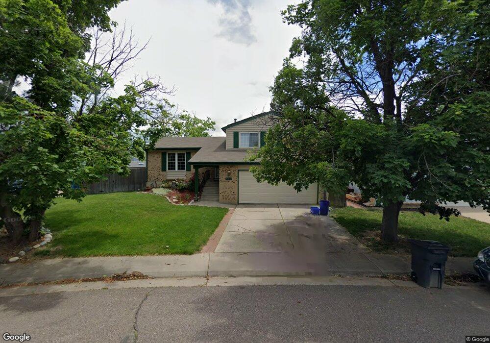
16675 E Rice Cir Aurora, CO 80015
Pheasant Run NeighborhoodEstimated Value: $452,927 - $471,000
About This Home
This home is located at 16675 E Rice Cir, Aurora, CO 80015 and is currently estimated at $464,482, approximately $300 per square foot. 16675 E Rice Cir is a home located in Arapahoe County with nearby schools including Independence Elementary School, Laredo Middle School, and Smoky Hill High School.
Ownership History
We collect this data history from publicly available records. To have your information removed, we recommend requesting removal directly through your county’s website.
Purchase Details
Home Financials for this Owner
Home Financials are based on the most recent Mortgage that was taken out on this home.Purchase Details
Home Financials for this Owner
Home Financials are based on the most recent Mortgage that was taken out on this home.Purchase Details
Home Financials for this Owner
Home Financials are based on the most recent Mortgage that was taken out on this home.Purchase Details
Purchase Details
Home Values in the Area
Average Home Value in this Area
Purchase History
We collect this data history from publicly available records. To have your information removed, we recommend requesting removal directly through your county’s website.
| Date | Buyer | Sale Price | Title Company |
|---|---|---|---|
| -- | -- | ||
| -- | -- | ||
| $160,000 | North American Title Co | ||
| -- | -- | ||
| -- | -- |
Mortgage History
We collect this data history from publicly available records. To have your information removed, we recommend requesting removal directly through your county’s website.
| Date | Status | Borrower | Loan Amount |
|---|---|---|---|
| Open | $64,000 | ||
| Open | $199,800 | ||
| Closed | $195,000 | ||
| Closed | $135,018 | ||
| Closed | $49,174 | ||
| Closed | $165,650 | ||
| Closed | $161,690 | ||
| Closed | $161,690 | ||
| Closed | $158,937 |
Tax History
We collect this data history from publicly available records. To have your information removed, we recommend requesting removal directly through your county’s website.
| Year | Tax Paid | Tax Assessment Tax Assessment Total Assessment is a certain percentage of the fair market value that is determined by local assessors to be the total taxable value of land and additions on the property. | Land | Improvement |
|---|---|---|---|---|
| 2026 | $2,540 | $28,899 | ||
| 2025 | $2,420 | $29,513 | ||
| 2024 | $2,134 | $30,840 | ||
| 2023 | $2,134 | $30,840 | $0 | $0 |
| 2022 | $1,725 | $23,818 | $0 | $0 |
| 2021 | $1,736 | $23,818 | $0 | $0 |
| 2020 | $1,733 | $24,139 | $0 | $0 |
| 2019 | $1,672 | $24,139 | $0 | $0 |
| 2018 | $1,436 | $19,483 | $0 | $0 |
| 2017 | $1,416 | $19,483 | $0 | $0 |
| 2016 | $1,417 | $18,284 | $0 | $0 |
| 2015 | $1,348 | $18,284 | $0 | $0 |
| 2014 | $964 | $11,582 | $0 | $0 |
| 2013 | -- | $13,340 | $0 | $0 |
Map
- 16636 E Rice Cir
- 16930 E Stanford Ave
- 16670 E Tufts Ave
- 16966 E Tufts Place
- 4694 S Ouray Way
- 4465 S Pagosa Way
- 4708 S Ouray Way
- 4683 S Buckley Way
- 4480 S Pitkin St Unit 127
- 17213 E Stanford Ave Unit F
- 4460 S Pitkin St Unit 115
- 4460 S Pitkin St Unit 120
- 4646 S Mobile Way
- 4784 S Olathe Way
- 17335 E Rice Cir Unit B
- 17335 E Rice Cir Unit C
- 17396 E Rice Cir Unit D
- 17478 E Rice Cir Unit C
- 16222 E Rice Place Unit B
- 17458 E Rice Cir Unit F
- 16654 E Rice Cir
- 16672 E Rice Cir
- 16682 E Rice Cir
- 16644 E Rice Cir
- 16651 E Rice Cir
- 16661 E Rice Cir
- 16645 E Rice Cir
- 16684 E Rice Cir
- 16663 E Rice Cir
- 16653 E Rice Cir
- 16655 E Rice Cir
- 16643 E Rice Cir
- 16665 E Rice Cir
- 16686 E Rice Cir
- 16681 E Rice Cir
- 16641 E Rice Cir
- 16673 E Rice Cir
- 16683 E Rice Cir
- 16671 E Rice Cir
- 16692 E Rice Cir
Ask me questions while you tour the home.