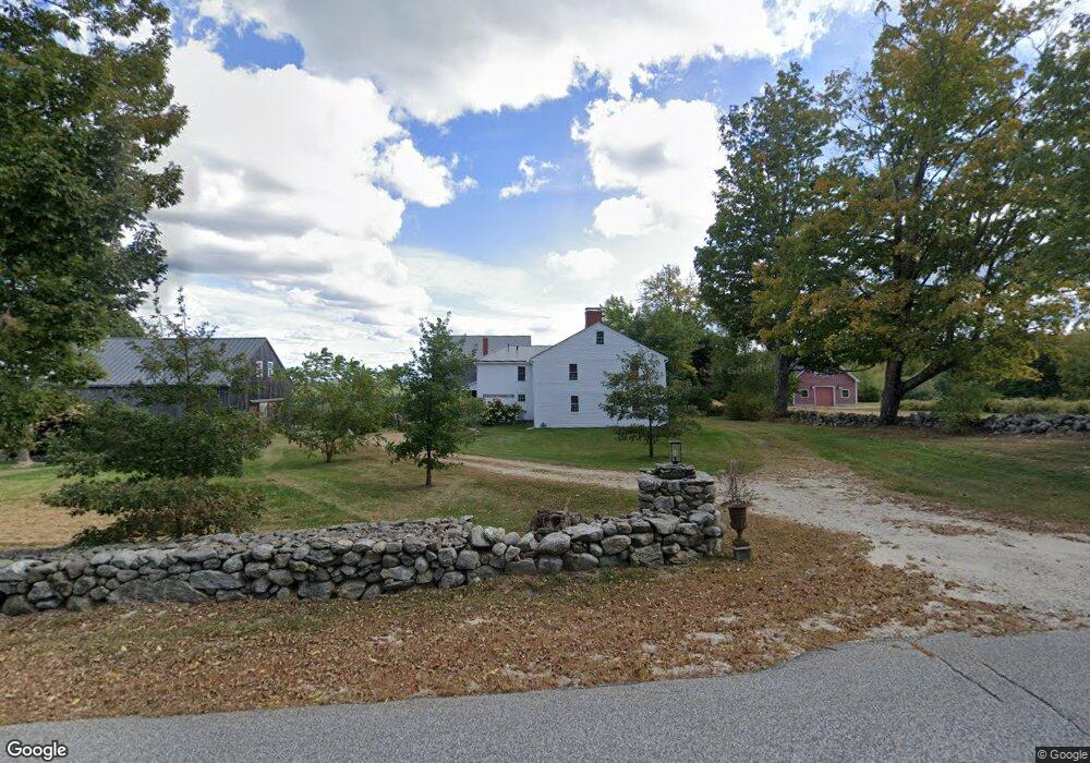
167 Cobbs Bridge Rd New Gloucester, ME 04260
Estimated Value: $646,000 - $1,459,000
5
Beds
3
Baths
4,100
Sq Ft
$279/Sq Ft
Est. Value
About This Home
This home is located at 167 Cobbs Bridge Rd, New Gloucester, ME 04260 and is currently estimated at $1,143,586, approximately $278 per square foot. 167 Cobbs Bridge Rd is a home located in Cumberland County with nearby schools including Gray-New Gloucester High School.
Ownership History
Date
Name
Owned For
Owner Type
Purchase Details
Closed on
Jan 29, 2008
Sold by
Christensen Marc D and Christensen Melissa A
Bought by
Fiori Michael A and Eisen Jane L
Current Estimated Value
Home Financials for this Owner
Home Financials are based on the most recent Mortgage that was taken out on this home.
Original Mortgage
$400,000
Interest Rate
6.17%
Mortgage Type
Purchase Money Mortgage
Create a Home Valuation Report for This Property
The Home Valuation Report is an in-depth analysis detailing your home's value as well as a comparison with similar homes in the area
Home Values in the Area
Average Home Value in this Area
Purchase History
| Date | Buyer | Sale Price | Title Company |
|---|---|---|---|
| Fiori Michael A | -- | -- |
Source: Public Records
Mortgage History
| Date | Status | Borrower | Loan Amount |
|---|---|---|---|
| Open | Fiori Michael A | $400,000 | |
| Closed | Fiori Michael A | $400,000 |
Source: Public Records
Tax History
| Year | Tax Paid | Tax Assessment Tax Assessment Total Assessment is a certain percentage of the fair market value that is determined by local assessors to be the total taxable value of land and additions on the property. | Land | Improvement |
|---|---|---|---|---|
| 2025 | $12,852 | $830,787 | $175,421 | $655,366 |
| 2024 | $12,380 | $831,448 | $176,082 | $655,366 |
| 2023 | $11,900 | $832,770 | $177,404 | $655,366 |
| 2022 | $11,516 | $834,465 | $179,099 | $655,366 |
| 2021 | $11,272 | $816,803 | $161,437 | $655,366 |
| 2020 | $11,149 | $816,787 | $161,421 | $655,366 |
| 2019 | $11,538 | $682,700 | $84,300 | $598,400 |
| 2018 | $10,799 | $683,500 | $85,100 | $598,400 |
| 2017 | $10,658 | $683,200 | $84,800 | $598,400 |
| 2016 | $10,039 | $682,900 | $84,500 | $598,400 |
| 2015 | $9,981 | $681,300 | $82,900 | $598,400 |
| 2014 | $9,879 | $681,300 | $82,900 | $598,400 |
| 2013 | $9,165 | $681,400 | $83,000 | $598,400 |
Source: Public Records
Map
Nearby Homes
- 56 Cobbs Bridge Rd
- 21 Bald Hill Rd
- 155 & 151 Gloucester Hill Rd
- 26 Hemlock Ln
- Bowdoin Way
- 10-56 C&E Bowdoin Way
- 168 Auburn Pownal Rd
- 1890 Pownal Rd
- TBD Emmaus Rd
- 521 Mayall Rd
- 14 Golden Way
- 71A Black Point Rd
- 059-007 Soper's Mill Rd
- 65 Blueberry Ln
- 436 Lot A Foster Rd
- 436 Lot B Foster Rd
- 270 Mayall Rd
- Lot 21-29 Weymouth Rd
- 850 Lawrence Rd
- 145 Harvest Hill Ln
- 201 Cobbs Bridge Rd
- 170 Cobbs Bridge Rd
- 146 Cobbs Bridge Rd
- 143 Cobbs Bridge Rd
- 143A Cobbs Bridge Rd
- 137 Cobbs Bridge Rd
- 199 Cobbs Bridge Rd
- 199 Cobbs Bridge Rd
- 137 Cobb's Bridge Rd
- 5 Belgian Way
- 0 Belgian Unit 845389
- 0 Belgian Unit 705906
- 0 Belgian Unit 988753
- 0 Belgian Unit 957685
- 199A Cobbs Bridge Rd
- 213 Cobbs Bridge Rd
- 199 Cobb's Bridge
- 119 Cobbs Bridge Rd
- 18 Belgian Way
- 32 Belgian Way
Your Personal Tour Guide
Ask me questions while you tour the home.