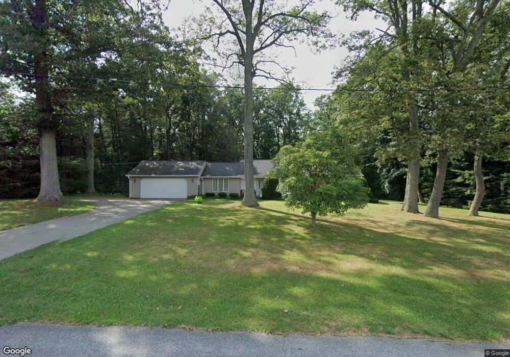
16750 Ridge Rd Upperco, MD 21155
Estimated Value: $438,747 - $453,000
About This Home
This home is located at 16750 Ridge Rd, Upperco, MD 21155 and is currently estimated at $443,687, approximately $287 per square foot. 16750 Ridge Rd is a home located in Baltimore County with nearby schools including Fifth District Elementary School, Hereford Middle School, and Hereford High School.
Ownership History
We collect this data history from publicly available records. To have your information removed, we recommend requesting removal directly through your county’s website.
Purchase Details
Home Financials for this Owner
Home Financials are based on the most recent Mortgage that was taken out on this home.Purchase Details
Home Financials for this Owner
Home Financials are based on the most recent Mortgage that was taken out on this home.Purchase Details
Purchase History
We collect this data history from publicly available records. To have your information removed, we recommend requesting removal directly through your county’s website.
| Date | Buyer | Sale Price | Title Company |
|---|---|---|---|
| $445,000 | Sage Title | ||
| -- | Resource Title Llc | ||
| $18,500 | -- |
Mortgage History
We collect this data history from publicly available records. To have your information removed, we recommend requesting removal directly through your county’s website.
| Date | Status | Borrower | Loan Amount |
|---|---|---|---|
| Open | $378,250 | ||
| Previous Owner | $471,000 |
Tax History
We collect this data history from publicly available records. To have your information removed, we recommend requesting removal directly through your county’s website.
| Year | Tax Paid | Tax Assessment Tax Assessment Total Assessment is a certain percentage of the fair market value that is determined by local assessors to be the total taxable value of land and additions on the property. | Land | Improvement |
|---|---|---|---|---|
| 2025 | $4,155 | $402,000 | $103,400 | $298,600 |
| 2024 | $4,155 | $378,667 | $0 | $0 |
| 2023 | $2,003 | $355,333 | $0 | $0 |
| 2022 | $3,809 | $332,000 | $98,700 | $233,300 |
| 2021 | $3,544 | $313,233 | $0 | $0 |
| 2020 | $3,544 | $294,467 | $0 | $0 |
| 2019 | $3,401 | $275,700 | $98,700 | $177,000 |
| 2018 | $3,344 | $270,967 | $0 | $0 |
| 2017 | $3,257 | $266,233 | $0 | $0 |
| 2016 | $2,717 | $261,500 | $0 | $0 |
| 2015 | $2,717 | $261,500 | $0 | $0 |
| 2014 | $2,717 | $261,500 | $0 | $0 |
Map
- 4331 Black Rock Rd
- 3413 Mount Zion Rd
- 3114 Mount Zion Rd
- 3116 Mount Carmel Rd
- 25 Thomas Shilling Ct
- 16506 Dubbs Rd
- 705 Spotters Ct
- 4630 Marksman Ct
- 4532 Whetstone Ct
- 4609 Marksman Ct
- 4470 Woodsman Dr Unit 731
- 940 Gaming Square
- 613 Hanover Pike
- 0 Black Rock Rd Unit MDCR2035422
- 848 Century St
- 4291 N Woods Trail
- 4302 Sycamore Dr
- 918 Century St
- 4691 Catalina Dr
- 17 Mamopa Ct
- 16754 Ridge Rd
- 16746 Ridge Rd
- 16742 Ridge Rd
- 16758 Ridge Rd
- 16800 Ridge Rd
- 16805 Ridge Rd
- 16730 Ridge Rd
- 16724 Ridge Rd
- 16811 Ridge Rd
- 16714 Ridge Rd
- 16815 Ridge Rd
- 4034 Black Rock Rd
- 16819 Ridge Rd
- 16712 Ridge Rd
- 4108 Black Rock Rd
- 3930 Black Rock Rd
- 4103 Black Rock Rd
- 4124 Black Rock Rd
- 16824 Ridge Rd
- 4220 Black Rock Rd
Ask me questions while you tour the home.