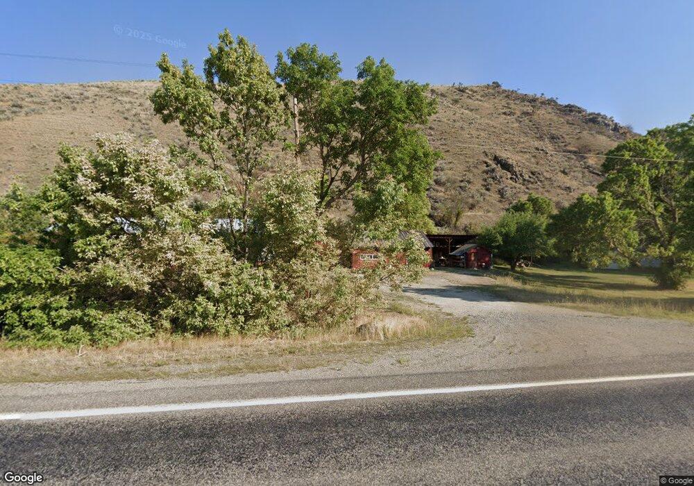
1683 Highway 93 N North Fork, ID 83466
Estimated Value: $226,992 - $492,000
2
Beds
2
Baths
768
Sq Ft
$496/Sq Ft
Est. Value
About This Home
This home is located at 1683 Highway 93 N, North Fork, ID 83466 and is currently estimated at $380,748, approximately $495 per square foot. 1683 Highway 93 N is a home with nearby schools including Salmon Pioneer Primary School and Salmon Jr./Sr. High School.
Ownership History
Date
Name
Owned For
Owner Type
Purchase Details
Closed on
Aug 27, 2025
Sold by
Charboneau Grace
Bought by
Bill Daniel D and Bill Jennifer K
Current Estimated Value
Purchase Details
Closed on
Mar 5, 2018
Sold by
Osborne Karen
Bought by
Prophet Ricky
Home Financials for this Owner
Home Financials are based on the most recent Mortgage that was taken out on this home.
Original Mortgage
$43,133
Interest Rate
4.15%
Mortgage Type
Purchase Money Mortgage
Create a Home Valuation Report for This Property
The Home Valuation Report is an in-depth analysis detailing your home's value as well as a comparison with similar homes in the area
Purchase History
| Date | Buyer | Sale Price | Title Company |
|---|---|---|---|
| Bill Daniel D | -- | Lemhi Title | |
| Prophet Ricky | -- | None Available |
Source: Public Records
Mortgage History
| Date | Status | Borrower | Loan Amount |
|---|---|---|---|
| Previous Owner | Prophet Ricky | $43,133 |
Source: Public Records
Tax History
| Year | Tax Paid | Tax Assessment Tax Assessment Total Assessment is a certain percentage of the fair market value that is determined by local assessors to be the total taxable value of land and additions on the property. | Land | Improvement |
|---|---|---|---|---|
| 2025 | $433 | $53,294 | $21,608 | $31,686 |
| 2024 | $368 | $53,294 | $21,608 | $31,686 |
| 2023 | $289 | $53,294 | $21,608 | $31,686 |
| 2022 | $188 | $58,812 | $21,608 | $37,204 |
| 2021 | $229 | $58,812 | $21,608 | $37,204 |
| 2020 | $233 | $58,812 | $21,608 | $37,204 |
| 2019 | $229 | $58,812 | $21,608 | $37,204 |
| 2018 | $232 | $58,812 | $21,608 | $37,204 |
| 2017 | $247 | $60,631 | $21,608 | $39,023 |
| 2016 | $255 | $60,631 | $21,608 | $39,023 |
| 2013 | $232 | $60,631 | $21,608 | $39,023 |
| 2011 | $232 | $62,251 | $19,508 | $42,743 |
Source: Public Records
Map
Nearby Homes
- TBD Hill Rd
- 4 Mule View Ln
- 20 Cherry Hill Ln
- 18 & 20 Cherry Hill Ln
- 14 Elk Ridge Rd
- 0 Hill Rd
- 1826 N Hwy 93
- 9 Little 4th of July Creek Rd
- 0 Nkn Fourth of July Creek Rd
- 261 Fourth of July Creek Rd
- TBD 4th of July Creek Rd
- 387 N Tower Creek Rd
- 53 Runnin Bear Rd
- 59 Savage Ranch Rd
- TBD Diamond Creek Ln
- 5 Sky Trail Ln
- 3&5 Capt Billy Boogie Way
- 2811 Hwy 93 N
- 53 Blackhawk Ln
- 53 Black Hawk Dr
- 1681 Highway 93 N
- 1679 Highway 93 N
- 1661 Highway 93 N
- 1714 Highway 93 N
- 1647 Highway 93 N
- 1714 U S 93
- 1657 Highway 93 N
- 1711 Highway 93 N
- 1730 Highway 93 N
- 1724 Highway 93 N
- 1712 Highway 93 N
- 16 Hwy 93
- 10 Front Rd
- 999 Hill Rd
- 8 Front Rd
- 9 Mule View Ln
- 10 Hill Rd
- 19 Hill Rd
- 6 Maxwell Bridge
- 1752 Hwy 93
Your Personal Tour Guide
Ask me questions while you tour the home.