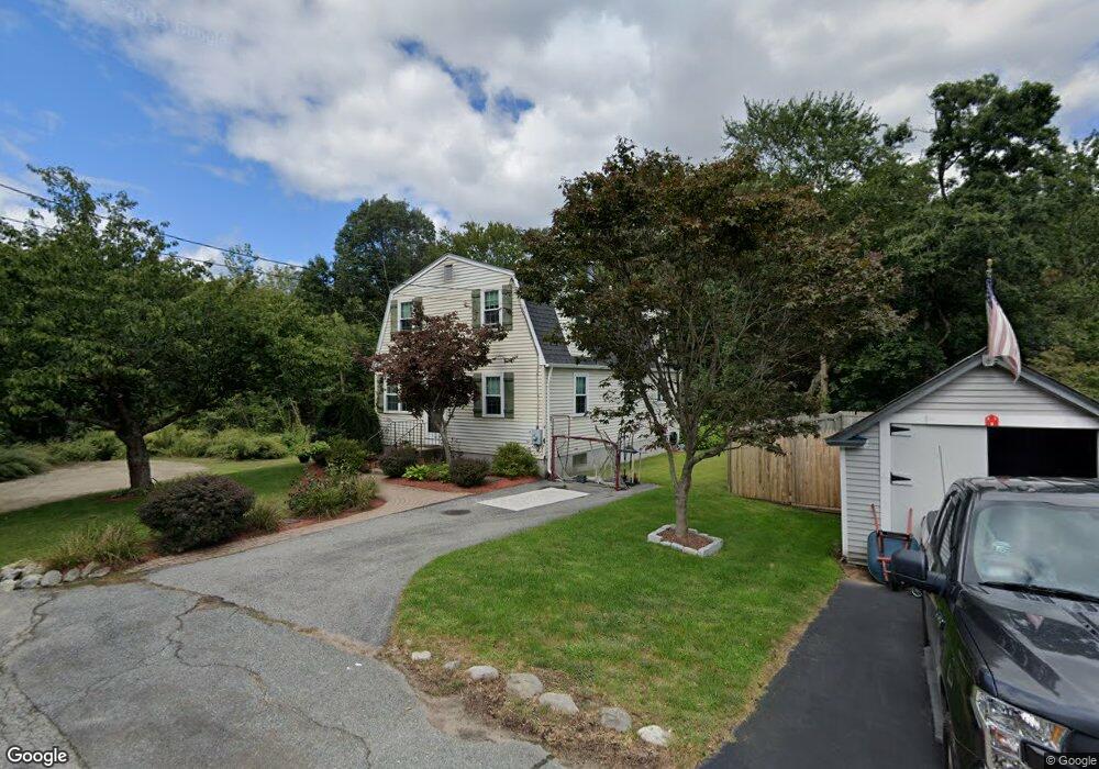
17 Avenue B Lincoln, RI 02865
Lime Rock NeighborhoodEstimated Value: $446,234 - $528,000
4
Beds
1
Bath
1,350
Sq Ft
$370/Sq Ft
Est. Value
About This Home
This home is located at 17 Avenue B, Lincoln, RI 02865 and is currently estimated at $499,309, approximately $369 per square foot. 17 Avenue B is a home located in Providence County with nearby schools including Lincoln Senior High School, Blackstone Valley Prep Elementary School 1, and Blackstone Valley Prep Elementary School 2.
Ownership History
Date
Name
Owned For
Owner Type
Purchase Details
Closed on
May 17, 1991
Sold by
Isherwood James V
Bought by
Horwath James A
Current Estimated Value
Create a Home Valuation Report for This Property
The Home Valuation Report is an in-depth analysis detailing your home's value as well as a comparison with similar homes in the area
Home Values in the Area
Average Home Value in this Area
Purchase History
| Date | Buyer | Sale Price | Title Company |
|---|---|---|---|
| Horwath James A | $113,000 | -- |
Source: Public Records
Mortgage History
| Date | Status | Borrower | Loan Amount |
|---|---|---|---|
| Open | Horwath James A | $15,000 | |
| Open | Horwath James A | $131,131 | |
| Closed | Horwath James A | $125,000 | |
| Closed | Horwath James A | $88,000 |
Source: Public Records
Tax History
| Year | Tax Paid | Tax Assessment Tax Assessment Total Assessment is a certain percentage of the fair market value that is determined by local assessors to be the total taxable value of land and additions on the property. | Land | Improvement |
|---|---|---|---|---|
| 2025 | $5,737 | $424,300 | $190,000 | $234,300 |
| 2024 | $5,672 | $326,900 | $144,100 | $182,800 |
| 2023 | $5,391 | $326,900 | $144,100 | $182,800 |
| 2022 | $5,378 | $326,900 | $144,100 | $182,800 |
| 2021 | $5,182 | $255,400 | $112,600 | $142,800 |
| 2020 | $5,144 | $255,400 | $112,600 | $142,800 |
| 2018 | $4,723 | $211,300 | $85,300 | $126,000 |
| 2017 | $4,627 | $211,300 | $85,300 | $126,000 |
| 2016 | $4,564 | $211,300 | $85,300 | $126,000 |
| 2015 | $4,591 | $195,100 | $81,000 | $114,100 |
| 2014 | $4,599 | $195,100 | $81,000 | $114,100 |
Source: Public Records
Map
Nearby Homes
- 699 Lower River Rd
- 1 Barway Ln
- 107 Old River Rd Unit 11
- 3 Barrett St
- 22b Dexter Rock Way
- 34 Dexter Rock Rd
- 546 River Rd
- 39 Streamview Dr Unit 34
- 31 Streamview Dr Unit 31
- 31 Streamview Dr
- 27 Streamview Dr
- 1112 Great Rd
- 200 Old Mendon Rd
- 461 River Rd
- 46 Timberland Dr
- 458 River Rd
- 500 Mendon Rd Unit 216
- 500 Mendon Rd Unit 320
- 97 Angell Rd
- 1504 Hunting Hill Dr
- 15 Avenue B
- 12 Avenue B
- 100 Avenue B Ave
- 874 Lower River Rd
- 880 Lower River Rd
- 0 Avenue B Ave
- 864 Lower River Rd
- 864 Lower River Rd Unit 1
- 882 Lower River Rd
- 858 Lower River Rd
- 858 Lower River Rd
- 858 Lower River Rd Unit 2
- 2 Avenue A
- 852 Lower River Rd
- 848 Lower River Rd
- 8 Avenue D
- 4 Avenue D
- 838 Lower River Rd
- 900 Lower River Rd
- 830 Lower River Rd
Your Personal Tour Guide
Ask me questions while you tour the home.