
Seller's Agent in 2025
Dorothy Jones
Howard Hanna Capital Inc
(518) 528-3811
5 in this area
96 Total Sales
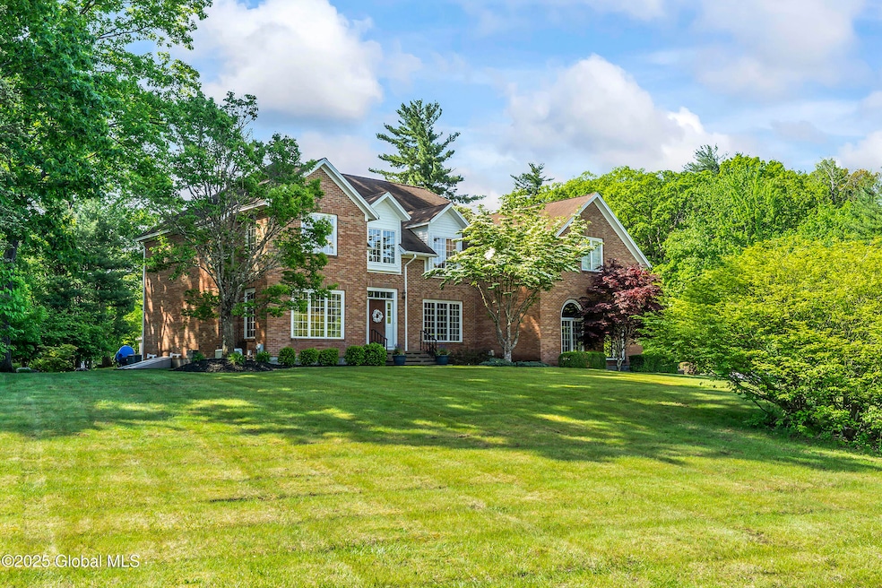
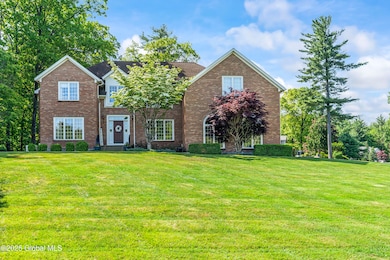
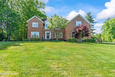
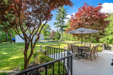
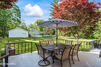
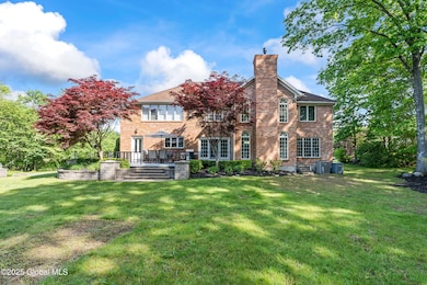
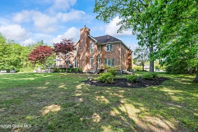
A rare opportunity to own this Custom-built Builders home showcasing unique features & the highest quality craftmanship. This 'all brick' luxury home boasts a spacious floorplan spanning over 5,600sf, w/ basement, on a .86 double lot! The Open layout features grand staircase leading to open loft area, soaring 2-story light filled FR, wood paneled office w/ marble flooring, 2 FP's, & the stunning gourmet kitchen is a Chefs dream, featuring huge center island & high-end appliances. Primary en-suite is a true retreat including a sitting room, BR, & stunning luxury BA, ample storage & closet space! Included w/ this property is 15 Brendan Lane, a .41 adjacent parcel adding space & privacy to the home. 3 bay garage, beautifully landscaped yard, this luxury home has it all!
Last Agent to Sell the Property
Howard Hanna Capital Inc License #30JO0898368 Listed on: 05/28/2025
| Date | Type | Sale Price | Title Company |
|---|---|---|---|
| Warranty Deed | -- | Chicago Title Insurance Compan | |
| Warranty Deed | $800,000 | Chicago Title Insurance Compan | |
| Warranty Deed | $430,000 | None Available |
| Date | Status | Loan Amount | Loan Type |
|---|---|---|---|
| Previous Owner | $344,000 | New Conventional |
| Date | Event | Price | List to Sale | Price per Sq Ft |
|---|---|---|---|---|
| 10/14/2025 10/14/25 | Sold | $800,000 | -4.8% | $171 / Sq Ft |
| 09/02/2025 09/02/25 | Pending | -- | -- | -- |
| 08/09/2025 08/09/25 | Price Changed | $839,999 | -1.2% | $179 / Sq Ft |
| 07/24/2025 07/24/25 | Price Changed | $849,999 | -5.5% | $181 / Sq Ft |
| 07/09/2025 07/09/25 | Price Changed | $899,000 | -3.3% | $192 / Sq Ft |
| 05/28/2025 05/28/25 | For Sale | $929,900 | -- | $198 / Sq Ft |
| Year | Tax Paid | Tax Assessment Tax Assessment Total Assessment is a certain percentage of the fair market value that is determined by local assessors to be the total taxable value of land and additions on the property. | Land | Improvement |
|---|---|---|---|---|
| 2025 | $19,773 | $577,000 | $46,700 | $530,300 |
| 2024 | $19,773 | $577,000 | $46,700 | $530,300 |
| 2023 | $201 | $577,000 | $46,700 | $530,300 |
| 2022 | $19,298 | $589,000 | $46,700 | $542,300 |
| 2021 | $19,057 | $589,000 | $46,700 | $542,300 |
| 2020 | $16,220 | $589,000 | $46,700 | $542,300 |
| 2019 | $9,544 | $589,000 | $46,700 | $542,300 |
| 2018 | $16,582 | $589,000 | $46,700 | $542,300 |
| 2017 | $17,059 | $589,000 | $46,700 | $542,300 |
| 2016 | $17,304 | $589,000 | $46,700 | $542,300 |
| 2015 | -- | $589,000 | $46,700 | $542,300 |
| 2014 | -- | $589,000 | $46,700 | $542,300 |
Seller's Agent in 2025
Dorothy Jones
Howard Hanna Capital Inc
(518) 528-3811
5 in this area
96 Total Sales
A
Buyer's Agent in 2025
Arielle Roberts
Empire Real Estate Firm LLC
(518) 937-3950
2 in this area
54 Total Sales
Source: Global MLS
MLS Number: 202518289
APN: 060-012-0001-057-000-0000
Disclaimer: Certain information contained herein is derived from information provided by parties other than Homes.com. All information provided is deemed reliable, but is not guaranteed to be accurate and should be independently verified.
![]() IDX information is provided exclusively for personal, non-commercial use, and may not be used for any purpose other than to identify prospective properties consumers may be interested in purchasing.
IDX information is provided exclusively for personal, non-commercial use, and may not be used for any purpose other than to identify prospective properties consumers may be interested in purchasing.
Information is deemed reliable but not guaranteed.
Local REALTOR® - Todd Siegel, Broker - (888)-952-6393
Ask me questions while you tour the home.