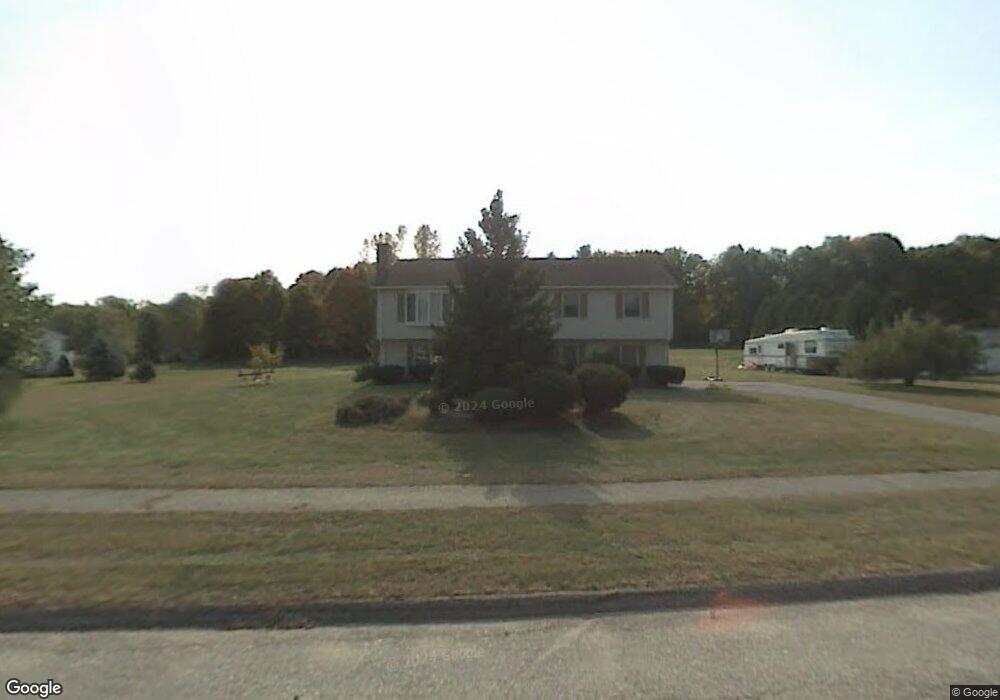
17 Deer Path Ln Westfield, MA 01085
Estimated Value: $442,189 - $485,000
3
Beds
2
Baths
1,236
Sq Ft
$373/Sq Ft
Est. Value
About This Home
This home is located at 17 Deer Path Ln, Westfield, MA 01085 and is currently estimated at $461,297, approximately $373 per square foot. 17 Deer Path Ln is a home located in Hampden County with nearby schools including Westfield High School, White Oak School, and Westfield Christian Academy.
Ownership History
Date
Name
Owned For
Owner Type
Purchase Details
Closed on
Nov 4, 1997
Sold by
Mclain Thomas I and Mclain Linda M
Bought by
Natario Robert J and Natario Tracy A
Current Estimated Value
Purchase Details
Closed on
Nov 9, 1989
Sold by
Ziter Peter J
Bought by
Mclain Thomas I
Create a Home Valuation Report for This Property
The Home Valuation Report is an in-depth analysis detailing your home's value as well as a comparison with similar homes in the area
Home Values in the Area
Average Home Value in this Area
Purchase History
| Date | Buyer | Sale Price | Title Company |
|---|---|---|---|
| Natario Robert J | $125,500 | -- | |
| Mclain Thomas I | $152,900 | -- |
Source: Public Records
Mortgage History
| Date | Status | Borrower | Loan Amount |
|---|---|---|---|
| Open | Mclain Thomas I | $180,000 | |
| Closed | Mclain Thomas I | $40,000 | |
| Closed | Mclain Thomas I | $30,000 |
Source: Public Records
Tax History
| Year | Tax Paid | Tax Assessment Tax Assessment Total Assessment is a certain percentage of the fair market value that is determined by local assessors to be the total taxable value of land and additions on the property. | Land | Improvement |
|---|---|---|---|---|
| 2025 | $5,888 | $387,900 | $151,500 | $236,400 |
| 2024 | $5,877 | $368,000 | $137,900 | $230,100 |
| 2023 | $5,601 | $342,100 | $131,400 | $210,700 |
| 2022 | $5,601 | $302,900 | $117,000 | $185,900 |
| 2021 | $5,500 | $291,300 | $110,500 | $180,800 |
| 2020 | $5,346 | $277,700 | $110,500 | $167,200 |
| 2019 | $5,226 | $265,700 | $105,300 | $160,400 |
| 2018 | $5,144 | $265,700 | $105,300 | $160,400 |
| 2017 | $5,053 | $260,200 | $106,600 | $153,600 |
| 2016 | $5,039 | $259,200 | $106,600 | $152,600 |
| 2015 | $4,806 | $259,200 | $106,600 | $152,600 |
| 2014 | $3,596 | $259,200 | $106,600 | $152,600 |
Source: Public Records
Map
Nearby Homes
- 336 Russellville Rd
- 134 Russellville Rd
- 68 Warfield Dr
- 132 North Rd
- 458 Montgomery Rd
- 52 & 53 Bayberry Ln
- 24 Jaeger Dr
- 45 Jaeger Dr
- 182 Lockhouse Rd
- Lot 5 Brickyard Rd
- 202 Brickyard Rd
- 38 Klondike Ave
- 0 Char Dr
- 0 Lockhouse Rd Unit 73496193
- 19 Arch Rd
- 19 Cottage Ave
- 57 White Loaf Rd
- 288 Buck Pond Rd
- 238 Prospect Street Extension
- 274 Prospect Street Extension
- 25 Deer Path Ln
- 11 Deer Path Ln
- 20 Deer Path Ln
- 14 Deer Path Ln
- 26 Deer Path Ln
- 31 Deer Path Ln
- 32 Deer Path Ln
- 283 Russellville Rd
- 37 Deer Path Ln
- 277 Russellville Rd
- 38 Deer Path Ln
- 263 Russellville Rd
- 284 Russellville Rd
- 297 Russellville Rd
- 222 & 246 Russellville Rd
- 44 Deer Path Ln
- 43 Deer Path Ln
- 301 Russellville Rd
- 245 Russellville Rd
- 270 Russellville Rd
Your Personal Tour Guide
Ask me questions while you tour the home.