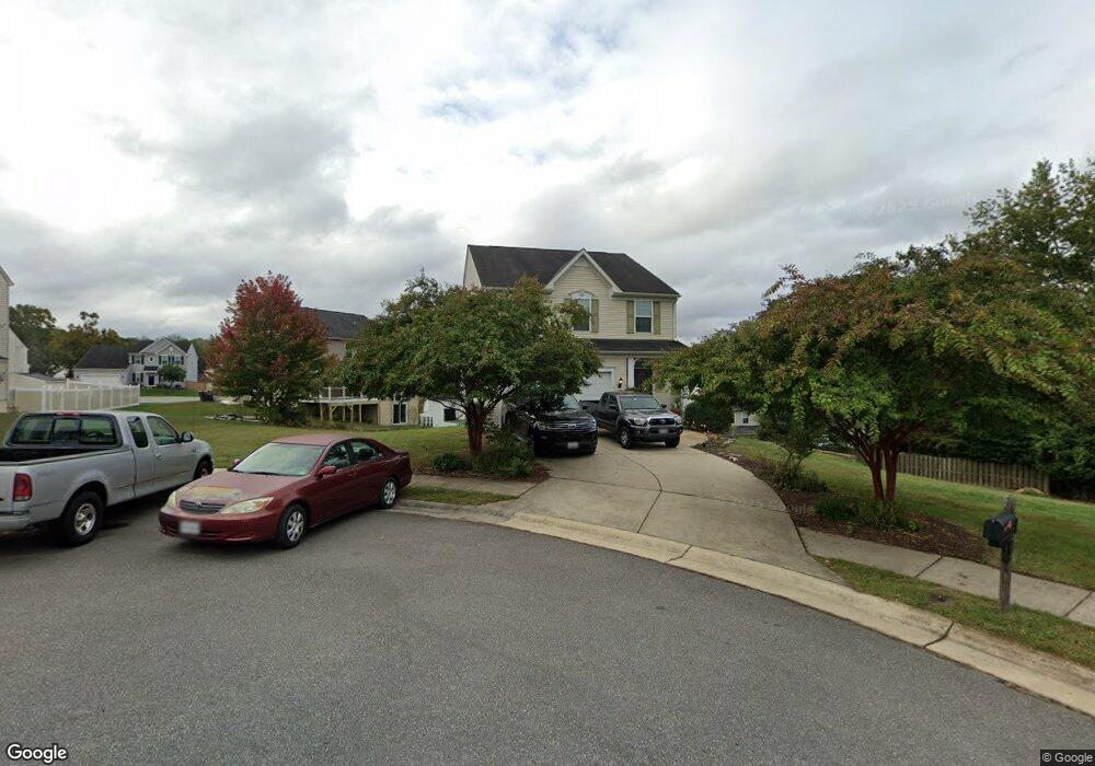
17 Firehawk Dr Stafford, VA 22554
Aquia Harbour NeighborhoodEstimated Value: $541,000 - $615,000
About This Home
This home is located at 17 Firehawk Dr, Stafford, VA 22554 and is currently estimated at $581,724, approximately $257 per square foot. 17 Firehawk Dr is a home located in Stafford County with nearby schools including Widewater Elementary School, Shirley C. Heim Middle School, and Brooke Point High School.
Ownership History
We collect this data history from publicly available records. To have your information removed, we recommend requesting removal directly through your county’s website.
Purchase Details
Home Financials for this Owner
Home Financials are based on the most recent Mortgage that was taken out on this home.Home Values in the Area
Average Home Value in this Area
Purchase History
We collect this data history from publicly available records. To have your information removed, we recommend requesting removal directly through your county’s website.
| Date | Buyer | Sale Price | Title Company |
|---|---|---|---|
| $385,135 | -- |
Mortgage History
We collect this data history from publicly available records. To have your information removed, we recommend requesting removal directly through your county’s website.
| Date | Status | Borrower | Loan Amount |
|---|---|---|---|
| Open | $382,135 |
Tax History
We collect this data history from publicly available records. To have your information removed, we recommend requesting removal directly through your county’s website.
| Year | Tax Paid | Tax Assessment Tax Assessment Total Assessment is a certain percentage of the fair market value that is determined by local assessors to be the total taxable value of land and additions on the property. | Land | Improvement |
|---|---|---|---|---|
| 2025 | $4,006 | $441,800 | $175,000 | $266,800 |
| 2024 | $4,006 | $441,800 | $175,000 | $266,800 |
| 2023 | $3,771 | $399,000 | $145,000 | $254,000 |
| 2022 | $3,392 | $399,000 | $145,000 | $254,000 |
| 2021 | $3,309 | $341,100 | $115,000 | $226,100 |
| 2020 | $3,309 | $341,100 | $115,000 | $226,100 |
| 2019 | $3,356 | $332,300 | $115,000 | $217,300 |
| 2018 | $3,290 | $332,300 | $115,000 | $217,300 |
| 2017 | $3,118 | $314,900 | $115,000 | $199,900 |
| 2016 | $3,118 | $314,900 | $115,000 | $199,900 |
| 2015 | -- | $312,500 | $115,000 | $197,500 |
| 2014 | -- | $312,500 | $115,000 | $197,500 |
Map
- 36 Bismark Dr
- 270 Telegraph Rd
- 57 Serenity Ln
- 2018 Victoria Dr
- 3361 Richmond Hwy
- 45 Denali Dr
- 39 Denali Dr
- 10 Rye Creek Dr
- 410 Wind Ridge Dr
- 112 Olympic Dr
- 14 Egret Ct
- 217 Mast Cove
- 213 Mast Cove
- 0 T M 21-80a
- 202 Harpoon Cove
- 102 Brenwick Ct
- 404 Kings Crest Dr
- 223 Bosun Cove
- 38 Hot Springs Way
- 209 Bosun Cove
Ask me questions while you tour the home.