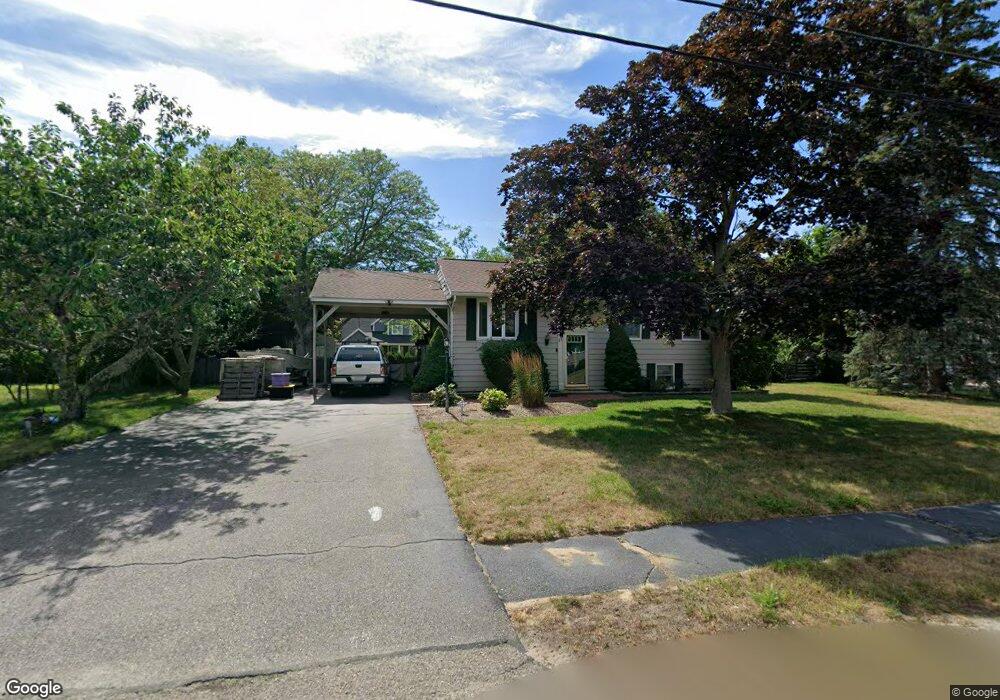
17 Gates Rd Marshfield, MA 02050
Estimated Value: $615,177 - $709,000
3
Beds
1
Bath
962
Sq Ft
$680/Sq Ft
Est. Value
About This Home
This home is located at 17 Gates Rd, Marshfield, MA 02050 and is currently estimated at $654,294, approximately $680 per square foot. 17 Gates Rd is a home located in Plymouth County with nearby schools including Daniel Webster, Furnace Brook Middle School, and Marshfield High School.
Ownership History
Date
Name
Owned For
Owner Type
Purchase Details
Closed on
Apr 1, 1994
Sold by
Casale Carmela M
Bought by
White Michael F and White Carolann
Current Estimated Value
Home Financials for this Owner
Home Financials are based on the most recent Mortgage that was taken out on this home.
Original Mortgage
$126,300
Interest Rate
7.07%
Mortgage Type
Purchase Money Mortgage
Create a Home Valuation Report for This Property
The Home Valuation Report is an in-depth analysis detailing your home's value as well as a comparison with similar homes in the area
Home Values in the Area
Average Home Value in this Area
Purchase History
| Date | Buyer | Sale Price | Title Company |
|---|---|---|---|
| White Michael F | $133,000 | -- |
Source: Public Records
Mortgage History
| Date | Status | Borrower | Loan Amount |
|---|---|---|---|
| Open | White Michael F | $217,000 | |
| Closed | White Michael F | $200,000 | |
| Closed | White Michael F | $50,000 | |
| Closed | White Michael F | $126,300 |
Source: Public Records
Tax History
| Year | Tax Paid | Tax Assessment Tax Assessment Total Assessment is a certain percentage of the fair market value that is determined by local assessors to be the total taxable value of land and additions on the property. | Land | Improvement |
|---|---|---|---|---|
| 2025 | $5,135 | $518,700 | $302,800 | $215,900 |
| 2024 | $5,242 | $504,500 | $288,400 | $216,100 |
| 2023 | $4,751 | $444,500 | $257,500 | $187,000 |
| 2022 | $4,751 | $366,900 | $216,300 | $150,600 |
| 2021 | $4,688 | $355,400 | $216,300 | $139,100 |
| 2020 | $4,426 | $332,000 | $195,700 | $136,300 |
| 2019 | $4,346 | $324,800 | $195,700 | $129,100 |
| 2018 | $4,246 | $317,600 | $195,700 | $121,900 |
| 2017 | $3,975 | $289,700 | $195,700 | $94,000 |
| 2016 | $3,949 | $284,500 | $195,700 | $88,800 |
| 2015 | $3,781 | $284,500 | $195,700 | $88,800 |
| 2014 | $3,600 | $270,900 | $195,700 | $75,200 |
Source: Public Records
Map
Nearby Homes
- 30 Chandler Dr
- 13 Harlow Rd
- 1 John St
- 42 Carr Rd
- 92 Salt Meadow Waye
- 1221 Ocean St
- 136 Revere St
- 17 Eden Rd
- 290 S River St
- 91 Winslow St
- 4 Fresh Brook Waye
- 568 Webster St
- 555 Webster St
- 130 Winslow Cemetery Rd
- 6 Maple Ln
- 10 Spyglass Landing Dr
- 95 Blackmount Dr
- 51 Meetinghouse Ln
- 235 Main St
- 412 Moraine St
Your Personal Tour Guide
Ask me questions while you tour the home.