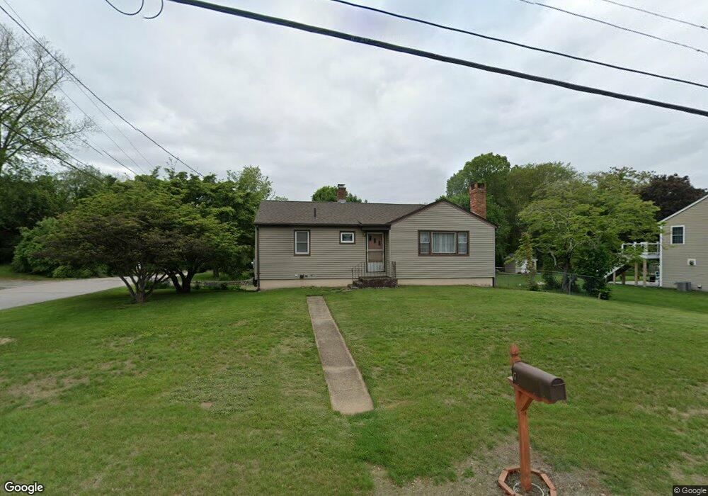
17 Michael Ln Ledyard, CT 06339
Ledyard AreaEstimated Value: $331,000 - $376,000
About This Home
This home is located at 17 Michael Ln, Ledyard, CT 06339 and is currently estimated at $343,396, approximately $344 per square foot. 17 Michael Ln is a home located in New London County with nearby schools including Ledyard Middle School, Ledyard High School, and Integrated Day Charter School.
Ownership History
We collect this data history from publicly available records. To have your information removed, we recommend requesting removal directly through your county’s website.
Purchase Details
Home Values in the Area
Average Home Value in this Area
Purchase History
We collect this data history from publicly available records. To have your information removed, we recommend requesting removal directly through your county’s website.
| Date | Buyer | Sale Price | Title Company |
|---|---|---|---|
| $107,000 | -- |
Tax History
We collect this data history from publicly available records. To have your information removed, we recommend requesting removal directly through your county’s website.
| Year | Tax Paid | Tax Assessment Tax Assessment Total Assessment is a certain percentage of the fair market value that is determined by local assessors to be the total taxable value of land and additions on the property. | Land | Improvement |
|---|---|---|---|---|
| 2025 | $4,542 | $122,290 | $42,420 | $79,870 |
| 2024 | $4,306 | $122,290 | $42,420 | $79,870 |
| 2023 | $4,226 | $122,290 | $42,420 | $79,870 |
| 2022 | $4,136 | $122,290 | $42,420 | $79,870 |
| 2021 | $4,109 | $122,290 | $42,420 | $79,870 |
| 2020 | $3,718 | $106,330 | $38,150 | $68,180 |
| 2019 | $3,728 | $106,330 | $38,150 | $68,180 |
| 2018 | $3,646 | $106,330 | $38,150 | $68,180 |
| 2017 | $3,460 | $106,330 | $38,150 | $68,180 |
| 2016 | $3,392 | $106,330 | $38,150 | $68,180 |
| 2015 | $3,232 | $106,330 | $38,150 | $68,180 |
| 2014 | $3,399 | $113,680 | $38,150 | $75,530 |
Map
- 6 Willow Ln
- 52 Middle Rd
- 153 Route 12
- 16 Marlene Dr
- 3 Holdsworth Rd
- 36 Route 2a
- 60 Bittersweet Dr
- 21 Tanager Ln
- 7 Maynard Hill Rd
- 18 Maynard Hill Rd
- 26 Dydo Dr
- 43 Church Hill Rd
- 5 Gail Ave
- 547 Old Laurel Hill Rd
- 14 Abbey Rd
- 31 Park Ave
- 0 Crouch Ave
- 16 Abbey Rd
- 7 Massapeag Point Rd
- 87 Fort Shantok Rd
Ask me questions while you tour the home.