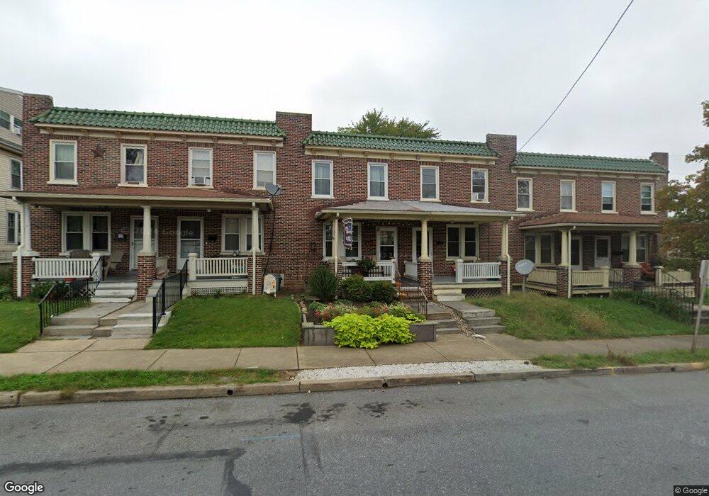
17 W Lincoln Ave Lititz, PA 17543
Estimated Value: $192,000 - $304,000
2
Beds
1
Bath
1,024
Sq Ft
$229/Sq Ft
Est. Value
About This Home
This home is located at 17 W Lincoln Ave, Lititz, PA 17543 and is currently estimated at $234,691, approximately $229 per square foot. 17 W Lincoln Ave is a home located in Lancaster County with nearby schools including Warwick Senior High School, Lititz Christian School, and Linden Hall.
Ownership History
Date
Name
Owned For
Owner Type
Purchase Details
Closed on
Oct 13, 2011
Sold by
Oleskowitz Edward C and Oleskowitz Sylvia J
Bought by
Welch Richard T
Current Estimated Value
Home Financials for this Owner
Home Financials are based on the most recent Mortgage that was taken out on this home.
Original Mortgage
$88,407
Outstanding Balance
$58,951
Interest Rate
4.25%
Mortgage Type
New Conventional
Estimated Equity
$175,740
Create a Home Valuation Report for This Property
The Home Valuation Report is an in-depth analysis detailing your home's value as well as a comparison with similar homes in the area
Home Values in the Area
Average Home Value in this Area
Purchase History
We collect this data history from publicly available records. To have your information removed, we recommend requesting removal directly through your county’s website.
| Date | Buyer | Sale Price | Title Company |
|---|---|---|---|
| Welch Richard T | $80,000 | Stewart Title Guaranty Co |
Source: Public Records
Mortgage History
We collect this data history from publicly available records. To have your information removed, we recommend requesting removal directly through your county’s website.
| Date | Status | Borrower | Loan Amount |
|---|---|---|---|
| Open | Welch Richard T | $88,407 |
Source: Public Records
Tax History
| Year | Tax Paid | Tax Assessment Tax Assessment Total Assessment is a certain percentage of the fair market value that is determined by local assessors to be the total taxable value of land and additions on the property. | Land | Improvement |
|---|---|---|---|---|
| 2026 | $2,459 | $108,100 | $35,800 | $72,300 |
| 2025 | $2,445 | $108,100 | $35,800 | $72,300 |
| 2024 | $2,445 | $108,100 | $35,800 | $72,300 |
| 2023 | $2,436 | $108,100 | $35,800 | $72,300 |
| 2022 | $2,301 | $108,100 | $35,800 | $72,300 |
| 2021 | $2,301 | $108,100 | $35,800 | $72,300 |
| 2020 | $2,301 | $108,100 | $35,800 | $72,300 |
| 2019 | $2,301 | $108,100 | $35,800 | $72,300 |
| 2018 | $1,655 | $108,100 | $35,800 | $72,300 |
| 2017 | $2,085 | $77,000 | $30,200 | $46,800 |
| 2016 | $2,085 | $77,000 | $30,200 | $46,800 |
| 2015 | $488 | $77,000 | $30,200 | $46,800 |
| 2014 | $1,403 | $77,000 | $30,200 | $46,800 |
Source: Public Records
Map
Nearby Homes
- LOT 14 Thaton Rd
- LOT 12 Thaton Rd
- 101 E Lincoln Ave
- 433 Springfield Ct
- 122 S Cedar St
- 135 S Cedar St
- 115 Saybrooke Dr
- 106 E 2nd Ave
- 213 Skylark Rd
- 305 Partridge Dr
- 601 E Main St
- 102 E Third Ave
- 100 Meadows Bend
- 34 S Oak St
- 508 W Marion St
- 3 Balsam Ln
- 541 Golden St
- 32 Green Acre Rd
- 30 Buttonwood Dr
- 35 Pinewood Ave
- 15 W Lincoln Ave
- 19 W Lincoln Ave
- 13 W Lincoln Ave
- 21 W Lincoln Ave
- 11 W Lincoln Ave
- 23 W Lincoln Ave
- 25 W Lincoln Ave
- 27 W Lincoln Ave
- 29 W Lincoln Ave
- 31 W Lincoln Ave
- 20 W Lincoln Ave
- 33 W Lincoln Ave
- 35 W Lincoln Ave
- 214 N Broad St
- 22 W Lincoln Ave
- 24 W Lincoln Ave
- 37 W Lincoln Ave
- 206 N Broad St
- 204 N Broad St
- 218 N Broad St
Your Personal Tour Guide
Ask me questions while you tour the home.