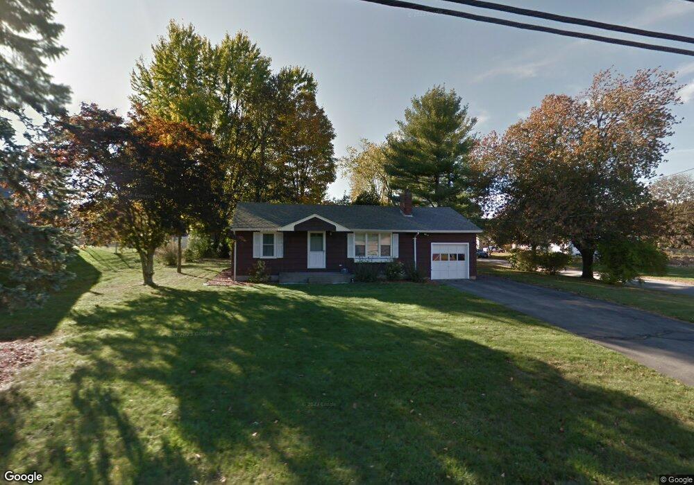
170 Maple St West Boylston, MA 01583
Estimated Value: $400,333 - $462,000
2
Beds
1
Bath
916
Sq Ft
$469/Sq Ft
Est. Value
About This Home
This home is located at 170 Maple St, West Boylston, MA 01583 and is currently estimated at $429,833, approximately $469 per square foot. 170 Maple St is a home located in Worcester County with nearby schools including Major Edwards Elementary School, West Boylston Junior/Senior High School, and Abby Kelley Foster Charter Public School.
Ownership History
Date
Name
Owned For
Owner Type
Purchase Details
Closed on
Apr 8, 2022
Sold by
Rizzo Gregory M
Bought by
Bergeron Matt A
Current Estimated Value
Home Financials for this Owner
Home Financials are based on the most recent Mortgage that was taken out on this home.
Original Mortgage
$348,570
Outstanding Balance
$328,993
Interest Rate
4.72%
Mortgage Type
FHA
Estimated Equity
$100,840
Purchase Details
Closed on
Nov 23, 2009
Sold by
Smiley Shirley F
Bought by
Rizzo Gregory Matthew
Home Financials for this Owner
Home Financials are based on the most recent Mortgage that was taken out on this home.
Original Mortgage
$187,540
Interest Rate
4.86%
Mortgage Type
Purchase Money Mortgage
Create a Home Valuation Report for This Property
The Home Valuation Report is an in-depth analysis detailing your home's value as well as a comparison with similar homes in the area
Home Values in the Area
Average Home Value in this Area
Purchase History
| Date | Buyer | Sale Price | Title Company |
|---|---|---|---|
| Bergeron Matt A | $355,000 | None Available | |
| Rizzo Gregory Matthew | $191,000 | -- |
Source: Public Records
Mortgage History
| Date | Status | Borrower | Loan Amount |
|---|---|---|---|
| Open | Bergeron Matt A | $348,570 | |
| Previous Owner | Rizzo Gregory Matthew | $187,540 |
Source: Public Records
Tax History
| Year | Tax Paid | Tax Assessment Tax Assessment Total Assessment is a certain percentage of the fair market value that is determined by local assessors to be the total taxable value of land and additions on the property. | Land | Improvement |
|---|---|---|---|---|
| 2025 | $51 | $366,300 | $96,900 | $269,400 |
| 2024 | $4,987 | $337,400 | $96,900 | $240,500 |
| 2023 | $4,892 | $314,000 | $96,200 | $217,800 |
| 2022 | $4,655 | $263,300 | $96,200 | $167,100 |
| 2021 | $4,532 | $245,500 | $92,700 | $152,800 |
| 2020 | $4,452 | $239,600 | $92,700 | $146,900 |
| 2019 | $4,173 | $221,400 | $92,700 | $128,700 |
| 2018 | $3,997 | $213,500 | $92,700 | $120,800 |
| 2017 | $3,593 | $191,100 | $92,700 | $98,400 |
| 2016 | $3,494 | $189,400 | $86,300 | $103,100 |
| 2015 | $3,354 | $182,900 | $85,500 | $97,400 |
Source: Public Records
Map
Nearby Homes
- 1 Highland Ave
- 152 Worcester St Unit 4
- 7 Alpine Dr
- 12 Whispering Pine Cir Unit 12
- 118 Worcester St
- 149 Woodland St
- 156 Hillside Village Dr
- 6 Church St
- 47 Eustis St
- 22 Apthorp St
- 239 Woodland St Unit 3
- 31 Danielles Way
- 25 Dixfield Rd
- 38 Juniper Ln
- 6 Idalla Ave
- 113 Newton St
- 24 Blake Ave
- 10 Malden St
- 210 Parker Ave
- 328 Brooks St
- 166 Maple St
- 3 Lexington Dr
- 7 Lexington Dr
- 162 Maple St
- 171 Maple St
- 167 Maple St
- 6 Bunkerhill Pkwy
- 175 Maple St
- 11 Lexington Dr
- 178 Maple St
- 153 Maple St
- 10 Bunkerhill Pkwy
- 15 Bunkerhill Pkwy
- 156 Maple St
- 8 Lexington Dr
- 25 Valley Forge Cir
- 179 Maple St
- 118-2&3 Maple St
- 108 Pierce St
- 19 Valley Forge Cir
Your Personal Tour Guide
Ask me questions while you tour the home.