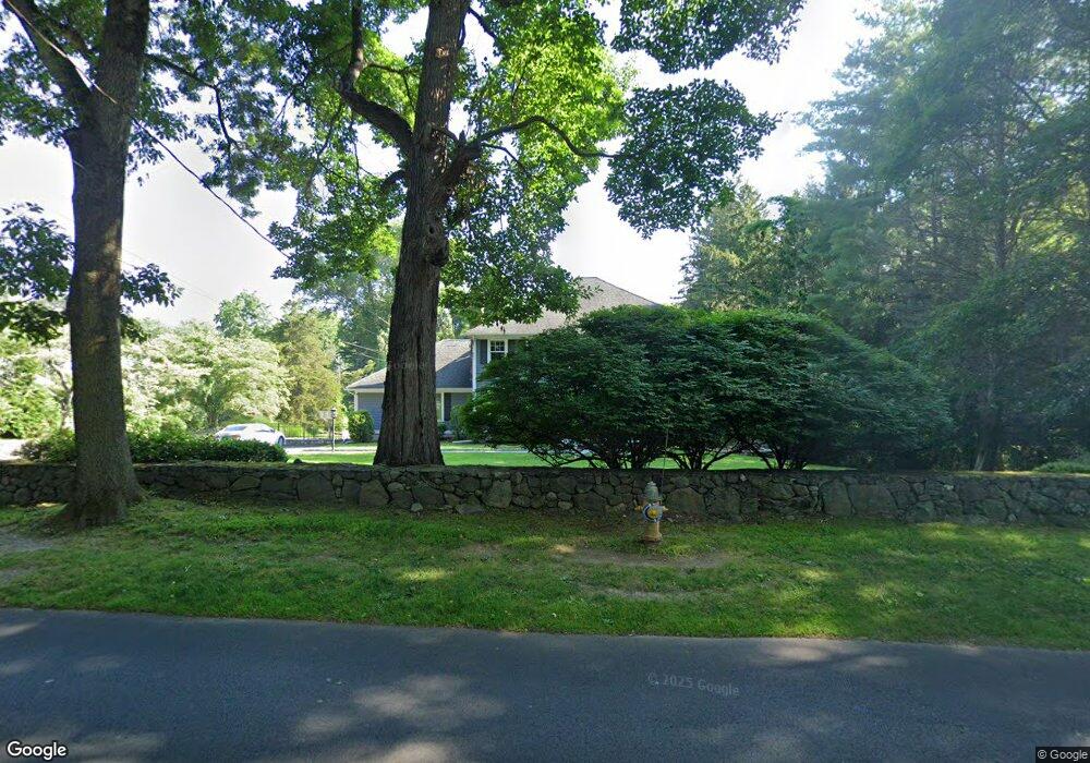
1700 Bronson Rd Fairfield, CT 06824
University NeighborhoodEstimated Value: $1,683,000 - $2,407,000
4
Beds
4
Baths
4,395
Sq Ft
$457/Sq Ft
Est. Value
About This Home
This home is located at 1700 Bronson Rd, Fairfield, CT 06824 and is currently estimated at $2,008,506, approximately $456 per square foot. 1700 Bronson Rd is a home located in Fairfield County with nearby schools including Mill Hill School, Roger Ludlowe Middle School, and Fairfield Ludlowe High School.
Ownership History
Date
Name
Owned For
Owner Type
Purchase Details
Closed on
Oct 10, 2006
Sold by
Snell Jeffrey R and Snell Linda R
Bought by
Greenberg Mitchell J and Greenberg Stefanie
Current Estimated Value
Purchase Details
Closed on
Jun 13, 2002
Sold by
Howard Martin and Howard Sandra
Bought by
Snell Jeffrey and Snell Linda R
Purchase Details
Closed on
Jul 1, 1996
Sold by
Sepe Ellen P
Bought by
Howard Martin and Howard Sandra
Create a Home Valuation Report for This Property
The Home Valuation Report is an in-depth analysis detailing your home's value as well as a comparison with similar homes in the area
Home Values in the Area
Average Home Value in this Area
Purchase History
We collect this data history from publicly available records. To have your information removed, we recommend requesting removal directly through your county’s website.
| Date | Buyer | Sale Price | Title Company |
|---|---|---|---|
| Greenberg Mitchell J | $1,032,500 | -- | |
| Greenberg Mitchell J | $1,032,500 | -- | |
| Snell Jeffrey | $875,000 | -- | |
| Snell Jeffrey | $875,000 | -- | |
| Howard Martin | $539,000 | -- | |
| Howard Martin | $539,000 | -- |
Source: Public Records
Mortgage History
We collect this data history from publicly available records. To have your information removed, we recommend requesting removal directly through your county’s website.
| Date | Status | Borrower | Loan Amount |
|---|---|---|---|
| Open | Howard Martin | $500,000 | |
| Closed | Howard Martin | $511,750 |
Source: Public Records
Tax History
| Year | Tax Paid | Tax Assessment Tax Assessment Total Assessment is a certain percentage of the fair market value that is determined by local assessors to be the total taxable value of land and additions on the property. | Land | Improvement |
|---|---|---|---|---|
| 2025 | $27,932 | $983,850 | $437,360 | $546,490 |
| 2024 | $27,449 | $983,850 | $437,360 | $546,490 |
| 2023 | $27,066 | $983,850 | $437,360 | $546,490 |
| 2022 | $26,800 | $983,850 | $437,360 | $546,490 |
| 2021 | $26,544 | $983,850 | $437,360 | $546,490 |
| 2020 | $25,862 | $965,370 | $432,810 | $532,560 |
| 2019 | $25,862 | $965,370 | $432,810 | $532,560 |
| 2018 | $22,165 | $840,840 | $432,810 | $408,030 |
| 2017 | $21,710 | $840,840 | $432,810 | $408,030 |
| 2016 | $21,399 | $840,840 | $432,810 | $408,030 |
| 2015 | $21,009 | $847,490 | $457,030 | $390,460 |
| 2014 | $20,679 | $847,490 | $457,030 | $390,460 |
Source: Public Records
Map
Nearby Homes
- 127 Field Rock Rd
- 1482 Bronson Rd
- 320 Warner Hill Rd
- 360 Duck Farm Rd
- 147 Carriage Dr
- 1373 Mill Plain Rd
- 12 Sconset Dr
- 264 Half Mile Rd
- 289 Old Mill Rd
- 790 Cedar Brook Ln
- 63 Henry St
- 2683 Bronson Rd
- 820 Hillside Rd
- 179 Lawrence Rd
- 647 Bronson Rd
- 177 High Meadow Rd
- 88 Middlebrook Dr
- 211 High Meadow Rd
- 688 Hulls Farm Rd
- 844 Mill Hill Terrace
- 1677 Bronson Rd
- 1660 Bronson Rd
- 1642 Bronson Rd
- 1731 Bronson Rd
- 1625 Bronson Rd
- 159 Field Rock Rd
- 1728 Bronson Rd
- 1780 Bronson Rd
- 1785 Bronson Rd
- 127 Fields Rock Rd
- 1573 Bronson Rd
- 1614 Bronson Rd
- 130 N Cedar Rd
- 191 Field Rock Rd
- 170 Warner Hill Rd
- 1566 Bronson Rd
- 1542 Bronson Rd
- 29 Cedar Rd
- 92 Field Rock Rd
- 93 Field Rock Rd
Your Personal Tour Guide
Ask me questions while you tour the home.