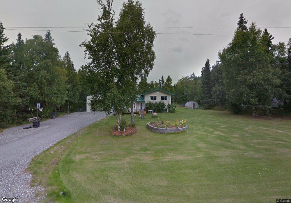
17005 E Browns Ave Palmer, AK 99645
Butte NeighborhoodEstimated Value: $229,000 - $534,000
4
Beds
3
Baths
2,600
Sq Ft
$153/Sq Ft
Est. Value
About This Home
This home is located at 17005 E Browns Ave, Palmer, AK 99645 and is currently estimated at $398,113, approximately $153 per square foot. 17005 E Browns Ave is a home located in Matanuska-Susitna Borough with nearby schools including Palmer High School, Butte Elementary School, and Palmer Middle School.
Ownership History
Date
Name
Owned For
Owner Type
Purchase Details
Closed on
Dec 15, 2010
Sold by
Crume Michael Wayne
Bought by
Macmaccrume Shelly Mac
Current Estimated Value
Purchase Details
Closed on
Oct 15, 2001
Sold by
Jenson Dwayne Allen and Jenson Lisa Lou
Bought by
Crume Michael W and Crume Shelley M
Home Financials for this Owner
Home Financials are based on the most recent Mortgage that was taken out on this home.
Original Mortgage
$55,000
Outstanding Balance
$21,560
Interest Rate
6.91%
Estimated Equity
$376,553
Create a Home Valuation Report for This Property
The Home Valuation Report is an in-depth analysis detailing your home's value as well as a comparison with similar homes in the area
Home Values in the Area
Average Home Value in this Area
Purchase History
| Date | Buyer | Sale Price | Title Company |
|---|---|---|---|
| Macmaccrume Shelly Mac | -- | None Available | |
| Crume Michael W | -- | -- |
Source: Public Records
Mortgage History
| Date | Status | Borrower | Loan Amount |
|---|---|---|---|
| Open | Crume Michael W | $55,000 |
Source: Public Records
Tax History
| Year | Tax Paid | Tax Assessment Tax Assessment Total Assessment is a certain percentage of the fair market value that is determined by local assessors to be the total taxable value of land and additions on the property. | Land | Improvement |
|---|---|---|---|---|
| 2025 | $6,784 | $474,500 | $37,000 | $437,500 |
| 2024 | $6,784 | $457,400 | $37,000 | $420,400 |
| 2023 | $6,465 | $440,900 | $37,000 | $403,900 |
| 2022 | $6,064 | $387,400 | $24,000 | $363,400 |
| 2021 | $5,854 | $339,300 | $24,000 | $315,300 |
| 2020 | $5,656 | $319,300 | $24,000 | $295,300 |
| 2019 | $4,529 | $253,900 | $24,000 | $229,900 |
| 2018 | $4,442 | $250,100 | $24,000 | $226,100 |
| 2017 | $4,387 | $247,000 | $24,000 | $223,000 |
| 2016 | $4,337 | $249,400 | $24,000 | $225,400 |
| 2015 | $3,545 | $241,900 | $24,000 | $217,900 |
| 2014 | $3,545 | $236,300 | $24,000 | $212,300 |
Source: Public Records
Map
Nearby Homes
- 265 N Tatlow Dr
- 17755 E Idle Dr
- 230 N Witherspoon Rd
- 800 Lazy Ln
- 801 Lazy Ln
- L7 E Mountain Vista Dr
- L10 E Mountain Vista Dr
- 506 N Hale Cir
- L10 B2 N Springer Cir
- 132 N Springer Cir
- L1 B2 N Springer Cir
- 15135 E Rocky Point Dr
- 15161 E Rocky Point Dr
- 1190 S Jewel St
- 1188 S Mary St
- 17000 E T and T Ln
- 3250 N Diana Ave
- 1120 S Jewel St
- 1115 S Jewel St
- 14014 E Jersey Loop
- 16965 E Browns Ave
- 17035 E Browns Ave
- 17000 E Browns Ave
- 16935 E Browns Ave
- 17065 E Browns Ave
- 995 N Smith Rd
- 975 N Smith Rd
- 17105 E Browns Ave
- 16905 E Browns Ave
- 16950 E Browns Ave
- 16960 E Lori Ann Cir
- 17049 E Lori Ann Cir
- 1005 N Smith Rd
- 865 N Smith Rd
- 955 N Smith Rd
- 16908 E Lori Ann Cir
- 835 N Smith Rd
- 765 N Smith Rd
- 1155 N Smith Rd
- 950 N Smith Rd
Your Personal Tour Guide
Ask me questions while you tour the home.