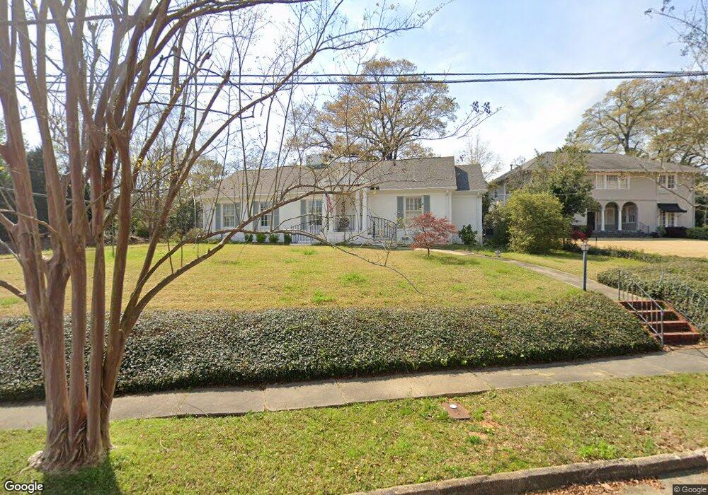
1701 Stark Ave Columbus, GA 31906
Wynnton Grove NeighborhoodEstimated Value: $311,483 - $337,000
About This Home
This home is located at 1701 Stark Ave, Columbus, GA 31906 and is currently estimated at $325,371, approximately $181 per square foot. 1701 Stark Ave is a home located in Muscogee County with nearby schools including Richards Middle School, Hardaway High School, and Wynnton Elementary School.
Ownership History
We collect this data history from publicly available records. To have your information removed, we recommend requesting removal directly through your county’s website.
Purchase Details
Home Financials for this Owner
Home Financials are based on the most recent Mortgage that was taken out on this home.Purchase Details
Home Values in the Area
Average Home Value in this Area
Purchase History
We collect this data history from publicly available records. To have your information removed, we recommend requesting removal directly through your county’s website.
| Date | Buyer | Sale Price | Title Company |
|---|---|---|---|
| $250,000 | None Listed On Document | ||
| $250,000 | -- | ||
| $145,500 | -- |
Mortgage History
We collect this data history from publicly available records. To have your information removed, we recommend requesting removal directly through your county’s website.
| Date | Status | Borrower | Loan Amount |
|---|---|---|---|
| Open | $200,000 | ||
| Closed | $200,000 |
Tax History
We collect this data history from publicly available records. To have your information removed, we recommend requesting removal directly through your county’s website.
| Year | Tax Paid | Tax Assessment Tax Assessment Total Assessment is a certain percentage of the fair market value that is determined by local assessors to be the total taxable value of land and additions on the property. | Land | Improvement |
|---|---|---|---|---|
| 2025 | $2,969 | $107,916 | $17,716 | $90,200 |
| 2024 | $2,968 | $107,916 | $17,716 | $90,200 |
| 2023 | $2,293 | $107,916 | $17,716 | $90,200 |
| 2022 | $3,095 | $89,036 | $17,716 | $71,320 |
| 2021 | $2,398 | $58,740 | $17,716 | $41,024 |
| 2020 | $2,399 | $58,740 | $17,716 | $41,024 |
| 2019 | $2,407 | $58,740 | $17,716 | $41,024 |
| 2018 | $1,838 | $58,200 | $16,280 | $41,920 |
| 2017 | $2,794 | $67,972 | $22,144 | $45,828 |
| 2016 | $947 | $67,325 | $13,528 | $53,797 |
| 2015 | $380 | $67,325 | $13,528 | $53,797 |
| 2014 | $381 | $67,325 | $13,528 | $53,797 |
| 2013 | -- | $67,325 | $13,528 | $53,797 |
Map
- 1808 Forest Ave
- 1680 Flournoy Dr
- 1530 Hilton Ave
- 2410 Craigston Dr
- 2010 Cherokee Ave
- 2217 13th St
- 1319 Hilton Ave Unit 4
- 2134 13th St
- 1513 Wells Dr
- 1940 Springdale Dr
- 1538 Preston Dr
- 1615 Iris Dr
- 1524 Preston Dr
- 2120 Preston Dr
- 1703 &1705 19th St
- 2718 Averett Dr
- 1648 17th Ave
- 1545 18th Ave
- 1228 Cedar Ave
- 1219 Forest Ave Unit 7
- 1708 Carter Ave
- 1700 Carter Ave
- 1701 Carter Ave
- 1725 Stark Ave
- 1711 Stark Ave
- 1800 Carter Ave
- 1715 Carter Ave
- 1667 Carter Ave
- 1805 Stark Ave
- 2207 17th St
- 1672 Wildwood Ave
- 1815 Stark Ave
- 1801 Carter Ave
- 1812 Carter Ave
- 1659 Carter Ave
- 1664 Carter Ave
- 1708 Wildwood Ave Unit 1710 Wildwood Avenue
- 1708 Wildwood Ave
- 1660 Wildwood Ave
- 1720 Stark Ave
Ask me questions while you tour the home.