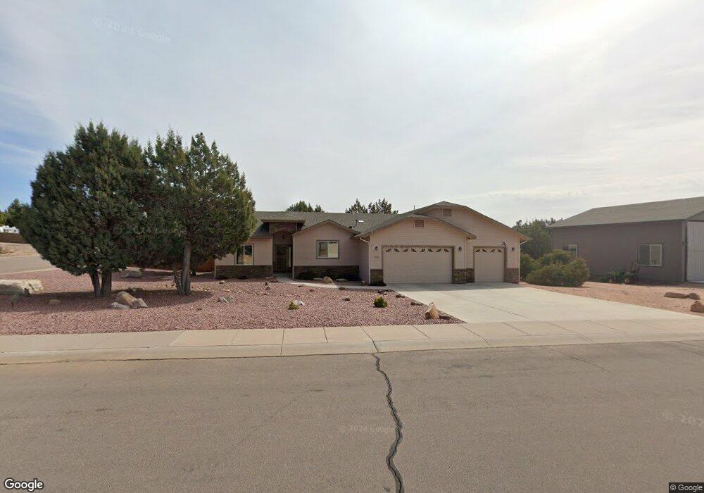
1701 W Davidson Cir Payson, AZ 85541
Estimated Value: $598,000 - $848,000
Studio
--
Bath
1,981
Sq Ft
$343/Sq Ft
Est. Value
About This Home
This home is located at 1701 W Davidson Cir, Payson, AZ 85541 and is currently estimated at $680,115, approximately $343 per square foot. 1701 W Davidson Cir is a home with nearby schools including Julia Randall Elementary School, Payson Elementary School, and Rim Country Middle School.
Ownership History
Date
Name
Owned For
Owner Type
Purchase Details
Closed on
Feb 2, 2016
Sold by
Hampton Hill and Hampton Barbara
Bought by
The Hill & Barbara Hampton Living Trust and Hampton Barbara A
Current Estimated Value
Purchase Details
Closed on
Apr 29, 2014
Sold by
Jeff Vaughn Homes Llc
Bought by
Hampton Hill and Hampton Barbara
Purchase Details
Closed on
Dec 18, 2013
Sold by
Cal Mazatzal Mountain Lots Llc
Bought by
Ce Residential #4 Llc
Home Financials for this Owner
Home Financials are based on the most recent Mortgage that was taken out on this home.
Original Mortgage
$775,000
Interest Rate
4.13%
Mortgage Type
New Conventional
Create a Home Valuation Report for This Property
The Home Valuation Report is an in-depth analysis detailing your home's value as well as a comparison with similar homes in the area
Purchase History
| Date | Buyer | Sale Price | Title Company |
|---|---|---|---|
| The Hill & Barbara Hampton Living Trust | -- | None Available | |
| Hampton Hill | $317,000 | Security Title Agency | |
| Jeff Vaughn Homes Llc | $75,000 | Security Title Agency | |
| Ce Residential #4 Llc | $847,500 | Lawyers Title Insurance Corp |
Source: Public Records
Mortgage History
| Date | Status | Borrower | Loan Amount |
|---|---|---|---|
| Previous Owner | Ce Residential #4 Llc | $775,000 |
Source: Public Records
Tax History
| Year | Tax Paid | Tax Assessment Tax Assessment Total Assessment is a certain percentage of the fair market value that is determined by local assessors to be the total taxable value of land and additions on the property. | Land | Improvement |
|---|---|---|---|---|
| 2026 | $3,378 | $48,109 | $14,140 | $33,969 |
| 2025 | $3,378 | -- | -- | -- |
| 2024 | $3,137 | $48,554 | $8,240 | $40,314 |
| 2023 | $3,137 | $44,784 | $6,064 | $38,720 |
| 2022 | $3,032 | $33,348 | $6,064 | $27,284 |
| 2021 | $2,851 | $33,348 | $6,064 | $27,284 |
| 2020 | $2,727 | $0 | $0 | $0 |
| 2019 | $2,643 | $0 | $0 | $0 |
| 2018 | $2,472 | $0 | $0 | $0 |
| 2017 | $2,300 | $0 | $0 | $0 |
| 2016 | $2,233 | $0 | $0 | $0 |
| 2015 | $334 | $0 | $0 | $0 |
Source: Public Records
Map
Nearby Homes
- 2301 W Graff Dr
- 2404 W Palmer Dr
- 2609 W Palmer Dr
- 525 N Peak Loop
- 605 N Bobby Jones Dr
- 603 N Hogan Dr
- 515 N Peak Loop
- 506 N Peak Loop
- 801 N Madison Dr
- 507 N Peak Loop
- 505 N Peak Loop
- 504 N Wagon Ct
- 502 N Wagon Ct
- 506 N Wagon Ct
- 807 N Thunder Ridge Cir
- 1200 W Airport Rd
- 1200 W Airport Rd Unit 96F-I
- 1003 W Falcon Lookout Ln
- 1003 W Falcon Lookout Ln Unit 11
- 1006 W Knotty Pine Cir
- 1302 Davidson Cir Unit 111
- 1302 Davidson Cir
- 1703 W Davidson Cir Unit 110
- 1703 W Davidson Cir
- 1301 N Earhart Cir Unit 99
- 1301 N Earhart Pkwy
- 1301 N Earhart Pkwy Unit 99
- 1702 W Davidson Cir Unit 105
- 1702 W Davidson Cir
- 1304 N Earhart Cir Unit 104
- 1304 N Earhart Cir
- 1700 W Davidson Cir
- 1301 N Chennault Pkwy Unit 99
- 1301 N Chennault Pkwy
- 1214 N Chennault Pkwy Unit 88
- 1214 N Chennault Pkwy
- 1214 N Earhart Pkwy Unit 88
- 1303 N Earhart Cir Unit 100
- 1303 N Earhart Cir
- 1705 W Davidson Cir Unit 109
Your Personal Tour Guide
Ask me questions while you tour the home.