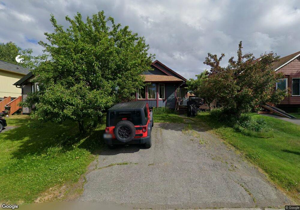
1705 Cedrus Cir Anchorage, AK 99507
Abbott Loop NeighborhoodEstimated Value: $309,015 - $409,000
3
Beds
1
Bath
1,100
Sq Ft
$332/Sq Ft
Est. Value
About This Home
This home is located at 1705 Cedrus Cir, Anchorage, AK 99507 and is currently estimated at $364,754, approximately $331 per square foot. 1705 Cedrus Cir is a home located in Anchorage Municipality with nearby schools including Bowman Elementary School, Hanshew Middle School, and Service High School.
Ownership History
Date
Name
Owned For
Owner Type
Purchase Details
Closed on
Aug 6, 2002
Sold by
Rowell Kevin
Bought by
Bond Renee
Current Estimated Value
Purchase Details
Closed on
Jul 23, 2002
Sold by
Rowell Kevin
Bought by
Bond Renee
Purchase Details
Closed on
Jun 29, 1998
Sold by
Martinez Maria
Bought by
Rowell Kevin and Bond Renee
Purchase Details
Closed on
Apr 23, 1992
Sold by
Martinez Able
Bought by
Martinez Maria
Home Financials for this Owner
Home Financials are based on the most recent Mortgage that was taken out on this home.
Original Mortgage
$75,255
Interest Rate
8.92%
Mortgage Type
FHA
Create a Home Valuation Report for This Property
The Home Valuation Report is an in-depth analysis detailing your home's value as well as a comparison with similar homes in the area
Home Values in the Area
Average Home Value in this Area
Purchase History
We collect this data history from publicly available records. To have your information removed, we recommend requesting removal directly through your county’s website.
| Date | Buyer | Sale Price | Title Company |
|---|---|---|---|
| Bond Renee | -- | -- | |
| Bond Renee | -- | -- | |
| Rowell Kevin | -- | -- | |
| Rowell Kevin | -- | -- | |
| Martinez Maria | -- | -- | |
| Martinez Maria | -- | -- | |
| Martinez Maria | -- | -- | |
| Martinez Maria | -- | -- | |
| Martinez Maria | -- | -- |
Source: Public Records
Mortgage History
We collect this data history from publicly available records. To have your information removed, we recommend requesting removal directly through your county’s website.
| Date | Status | Borrower | Loan Amount |
|---|---|---|---|
| Previous Owner | Martinez Maria | $75,255 | |
| Closed | Rowell Kevin | $0 |
Source: Public Records
Tax History
| Year | Tax Paid | Tax Assessment Tax Assessment Total Assessment is a certain percentage of the fair market value that is determined by local assessors to be the total taxable value of land and additions on the property. | Land | Improvement |
|---|---|---|---|---|
| 2025 | $2,732 | $259,600 | $84,100 | $175,500 |
| 2024 | $2,732 | $244,200 | $84,100 | $160,100 |
| 2023 | $3,810 | $223,700 | $84,100 | $139,600 |
| 2022 | $3,130 | $232,300 | $84,000 | $148,300 |
| 2021 | $3,766 | $209,000 | $84,000 | $125,000 |
| 2020 | $2,876 | $211,800 | $84,000 | $127,800 |
| 2019 | $2,737 | $209,100 | $84,000 | $125,100 |
| 2018 | $2,813 | $214,400 | $87,700 | $126,700 |
| 2017 | $3,030 | $213,500 | $83,200 | $130,300 |
| 2016 | $2,723 | $209,700 | $83,200 | $126,500 |
| 2015 | $2,723 | $210,200 | $76,000 | $134,200 |
| 2014 | $2,723 | $197,700 | $76,000 | $121,700 |
Source: Public Records
Map
Nearby Homes
- 10261 Arborvitae Dr
- 1741 Cedrus Cir
- 10248 Jamestown Dr Unit H
- 10330 Arborvitae Dr
- 10250 Jamestown Dr Unit B20
- 9599 Brayton Dr Unit 422
- 1913 Sturbridge Ct Unit 57
- 1756 Hollybrook Cir Unit 27
- 1900-1941 Marthas Vineyard Cir
- 1928 Colony Place Unit 44
- 1770 Elcadore Dr Unit A
- 10201 Thimble Berry Dr
- 1720 Elcadore Dr Unit B
- 9611 Newhaven Loop
- 10551 Jamestown Dr
- 8000 Independence Park Dr
- 9730 Vanguard Dr Unit 14
- 10621 Commodore Dr
- 10140 Goose Berry Place
- 10132 Goose Berry Place
- 10109 Betula Dr
- 10101 Betula Dr
- 10111 Betula Dr
- 10121 Betula Dr
- 1704 Cedrus Cir
- 1710 Cedrus Cir
- 1700 Cedrus Cir
- 10131 Betula Dr
- 1714 Cedrus Cir
- 1661 Betula Cir
- 1720 Cedrus Cir
- 10120 Betula Dr
- 10110 Betula Dr
- 10141 Betula Dr
- 1660 Cedrus Ct
- 10100 Betula Dr
- 1651 Betula Cir
- 1724 Cedrus Cir
- 10140 Betula Dr
- 1640 Cedrus Ct
Your Personal Tour Guide
Ask me questions while you tour the home.