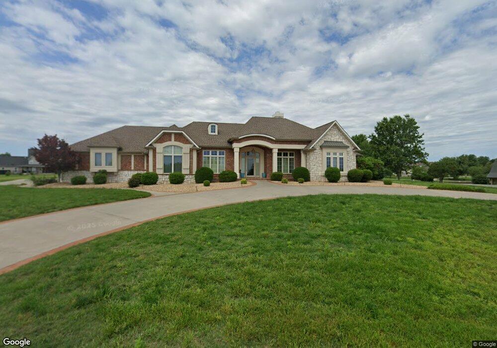
1705 Connor Dr Carthage, MO 64836
Estimated Value: $459,000 - $747,000
4
Beds
3
Baths
4,500
Sq Ft
$140/Sq Ft
Est. Value
About This Home
This home is located at 1705 Connor Dr, Carthage, MO 64836 and is currently estimated at $630,685, approximately $140 per square foot. 1705 Connor Dr is a home located in Jasper County with nearby schools including Carthage High School, St. Ann's Catholic School, and Victory Academy.
Ownership History
Date
Name
Owned For
Owner Type
Purchase Details
Closed on
Nov 4, 2024
Sold by
William K Colaw Revocable Trust and Colaw William K
Bought by
Ali Mohammad and Ali Heather
Current Estimated Value
Purchase Details
Closed on
Jan 20, 2023
Sold by
William J J and William Elizabeth J
Bought by
Vigueras Louis R and Vigueras Teresa A
Home Financials for this Owner
Home Financials are based on the most recent Mortgage that was taken out on this home.
Original Mortgage
$501,930
Interest Rate
6.33%
Mortgage Type
VA
Purchase Details
Closed on
Dec 14, 2009
Sold by
Field Joseph and Field Ruth
Bought by
Colaw William K and William K Colaw Revocable Trust
Home Financials for this Owner
Home Financials are based on the most recent Mortgage that was taken out on this home.
Original Mortgage
$427,000
Interest Rate
5.01%
Mortgage Type
Future Advance Clause Open End Mortgage
Create a Home Valuation Report for This Property
The Home Valuation Report is an in-depth analysis detailing your home's value as well as a comparison with similar homes in the area
Home Values in the Area
Average Home Value in this Area
Purchase History
| Date | Buyer | Sale Price | Title Company |
|---|---|---|---|
| Ali Mohammad | -- | None Listed On Document | |
| Vigueras Louis R | -- | -- | |
| William J & Elizabeth J Wilson Joint Revocabl | -- | -- | |
| Colaw William K | -- | Fatco |
Source: Public Records
Mortgage History
| Date | Status | Borrower | Loan Amount |
|---|---|---|---|
| Previous Owner | Vigueras Louis R | $501,930 | |
| Previous Owner | Colaw William K | $427,000 |
Source: Public Records
Tax History
| Year | Tax Paid | Tax Assessment Tax Assessment Total Assessment is a certain percentage of the fair market value that is determined by local assessors to be the total taxable value of land and additions on the property. | Land | Improvement |
|---|---|---|---|---|
| 2025 | $4,694 | $103,170 | $6,270 | $96,900 |
| 2024 | $4,694 | $91,190 | $6,270 | $84,920 |
| 2023 | $4,694 | $91,190 | $6,270 | $84,920 |
| 2022 | $5,106 | $99,520 | $6,270 | $93,250 |
| 2021 | $5,051 | $99,520 | $6,270 | $93,250 |
| 2020 | $4,833 | $91,280 | $6,270 | $85,010 |
| 2019 | $4,842 | $91,280 | $6,270 | $85,010 |
| 2018 | $4,939 | $93,340 | $0 | $0 |
| 2016 | $4,920 | $93,050 | $0 | $0 |
Source: Public Records
Map
Nearby Homes
- 1704 Liam St
- 1624 Liam St
- 2000 Amber Ln
- 2000 Beau Dr
- Lot 3 2nd Addition (Piper Dr) Unit 3
- 1798 W Fairview Ave
- 1373 W Fairview Ave
- 1422 W Macon St
- 1206 Douglas Ct
- 1271 S Plum Ln
- 1732 Robertson Ave
- 1736 Robertson Ave
- 1716 Robertson Ave
- 1500 Robertson Ave
- 1107 Ash St
- TBD Hazel Ave
- 1615 Forest St
- 509 W Highland Ave
- 2030 Forest St
- 8070 County Road 166
Your Personal Tour Guide
Ask me questions while you tour the home.