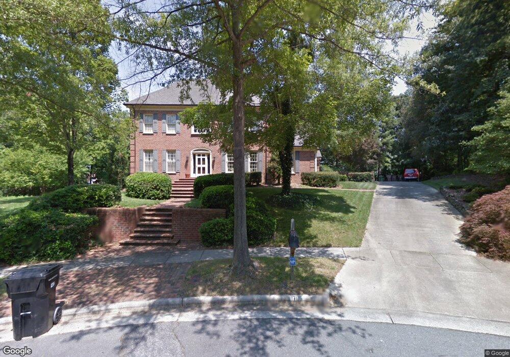
1705 Heathgate Point High Point, NC 27262
Greater High Point NeighborhoodEstimated Value: $561,000 - $705,000
About This Home
This home is located at 1705 Heathgate Point, High Point, NC 27262 and is currently estimated at $637,106, approximately $176 per square foot. 1705 Heathgate Point is a home located in Guilford County with nearby schools including Northwood Elementary School, Ferndale Middle School, and High Point Central High School.
Ownership History
We collect this data history from publicly available records. To have your information removed, we recommend requesting removal directly through your county’s website.
Purchase Details
Purchase Details
Home Financials for this Owner
Home Financials are based on the most recent Mortgage that was taken out on this home.Home Values in the Area
Average Home Value in this Area
Purchase History
We collect this data history from publicly available records. To have your information removed, we recommend requesting removal directly through your county’s website.
| Date | Buyer | Sale Price | Title Company |
|---|---|---|---|
| -- | Chicago Title Insurance Comp | ||
| -- | Attorney |
Mortgage History
We collect this data history from publicly available records. To have your information removed, we recommend requesting removal directly through your county’s website.
| Date | Status | Borrower | Loan Amount |
|---|---|---|---|
| Closed | $150,000 |
Tax History
We collect this data history from publicly available records. To have your information removed, we recommend requesting removal directly through your county’s website.
| Year | Tax Paid | Tax Assessment Tax Assessment Total Assessment is a certain percentage of the fair market value that is determined by local assessors to be the total taxable value of land and additions on the property. | Land | Improvement |
|---|---|---|---|---|
| 2025 | $5,975 | $433,600 | $66,000 | $367,600 |
| 2024 | $5,975 | $433,600 | $66,000 | $367,600 |
| 2023 | $5,975 | $433,600 | $66,000 | $367,600 |
| 2022 | $5,845 | $433,600 | $66,000 | $367,600 |
| 2021 | $5,407 | $392,400 | $55,000 | $337,400 |
| 2020 | $5,407 | $392,400 | $55,000 | $337,400 |
| 2019 | $5,407 | $392,400 | $0 | $0 |
| 2018 | $5,380 | $392,400 | $0 | $0 |
| 2017 | $5,407 | $392,400 | $0 | $0 |
| 2016 | $5,177 | $369,100 | $0 | $0 |
| 2015 | -- | $369,100 | $0 | $0 |
| 2014 | $5,293 | $369,100 | $0 | $0 |
Map
- 1700 Farnsworth Ct
- 1718 Farnsworth Ct
- 900 W Lexington Ave
- 1312 Kensington Dr
- 1414 Trafalgar Dr
- 2214 Shadow Valley Rd Unit E
- 1300 Robin Hood Rd
- 2218 Shadow Valley Rd Unit B
- 2215 Shadow Valley Rd Unit H
- 705 W Lexington Ave
- 744 Celtic Crossing Dr
- 1300 Kentucky St
- 321 W Parris Ave
- 629 Rockspring Rd
- 1105 Robin Hood Rd Unit F
- 619 W Lexington Ave
- 1319 Heathcliff Ct
- 4086 Stallion St
- 1001 Country Club Dr
- 4220 Canter Creek Ln
- 1204 Brookfield Ct
- 1706 Farnsworth Ct
- 1703 Farnsworth Ct
- 1701 Farnsworth Ct
- 1705 Farnsworth Ct
- 1207 Brookfield Ct
- 1710 Farnsworth Ct
- 1209 Brookfield Ct
- 1205 Brookfield Ct
- 1707 Farnsworth Ct
- 1211 Brookfield Ct
- 1200 Brookfield Ct
- 1203 Brookfield Ct
- 1702 Heathcliff Rd
- 1704 Heathcliff Rd
- 1700 Heathcliff Rd
- 1709 Farnsworth Ct
- 1213 Brookfield Ct
- 1716 Farnsworth Ct
- 1201 Brookfield Ct
Ask me questions while you tour the home.