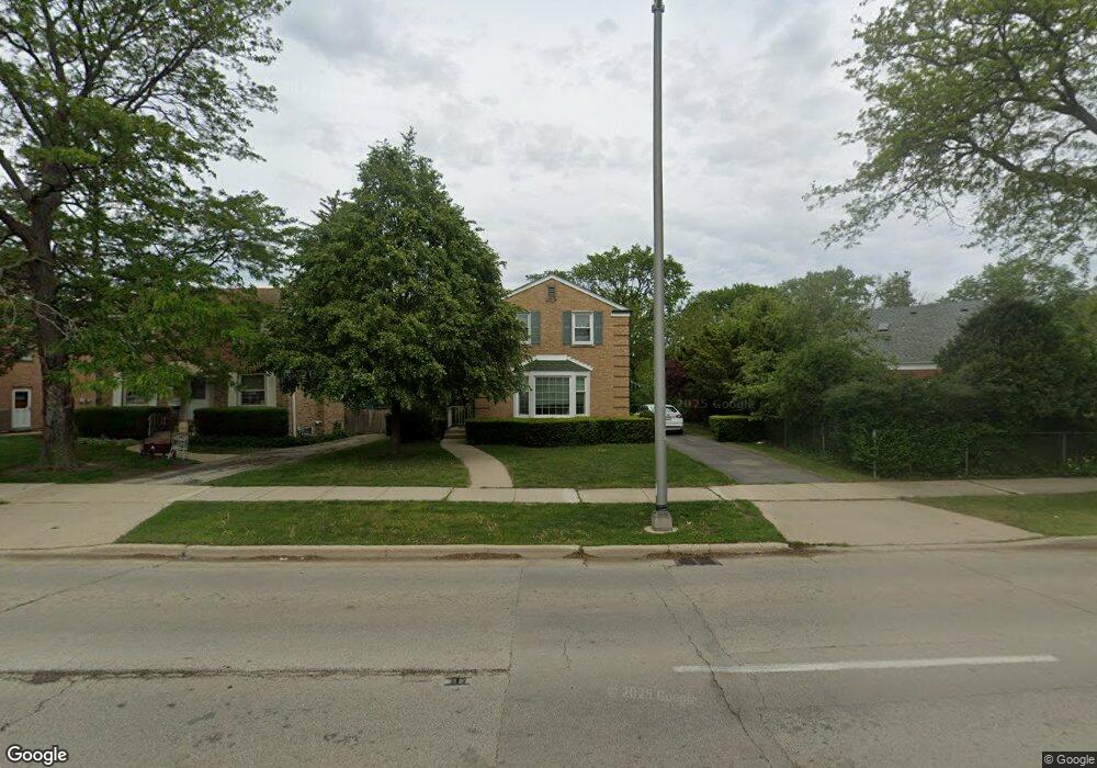
1705 Mannheim Rd Des Plaines, IL 60018
Estimated Value: $307,000 - $394,969
3
Beds
1
Bath
1,193
Sq Ft
$296/Sq Ft
Est. Value
About This Home
This home is located at 1705 Mannheim Rd, Des Plaines, IL 60018 and is currently estimated at $353,492, approximately $296 per square foot. 1705 Mannheim Rd is a home located in Cook County with nearby schools including South Elementary School, Algonquin Middle School, and Maine West High School.
Ownership History
Date
Name
Owned For
Owner Type
Purchase Details
Closed on
Mar 8, 1999
Sold by
Roller Robert O and Roller Mary M
Bought by
Roller Robert O and Roller Mary M
Current Estimated Value
Create a Home Valuation Report for This Property
The Home Valuation Report is an in-depth analysis detailing your home's value as well as a comparison with similar homes in the area
Home Values in the Area
Average Home Value in this Area
Purchase History
We collect this data history from publicly available records. To have your information removed, we recommend requesting removal directly through your county’s website.
| Date | Buyer | Sale Price | Title Company |
|---|---|---|---|
| Roller Robert O | -- | -- |
Source: Public Records
Tax History
| Year | Tax Paid | Tax Assessment Tax Assessment Total Assessment is a certain percentage of the fair market value that is determined by local assessors to be the total taxable value of land and additions on the property. | Land | Improvement |
|---|---|---|---|---|
| 2025 | $2,913 | $33,000 | $7,100 | $25,900 |
| 2024 | $2,913 | $32,000 | $6,035 | $25,965 |
| 2023 | $2,933 | $32,000 | $6,035 | $25,965 |
| 2022 | $2,933 | $32,000 | $6,035 | $25,965 |
| 2021 | $3,206 | $17,092 | $4,970 | $12,122 |
| 2020 | $3,035 | $17,092 | $4,970 | $12,122 |
| 2019 | $2,988 | $19,205 | $4,970 | $14,235 |
| 2018 | $3,326 | $25,069 | $4,260 | $20,809 |
| 2017 | $3,210 | $25,069 | $4,260 | $20,809 |
| 2016 | $3,804 | $25,069 | $4,260 | $20,809 |
| 2015 | $4,348 | $18,878 | $3,727 | $15,151 |
| 2014 | $4,284 | $18,878 | $3,727 | $15,151 |
| 2013 | $4,787 | $21,098 | $3,727 | $17,371 |
Source: Public Records
Map
Nearby Homes
- 1678 Ash St
- 1857 Pine St
- 1078 Bogart St
- 1080 Bogart St
- 1830 Dexter Ln
- 1030 Bogart St
- 1458 Kingston Ct
- 1693 Linden St
- 2129 Ash St Unit G
- 794 E Lincoln Ave
- 1370 Fargo Ave Unit E
- 805 S Tures Ln
- 1653 Stockton Ave
- 1304 Dennis Place
- 1515 Orchard St
- 1634 E Forest Ave
- 1495 E Algonquin Rd
- 1455 Campbell Ave
- 1117 Margret St
- 2124 Westview Dr
- 1703 Mannheim Rd
- 1708 Spruce Ave
- 1695 Mannheim Rd
- 1684 Spruce Ave
- 1687 Mannheim Rd
- 1672 Spruce Ave
- 1681 Mannheim Rd
- 1713 Spruce Ave
- 1719 Lee St
- 1704 Mannheim Rd
- 1706 Mannheim Rd
- 1705 Spruce Ave
- 1701 Spruce Ave
- 1708 Mannheim Rd
- 1695 Spruce Ave
- 1671 Mannheim Rd
- 1664 Spruce Ave
- 1710 Mannheim Rd
- 1687 Spruce Ave
- 1715 Mannheim Rd
Your Personal Tour Guide
Ask me questions while you tour the home.